Safety Score: 3,0 of 5.0 based on data from 9 authorites. Meaning we advice caution when travelling to United Kingdom.
Travel warnings are updated daily. Source: Travel Warning United Kingdom. Last Update: 2024-05-10 08:04:54
Explore Ratlinghope
Ratlinghope in Shropshire (England) is located in United Kingdom about 138 mi (or 222 km) north-west of London, the country's capital.
Local time in Ratlinghope is now 08:22 PM (Friday). The local timezone is named Europe / London with an UTC offset of one hour. We know of 9 airports in the wider vicinity of Ratlinghope, of which 5 are larger airports. The closest airport in United Kingdom is Hawarden Airport in a distance of 43 mi (or 68 km), North. Besides the airports, there are other travel options available (check left side).
There are several Unesco world heritage sites nearby. The closest heritage site in United Kingdom is Pontcysyllte Aqueduct and Canal in a distance of 28 mi (or 45 km), North. Also, if you like golfing, there is an option about 33 mi (or 53 km). away. If you need a place to sleep, we compiled a list of available hotels close to the map centre further down the page.
Depending on your travel schedule, you might want to pay a visit to some of the following locations: Norbury, Lydham, Westbury, Great Hanwood and Longnor. To further explore this place, just scroll down and browse the available info.
Local weather forecast
Todays Local Weather Conditions & Forecast: 21°C / 69 °F
| Morning Temperature | 13°C / 55 °F |
| Evening Temperature | 17°C / 63 °F |
| Night Temperature | 13°C / 56 °F |
| Chance of rainfall | 1% |
| Air Humidity | 56% |
| Air Pressure | 1022 hPa |
| Wind Speed | Light breeze with 5 km/h (3 mph) from North-West |
| Cloud Conditions | Overcast clouds, covering 100% of sky |
| General Conditions | Light rain |
Saturday, 11th of May 2024
18°C (64 °F)
12°C (54 °F)
Light rain, gentle breeze, overcast clouds.
Sunday, 12th of May 2024
16°C (60 °F)
12°C (53 °F)
Moderate rain, gentle breeze, overcast clouds.
Monday, 13th of May 2024
12°C (54 °F)
10°C (50 °F)
Moderate rain, moderate breeze, overcast clouds.
Hotels and Places to Stay
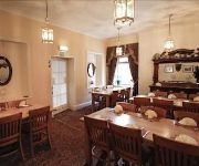
The Stiperstones Inn
Videos from this area
These are videos related to the place based on their proximity to this place.
shropshire eastridge biking vid
me and sam in estrage doing downhill on are hardtails in shropshire.
Eastridge Shropshire MTB Trail Ride
Team Horizon Richy Lewis John Ward Simon Kirkham Tim Beddles training ride @ eastridge in Shropshire preparing for the Gravity enduro these boys are quick.
Eastridge Downhill 98' nationals track HD movie 2012
Riding at Eastridge Forest on the old 1998 British National track.
Mountain Biking Long Mynd - east side descent to Little Stretton
Descent of Long Mynd from Grindle down to Little Stretton, near Church Stretton, Shropshire July 2011.
Long Mynd MTB Trip
Alex and myself went for a 4 day trip to the Long Mynd and Eastridge, here's some of the footage, look out for the crashes! Alex- Specialised Stumpjumper Me- Stanton Slackline 631.
Mountain Biking Long Mynd - ridge descent into Batch Valley
Friday night ride, ridge descent from Haddon into Batch Valley, All Stretton. Church Stretton, Shropshire, July 2011.
Mountain Biking Long Mynd - Burway off road descent
Descent off the Long Mynd down a few off road areas alongside the Burway, Church Stretton, Shropshire August 2011.
Mountain Biking Long Mynd - riding down Minton Batch
Descent of Long Mynd down Minton Batch, Church Stretton, Shropshire July 2011. Also clips coming down through the forestry near Hamperley.
Mountain Biking Long Mynd - west side descent near Asterton
West side descent of the Long Mynd near Asterton. Church Stretton, Shropshire, July 2011.
Mountain Biking Long Mynd - Carding Mill Valley - lower section
Descent of Long Mynd down Motts Road, Carding Mill Valley, lower singletrack section after the stream crossing, Church Stretton, Shropshire July 2011.
Videos provided by Youtube are under the copyright of their owners.
Attractions and noteworthy things
Distances are based on the centre of the city/town and sightseeing location. This list contains brief abstracts about monuments, holiday activities, national parcs, museums, organisations and more from the area as well as interesting facts about the region itself. Where available, you'll find the corresponding homepage. Otherwise the related wikipedia article.
Ratlinghope
Ratlinghope is a village and civil parish in Shropshire, England. It is situated four miles (6 km) west from Church Stretton and twelve miles (19 km) south from Shrewsbury. Historically it is located in the hundred of Purslow. For Church of England purposes it is in the rural deanery of Bishop's Castle, archdeaconry of Ludlow, and diocese of Hereford.


