Safety Score: 3,0 of 5.0 based on data from 9 authorites. Meaning we advice caution when travelling to United Kingdom.
Travel warnings are updated daily. Source: Travel Warning United Kingdom. Last Update: 2024-05-10 08:04:54
Discover Culmington
Culmington in Shropshire (England) is a place in United Kingdom about 129 mi (or 207 km) north-west of London, the country's capital city.
Current time in Culmington is now 10:01 AM (Friday). The local timezone is named Europe / London with an UTC offset of one hour. We know of 9 airports near Culmington, of which 5 are larger airports. The closest airport in United Kingdom is Birmingham International Airport in a distance of 42 mi (or 68 km), East. Besides the airports, there are other travel options available (check left side).
There are several Unesco world heritage sites nearby. The closest heritage site in United Kingdom is Pontcysyllte Aqueduct and Canal in a distance of 38 mi (or 61 km), North. Also, if you like playing golf, there are a few options in driving distance. If you need a hotel, we compiled a list of available hotels close to the map centre further down the page.
While being here, you might want to pay a visit to some of the following locations: Bromfield, Burrington, Downton, Elton and Cardington. To further explore this place, just scroll down and browse the available info.
Local weather forecast
Todays Local Weather Conditions & Forecast: 19°C / 67 °F
| Morning Temperature | 13°C / 55 °F |
| Evening Temperature | 18°C / 65 °F |
| Night Temperature | 14°C / 57 °F |
| Chance of rainfall | 3% |
| Air Humidity | 70% |
| Air Pressure | 1024 hPa |
| Wind Speed | Light breeze with 4 km/h (3 mph) from North |
| Cloud Conditions | Overcast clouds, covering 100% of sky |
| General Conditions | Moderate rain |
Saturday, 11th of May 2024
19°C (67 °F)
14°C (57 °F)
Light rain, gentle breeze, broken clouds.
Sunday, 12th of May 2024
19°C (65 °F)
13°C (55 °F)
Light rain, gentle breeze, overcast clouds.
Monday, 13th of May 2024
15°C (59 °F)
11°C (51 °F)
Light rain, fresh breeze, broken clouds.
Hotels and Places to Stay
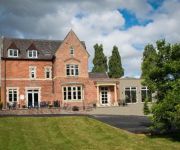
The Clive Restaurant with Rooms
The Cliffe at Dinham
Feathers
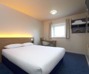
TRAVELODGE LUDLOW
FISHMORE HALL
Videos from this area
These are videos related to the place based on their proximity to this place.
Vision Project 2014 - St Laurence's Church, Ludlow, England
Shaun Ward, Clerk of Works at St. Laurence's, describes the recent restoration work on the church fabric and plans for the future.
Ludlow Station, Ludlow, Shropshire
Video taken on Ludlow Station. Arriving and departing southbound ATW Class 175 Coradia. Arriving ATW class 150 which we then travel on as it goes north towards Shrewsbury.
Short session at Ludlow Castle :: The Ghost Trust
www.ghosttrust.com Michelle takes her sister out for a quick ghost hunt at the east wall of Ludlow Castle and get some interesting results from bothe the echovox and sb7 spirit box.
Historic Ludlow
Ludlow Castle was built and tourism began - usually by Welsh activists 900 years later and things had changed a bit - here is a lesson in modern Ludlow history (move over Mr Wise and David Lloyd!)
Ludlow Food Festival 2010
2010 has been another great year for the Ludlow Food Festival, with about 150 exhibitors and spread across three days, the event attracted about 20000 visitors and trade was brisk. Olive and...
Ludlow 2010 River Teme Town Weirs . . .
Cycle along the River Teme in Ludlow to check out the shape of the water at the reconstructed Town Weirs . . .
The River Teme Ludlow First Weir
Wombourne Kayak Club playing on the first weir drop. Barry, Richard and Mike. Tim is filming and has the giggles.
www.rallyesportescorts.co.uk Mex IT @ Ludlow Gravel Sprint 08 - MKII Escort RS Mexico RS1800 RS2000
www.rallyesportescorts.co.uk - Ricky Williams driving his MKI Mexico 1600cc 1st in class 19th overall at Hays Park competing in the Ludlow Gravel Sprintlow - MKII Escort RS Mexico RS1800 RS2000.
Videos provided by Youtube are under the copyright of their owners.
Attractions and noteworthy things
Distances are based on the centre of the city/town and sightseeing location. This list contains brief abstracts about monuments, holiday activities, national parcs, museums, organisations and more from the area as well as interesting facts about the region itself. Where available, you'll find the corresponding homepage. Otherwise the related wikipedia article.
Ludlow Racecourse
Ludlow Racecourse is a thoroughbred horse racing venue located near Ludlow, Shropshire, England. The B4365 crosses the racecourse at three points of the tracks and traffic is stopped when the course is in use. The venue is located between the small villages of Bromfield and Stanton Lacy, just off the A49.
Diddlebury
Diddlebury is a small village and large civil parish in Shropshire, England. It is situated in the Corvedale on the B4368 road about 5 miles north east of Craven Arms. The name "Diddlebury" is thought to have originated from that of a local Anglo-Saxon chieftain Duddela an Old English name and 'burgh' (meaning dwelling or settlement and probably fortified).
Culmington
Culmington is a small village and civil parish in south Shropshire, England. The nearest towns are Craven Arms and Ludlow. The village is situated just off the B4365 road, north of Stanton Lacy. The River Corve flows just to its east. The village lies at around 100m above sea level.


