Safety Score: 3,0 of 5.0 based on data from 9 authorites. Meaning we advice caution when travelling to United Kingdom.
Travel warnings are updated daily. Source: Travel Warning United Kingdom. Last Update: 2024-04-28 08:22:10
Explore Rushton
Rushton in Northamptonshire (England) with it's 461 inhabitants is a city in United Kingdom about 70 mi (or 112 km) north-west of London, the country's capital.
Local time in Rushton is now 10:17 PM (Sunday). The local timezone is named Europe / London with an UTC offset of one hour. We know of 11 airports in the vicinity of Rushton, of which 5 are larger airports. The closest airport in United Kingdom is Sywell Aerodrome in a distance of 9 mi (or 15 km), South. Besides the airports, there are other travel options available (check left side).
There are several Unesco world heritage sites nearby. The closest heritage site in United Kingdom is Derwent Valley Mills in a distance of 42 mi (or 68 km), North. Also, if you like golfing, there are multiple options in driving distance. If you need a place to sleep, we compiled a list of available hotels close to the map centre further down the page.
Depending on your travel schedule, you might want to pay a visit to some of the following locations: Seaton, Ridlington, Preston, Wing and Morcott. To further explore this place, just scroll down and browse the available info.
Local weather forecast
Todays Local Weather Conditions & Forecast: 7°C / 45 °F
| Morning Temperature | 5°C / 42 °F |
| Evening Temperature | 9°C / 47 °F |
| Night Temperature | 4°C / 39 °F |
| Chance of rainfall | 24% |
| Air Humidity | 92% |
| Air Pressure | 1005 hPa |
| Wind Speed | Fresh Breeze with 15 km/h (9 mph) from South-East |
| Cloud Conditions | Overcast clouds, covering 100% of sky |
| General Conditions | Heavy intensity rain |
Monday, 29th of April 2024
13°C (55 °F)
9°C (48 °F)
Overcast clouds, fresh breeze.
Tuesday, 30th of April 2024
13°C (56 °F)
8°C (47 °F)
Light rain, moderate breeze, broken clouds.
Wednesday, 1st of May 2024
15°C (59 °F)
12°C (53 °F)
Light rain, gentle breeze, overcast clouds.
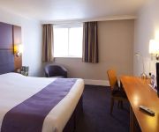
Hotels and Places to Stay
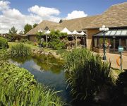
Kettering Park Hotel and Spa
Holiday Inn Express KETTERING
Travel Plaza
Best Western Rockingham Forest
Hampton by Hilton Corby-Kettering
Kettering
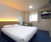
TRAVELODGE KETTERING
The Raven Hotel - Inn
Corby
Videos from this area
These are videos related to the place based on their proximity to this place.
Leaving the A14 westbound to Corby/Stamford-Kettering A6003
The aim of this video is to help learner drivers who are just about ready for test to negotiate the route off the A14 onto the A43 and then onto the A6003 into kettering.
Kettering Roundabouts, Northampton Road to town centre.
The aim of this video is to help learner drivers see how to negotiate the new double roundabouts when travelling along Northampton Road up the hill towards Kettering town centre.
Tough Mudder 2013 Kettering, Rob gets the shocker!
The Sortwell twins and Alison attempt the final obstacle at the Tough Mudder 2013 race in Kettering Sorry for the audio!
Walls and Floors Showroom, Kettering, Northamptonshire
Our main showroom in Kettering, has been established for over 23 years and is one of the largest showrooms in the UK. We have a diverse collection of displays from some of the biggest manufacturers.
Park Road Infant School Kettering
Park Road Infant School; school council members promoting a crowdfunding attempt to raise funds for a new infant's play area AND outdoor teaching area, within Rockingham Road Pleasure Park!...
party 06/06/09 podington (kettering)
banging party in podingtom near kettering in a barn mutiriger early Sunday morning.
The Bathroom Store Kettering Video.mp4
Welcome to The Bathroom Store Kettering. This video contains some of the finest bathroom suites and accessories in our showroom.
Rothwell Fair Classic Vehicle Parade 2014
The Rothwell Fair Sunday Classic Vehicle Parade sets off on its journey around the town from Columbus Crescent recreation area.
Videos provided by Youtube are under the copyright of their owners.
Attractions and noteworthy things
Distances are based on the centre of the city/town and sightseeing location. This list contains brief abstracts about monuments, holiday activities, national parcs, museums, organisations and more from the area as well as interesting facts about the region itself. Where available, you'll find the corresponding homepage. Otherwise the related wikipedia article.
Rushton Triangular Lodge
The Triangular Lodge is a folly, designed and constructed between 1593 and 1597 by Sir Thomas Tresham near Rushton, Northamptonshire, England. It is now in the care of English Heritage. The stone used for the construction was alternating bands of dark and light limestone. Tresham was a Roman Catholic and was imprisoned for a total of fifteen years in the late 16th century for refusing to become a Protestant. On his release in 1593, he designed the Lodge as a protestation of his faith.
Borough of Kettering
Kettering is a local government district and borough in Northamptonshire, England. It is named after its main town Kettering where the council is based. It borders onto the District of Harborough in the neighbouring county of Leicestershire, the Borough of Corby, the District of East Northamptonshire, the District of Daventry and the Borough of Wellingborough. The village of Cranford was used to film the US blockbuster "Nanny Mcphee" starring local Lucy Naylor as Nanny Mcphee.
Connect Radio 97.2 & 107.4
Connect Radio 97.2 and 107.4 is a commercial radio station in the United Kingdom broadcasting to Northamptonshire. It is owned by Adventure Radio and based in Kettering.
Kettering (UK Parliament constituency)
Kettering is a constituency in Northamptonshire represented in the House of Commons of the UK Parliament since 2005 by Philip Hollobone, a Conservative.
Rothwell Town F.C
Rothwell Town F.C. was a football club based in Rothwell in the north of Northamptonshire. They were founding members of the Northamptonshire League in 1895, and played in the United Counties League Division One until 2011–12.
Kettering Rural District
Kettering was a rural district in Northamptonshire in England from 1894 to 1974. It was formed under the Local Government Act 1972 based on Kettering rural sanitary district. It was named after but did not include Kettering itself. Burton Latimer became a separate urban district in 1923.
Rockingham Road
Rockingham Road is a football stadium in Kettering, Northamptonshire, England. It was home to Kettering Town F.C. who play in the Conference National, from 1897 up until 2011. The ground has a capacity of 6,264, of which 1,800 is seated. Away fans are allocated 890 standing spaces behind the goal at one end of the ground and if fully segregated 326 seats in the mainstand.
Kettering General Hospital
Kettering General Hospital is a NHS hospital in Kettering, Northamptonshire, England. The hospital was founded in 1897 and became part of the NHS in 1994. The hospital covers North Northamptonshire.


