Safety Score: 3,0 of 5.0 based on data from 9 authorites. Meaning we advice caution when travelling to United Kingdom.
Travel warnings are updated daily. Source: Travel Warning United Kingdom. Last Update: 2024-04-28 08:22:10
Explore Weekley
Weekley in Northamptonshire (England) is located in United Kingdom about 67 mi (or 108 km) north of London, the country's capital.
Local time in Weekley is now 07:26 AM (Monday). The local timezone is named Europe / London with an UTC offset of one hour. We know of 11 airports in the wider vicinity of Weekley, of which 5 are larger airports. The closest airport in United Kingdom is Sywell Aerodrome in a distance of 9 mi (or 14 km), South-West. Besides the airports, there are other travel options available (check left side).
There are several Unesco world heritage sites nearby. The closest heritage site in United Kingdom is Blenheim Palace in a distance of 40 mi (or 64 km), South. Also, if you like golfing, there are multiple options in driving distance. If you need a place to sleep, we compiled a list of available hotels close to the map centre further down the page.
Depending on your travel schedule, you might want to pay a visit to some of the following locations: Seaton, Podington, Morcott, Preston and Wing. To further explore this place, just scroll down and browse the available info.
Local weather forecast
Todays Local Weather Conditions & Forecast: 13°C / 55 °F
| Morning Temperature | 5°C / 40 °F |
| Evening Temperature | 11°C / 52 °F |
| Night Temperature | 9°C / 48 °F |
| Chance of rainfall | 0% |
| Air Humidity | 71% |
| Air Pressure | 1013 hPa |
| Wind Speed | Fresh Breeze with 14 km/h (9 mph) from North |
| Cloud Conditions | Overcast clouds, covering 94% of sky |
| General Conditions | Overcast clouds |
Tuesday, 30th of April 2024
13°C (56 °F)
8°C (47 °F)
Light rain, moderate breeze, broken clouds.
Wednesday, 1st of May 2024
15°C (59 °F)
12°C (53 °F)
Light rain, gentle breeze, overcast clouds.
Thursday, 2nd of May 2024
11°C (51 °F)
9°C (47 °F)
Moderate rain, moderate breeze, overcast clouds.
Hotels and Places to Stay
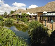
Kettering Park Hotel and Spa
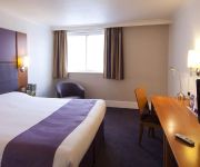
Holiday Inn Express KETTERING
Holiday Inn CORBY - KETTERING A43
Kettering
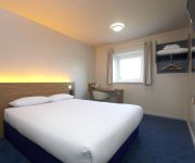
TRAVELODGE KETTERING
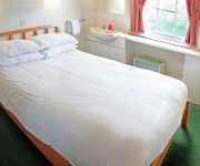
The Raven Hotel - Inn
Corby
Videos from this area
These are videos related to the place based on their proximity to this place.
Tough Mudder 2013 Kettering, Rob gets the shocker!
The Sortwell twins and Alison attempt the final obstacle at the Tough Mudder 2013 race in Kettering Sorry for the audio!
Green Laning Enduro solo, Honda CRF450R in Kettering, Northants.
out for a little ride on my own, hitting some lanes in Kettering. 1st ride out in a while, my riding improves as i gain confidence.
Kettering Carnival August 2012 Part 1
The procession sets off from Stamford Road at 1pm. Towards the end of this clip an ambulance that was in the service road sets off through the procession. There was around a 10 minute pause...
O Gauge Live Steam - Kettering 2015
A short clip of live steam at Kettering including Rafe Shirley's amazing model of Columbine - A Grand Junction Railway 2-2-2 - pulling 4 modern bogie coaches. It fits into the palm of your...
Kettering Labour - Campaigning for the NHS
Out in Kettering town centre speaking to residents about the damage being done to the NHS by the Tory-led coalition and why it's essential that we protect our health service.
2012 Olympic Torch Relay in to Kettering Northamptonshire 2nd July ~ The Parade
2012 Olympic Torch Relay in to Kettering Northamptonshire 2nd July ~ The Parade Caution ~ I'd read the description then you don't have to watch the seven minute vid! Featuring the children...
Kettering U9's Season Review 2011 - 2012
A video compilation of photos throughout the incredible 2011 - 2012 season. For more information about the Under 9's see http://www.pitchero.com/clubs/kettering/m/team-info-53023.html.
Walls and Floors Showroom, Kettering, Northamptonshire
Our main showroom in Kettering, has been established for over 23 years and is one of the largest showrooms in the UK. We have a diverse collection of displays from some of the biggest manufacturers.
Videos provided by Youtube are under the copyright of their owners.
Attractions and noteworthy things
Distances are based on the centre of the city/town and sightseeing location. This list contains brief abstracts about monuments, holiday activities, national parcs, museums, organisations and more from the area as well as interesting facts about the region itself. Where available, you'll find the corresponding homepage. Otherwise the related wikipedia article.
Connect Radio 97.2 & 107.4
Connect Radio 97.2 and 107.4 is a commercial radio station in the United Kingdom broadcasting to Northamptonshire. It is owned by Adventure Radio and based in Kettering.
Kettering railway station
Kettering railway station serves the town of Kettering in Northamptonshire, England. It lies south-west of the town centre, on the Midland Main Line,Bad rounding here{{#invoke:Math|precision_format| 115*1,000/1,609.344 | 1-1 }} miles (115 km) north of London St. Pancras and is served primarily by semi-fast East Midlands Trains Class 222 "Meridian" trains, with some HSTs at peak times.
Boughton House
Boughton House is a country house about 3 miles north-east of Kettering off the A43 road near Geddington in Northamptonshire, England, which belongs to the Duke of Buccleuch.
A509 road
The A509 is a short A-class road (around 30 miles long) for north-south journeys in south central England, forming the route from Kettering in Northamptonshire to the M1 and A5 in Milton Keynes. The road begins at Wicksteed Park in the outskirts of Kettering. It then crosses the A14 and goes through Isham and Great Harrowden. After this it goes on to form the Wellingborough western bypass before crossing into the Borough of Milton Keynes.
Kettering Borough Council
Kettering Borough Council is a local authority in Kettering Borough, composed of 36 local councillors and currently controlled by the Conservatives, who have controlled the Council since the 2003 local elections, where they gained control from Labour with a majority of 15. Having retained control in the 2007 local elections, the Council is currently led by Cllr. Jim Hakewill. Kettering Borough Council was established in 1973, as part of reforms marked by the Local Government Act 1972.
Town Ground, Kettering
The Town Ground in Kettering, England was used by Northamptonshire for 65 first-class cricket matches between 1923 and 1971. It also staged four List A games in the early 1970s, and has occasionally been used by Northamptonshire's Second XI.
Rockingham Road
Rockingham Road is a football stadium in Kettering, Northamptonshire, England. It was home to Kettering Town F.C. who play in the Conference National, from 1897 up until 2011. The ground has a capacity of 6,264, of which 1,800 is seated. Away fans are allocated 890 standing spaces behind the goal at one end of the ground and if fully segregated 326 seats in the mainstand.
St Peter's School, Kettering
St Peter's School in Kettering is a primary independent school with a Christian ethos. The school teaches children aged from 3 years to 11, children moving from nursery school through infant (Key Stage 1) to Junior (Key Stage 2). After leaving, children move confidently on to the chosen secondary school.


