Safety Score: 3,0 of 5.0 based on data from 9 authorites. Meaning we advice caution when travelling to United Kingdom.
Travel warnings are updated daily. Source: Travel Warning United Kingdom. Last Update: 2024-04-19 08:03:45
Discover Brigstock
Brigstock in Northamptonshire (England) with it's 1,357 citizens is a city in United Kingdom about 69 mi (or 111 km) north of London, the country's capital city.
Local time in Brigstock is now 10:23 PM (Friday). The local timezone is named Europe / London with an UTC offset of one hour. We know of 11 airports in the vicinity of Brigstock, of which 5 are larger airports. The closest airport in United Kingdom is Sywell Aerodrome in a distance of 13 mi (or 21 km), South-West. Besides the airports, there are other travel options available (check left side).
There are several Unesco world heritage sites nearby. The closest heritage site in United Kingdom is Derwent Valley Mills in a distance of 40 mi (or 64 km), North. Also, if you like golfing, there are a few options in driving distance. Looking for a place to stay? we compiled a list of available hotels close to the map centre further down the page.
When in this area, you might want to pay a visit to some of the following locations: Seaton, Morcott, South Luffenham, North Luffenham and Wing. To further explore this place, just scroll down and browse the available info.
Local weather forecast
Todays Local Weather Conditions & Forecast: 12°C / 53 °F
| Morning Temperature | 8°C / 47 °F |
| Evening Temperature | 7°C / 45 °F |
| Night Temperature | 2°C / 35 °F |
| Chance of rainfall | 1% |
| Air Humidity | 71% |
| Air Pressure | 1015 hPa |
| Wind Speed | Fresh Breeze with 15 km/h (9 mph) from South-East |
| Cloud Conditions | Broken clouds, covering 78% of sky |
| General Conditions | Light rain |
Saturday, 20th of April 2024
8°C (47 °F)
1°C (34 °F)
Broken clouds, moderate breeze.
Sunday, 21st of April 2024
8°C (47 °F)
1°C (34 °F)
Overcast clouds, moderate breeze.
Monday, 22nd of April 2024
6°C (42 °F)
4°C (38 °F)
Light rain, light breeze, overcast clouds.
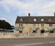
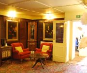
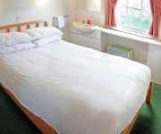
Hotels and Places to Stay
Holiday Inn CORBY - KETTERING A43
The Woolpack Inn
Bridge
The Raven Hotel - Inn
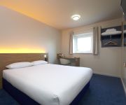
TRAVELODGE KETTERING THRAPSTON
Videos from this area
These are videos related to the place based on their proximity to this place.
Banger Session at Corby
Me, Dan and Darren had an awesome session at adrenaline alley yesterday. Half of what happened was not filmed because we were having too much fun riding. The majority of the day was chilled...
Ollyedits Corby Adrenaline Alley
elliot brace, Joseph martin, Ollyedits, olly, morgan, ollymorgan, street, bmx, dirt, park, rampworx, Corby, envy, 2010, 2011, 2012, 2013, wethepeople, envy, versus, black, red, tan, wall,...
Adrenaline Alley Skate Park Corby 21-07-2013
Dirt jump session from Adrenaline Alley. Big thanks to Casper and the rest of the staff for keeping the jumps maintained to such a high standard.
Day trip to Adrenaline Alley (Corby) - Headcam
Just a few clips at the end of the day that I put together from our trip to Corby.
SHR-EDIT Corby Skate Crew Road trip
On a rainy Thursday evening we went out for a shred at Adrenaline Alley in Corby, Northamptonshire.
Flying Fortress Stages Rally 2012 Select Cars Subaru Impreza
Gary Wayne Shane Barnes Dukeries Motor Club Flying Fortress Stages Rally 2012 Grafton Underwood Finished 3rd Overall Footage courtesy of Mad Video www.madvideo.co.uk.
Flying Fortress Stages 2013 Select Cars Impreza Incar 3 Crash
Subaru Impreza Crash on the Dukeries Single Venue Rally at Grafton Underwood.
Flying Fortress Stages 2013 Select Cars Impreza Car 3
Flying Fortress Stages 2013 Select Cars Impreza Gary Wayne Andy Smith Dukeries Motor Club Grafton Underwood.
Videos provided by Youtube are under the copyright of their owners.
Attractions and noteworthy things
Distances are based on the centre of the city/town and sightseeing location. This list contains brief abstracts about monuments, holiday activities, national parcs, museums, organisations and more from the area as well as interesting facts about the region itself. Where available, you'll find the corresponding homepage. Otherwise the related wikipedia article.
Rockingham Forest
Rockingham Forest is a former royal hunting forest in the in the county of Northamptonshire, England. It is an area of some 200 square miles lying between the River Welland and River Nene and the towns of Stamford and Kettering. It has a rich and varied landscape, with farmland, open pasture, pockets of woodland and villages built from local stone.
A427 road
The A427 road is a major road in the English Midlands. It connects the Leicestershire town of Market Harborough and the A6 with the Northamptonshire town of Oundle and the A605.
RAF Grafton Underwood
RAF Grafton Underwood is a former World War II airfield in England. The field is located 4 miles NE of Kettering in Northamptonshire.


