Safety Score: 3,0 of 5.0 based on data from 9 authorites. Meaning we advice caution when travelling to United Kingdom.
Travel warnings are updated daily. Source: Travel Warning United Kingdom. Last Update: 2024-04-26 08:02:42
Delve into Duddington
Duddington in Northamptonshire (England) is located in United Kingdom about 77 mi (or 124 km) north of London, the country's capital town.
Current time in Duddington is now 08:42 PM (Friday). The local timezone is named Europe / London with an UTC offset of one hour. We know of 12 airports close to Duddington, of which 5 are larger airports. The closest airport in United Kingdom is RAF Cottesmore in a distance of 11 mi (or 17 km), North-West. Besides the airports, there are other travel options available (check left side).
There are several Unesco world heritage sites nearby. The closest heritage site in United Kingdom is Derwent Valley Mills in a distance of 30 mi (or 48 km), North. Also, if you like playing golf, there are some options within driving distance. If you need a hotel, we compiled a list of available hotels close to the map centre further down the page.
While being here, you might want to pay a visit to some of the following locations: Ketton, Tinwell, South Luffenham, Tickencote and North Luffenham. To further explore this place, just scroll down and browse the available info.
Local weather forecast
Todays Local Weather Conditions & Forecast: 9°C / 49 °F
| Morning Temperature | 2°C / 35 °F |
| Evening Temperature | 9°C / 49 °F |
| Night Temperature | 3°C / 38 °F |
| Chance of rainfall | 1% |
| Air Humidity | 71% |
| Air Pressure | 1005 hPa |
| Wind Speed | Gentle Breeze with 8 km/h (5 mph) from West |
| Cloud Conditions | Overcast clouds, covering 95% of sky |
| General Conditions | Light rain |
Saturday, 27th of April 2024
7°C (45 °F)
7°C (45 °F)
Light rain, moderate breeze, overcast clouds.
Sunday, 28th of April 2024
7°C (44 °F)
4°C (39 °F)
Moderate rain, moderate breeze, overcast clouds.
Monday, 29th of April 2024
12°C (54 °F)
7°C (44 °F)
Sky is clear, moderate breeze, clear sky.
Hotels and Places to Stay
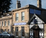
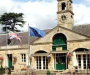
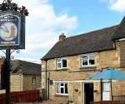
William Cecil
BEST WESTERN Normanton Park Hotel
Boot and Shoe
Videos from this area
These are videos related to the place based on their proximity to this place.
Lego Star Wars - St. Patrick's Day Special
My very first St. Patrick's Day Special! It's St. Patrick's Day at the Death Star and Darth Vader is not wearing green so a stormtrooper decides to pull something on Vader.
Off Road 4x4 at Tixover Quarry - Pay & Play (24 October 2010)
Photos of the day can be found here: http://rhobbs.co.uk/a5r Off roading at Tixover Quarry on Sun 24 October 2010.
Off Road 4x4 in Snow & Ice @ Tixover Quarry Pay & Play Day (28 Nov 2010)
Photos of the day can be found here: http://rhobbs.co.uk/aa2 Off roading in the snow and ice at Tixover Quarry on Sun 28 Nov 2010. Video from both on-board my own Land Rover Discovery and...
Daniels TV - Episode 1
Stamford manager Graham Drury, midfielder Danny Brooks and first-team coach Dean West look ahead of the trip to Brigg Town in the pilot episode of Daniels TV. Let us know what you think via...
Riverside Cafe Stamford
Cafe, French Patisserie serving Light lunches and pastries from 10 am to 5pm everyday. Relaxing and friendly premises to enjoy homemade cakes, quality teas and coffee, or lunches around a...
Bees 01 Jun 2014 Stamford Lincs UK
Bees in an old bird box. They're tricky little blighters to film as they move so fast! "If you find a bumblebee nest, consider yourself very lucky! They aren...
Passengers taking the train on a sunny summer day at Stamford, Lincs
On a warm summer day passengers collect their bags and join an eastbound Cross Country train at the charming stone-built Midland Railway station in Stamford, Lincs, England.
Videos provided by Youtube are under the copyright of their owners.
Attractions and noteworthy things
Distances are based on the centre of the city/town and sightseeing location. This list contains brief abstracts about monuments, holiday activities, national parcs, museums, organisations and more from the area as well as interesting facts about the region itself. Where available, you'll find the corresponding homepage. Otherwise the related wikipedia article.
River Chater
The River Chater is a river in the East Midlands of England. It is a tributary of the River Welland, and is about 12 miles long. It rises near Whatborough Hill in Leicestershire, and then flows east, past the sites of Sauvey Castle, and Launde Abbey, before crossing the county boundary with Rutland. It continues east, to the north of Ridlington, Preston, and then to the south of Manton and the north of Wing. At North Luffenham, it meets a stream that had risen south of Ridlington.
Luffenham Heath Golf Club
Luffenham Heath is an 18-hole golf course near South Luffenham in Rutland, England. Designed by Harry Colt, it began under the patronage of the Earl of Ancaster who had exchanged fields in South Luffenham for common land on the Heath. The opening event in 1911, witnessed by over a thousand spectators, was an exhibition match between James Braid and Harry Vardon. The club initially attracted an aristocratic membership.
Easton on the Hill Rural District
Easton on the Hill was a rural district in Northamptonshire, England from 1894 to 1935. It was formed under the Local Government Act 1894 from that part of the Stamford rural sanitary district which was in Northamptonshire proper. It consisted of the three parishes of Collyweston, Duddington and Easton on the Hill. The district was abolished in 1935 under a County Review Order, becoming part of the new Oundle and Thrapston Rural District.
RAF Kings Cliffe
Royal Air Force Station Kings Cliffe or more simply RAF Kings Cliffe is a former Royal Air Force station located near Kings Cliffe, Northamptonshire, 12 miles west of Peterborough in Cambridgeshire. Originally the airfield was grass-surfaced but hard-surfaced runways and a perimeter track were laid down early in 1943.
Ketton and Collyweston railway station
Ketton and Collyweston railway station is a former station serving the villages of Ketton, Geeston, Aldgate and Collyweston, Rutland. It is located in Geeston adjacent to a level crossing on the Ketton to Collyweston road. It is under half a mile from Ketton but over a mile from Collyweston. It closed in 1966 but has been proposed for reopening.
Fineshade Wood
Fineshade Wood is a large wooded area in the county of Northamptonshire in the English East Midlands region. The wood is protected by and cared for by the Forestry Commission and is part of the former royal hunting forest of Rockingham Forest. Fineshade is well known for its population of Red Kites. The wood is located off of the A43 road heading towards Stamford from Corby. The site has a caravan park which is open all year round.
Fineshade Priory
Fineshade Priory was a priory of Augustinian Canons Regular in Northamptonshire, England. It was founded before 1208 by Richard Engayne (Engain), Lord of Blatherwycke on the site of a small castle and dissolved in 1536. The buildings were granted to Lord Russell 1541/2. Sir Robert Kirkham bought it in 1545 and converted the west range into a country residence, which was demolished along with the remains of the priory in 1749. A house was subsequently built on the site but demolished in 1956.


