Safety Score: 3,0 of 5.0 based on data from 9 authorites. Meaning we advice caution when travelling to United Kingdom.
Travel warnings are updated daily. Source: Travel Warning United Kingdom. Last Update: 2024-04-28 08:22:10
Touring Nassington
Nassington in Northamptonshire (England) with it's 827 residents is a town located in United Kingdom about 73 mi (or 118 km) north of London, the country's capital place.
Time in Nassington is now 02:19 PM (Sunday). The local timezone is named Europe / London with an UTC offset of one hour. We know of 12 airports nearby Nassington, of which 5 are larger airports. The closest airport in United Kingdom is RAF Cottesmore in a distance of 15 mi (or 25 km), North-West. Besides the airports, there are other travel options available (check left side).
There are several Unesco world heritage sites nearby. The closest heritage site in United Kingdom is Derwent Valley Mills in a distance of 33 mi (or 53 km), North. Also, if you like the game of golf, there are several options within driving distance. Need some hints on where to stay? We compiled a list of available hotels close to the map centre further down the page.
Being here already, you might want to pay a visit to some of the following locations: Wansford, Thornhaugh, Wittering, Southorpe and Upton. To further explore this place, just scroll down and browse the available info.
Local weather forecast
Todays Local Weather Conditions & Forecast: 7°C / 45 °F
| Morning Temperature | 8°C / 46 °F |
| Evening Temperature | 6°C / 42 °F |
| Night Temperature | 4°C / 39 °F |
| Chance of rainfall | 15% |
| Air Humidity | 96% |
| Air Pressure | 1000 hPa |
| Wind Speed | Fresh Breeze with 13 km/h (8 mph) from South-West |
| Cloud Conditions | Overcast clouds, covering 100% of sky |
| General Conditions | Moderate rain |
Monday, 29th of April 2024
13°C (55 °F)
7°C (45 °F)
Broken clouds, fresh breeze.
Tuesday, 30th of April 2024
14°C (58 °F)
8°C (47 °F)
Broken clouds, fresh breeze.
Wednesday, 1st of May 2024
17°C (62 °F)
10°C (51 °F)
Light rain, gentle breeze, scattered clouds.
Hotels and Places to Stay
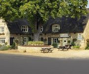
The Crown Inn
Haycock Hotel
The Talbot
Videos from this area
These are videos related to the place based on their proximity to this place.
Nene Valley Railway - City of Peterborough & Thomas the Engine
ARTICLE: http://wp.me/p2jdAu-2EM http://twitter.com/jameswoodcock I visit Nene Valley Railway and take a ride on the City of Peterborough & Thomas the Engine.
Arrow Season 3 Episode 3 Review (Thea Returns To Star City)
I do not own Green Arrow, The CW, Warner Bros, DC Comics, The Flash, DC Universe or any of the characters involved in I do not own the pictures during the video this video. I do not own the...
Lauren Platt
Video for the amazingly talented lauren platt finished 4th on the x factor 2014 17 years old, so proud Fan video for her, show her how much love and support her #platters have for her! Thanks...
SJ Y7 1212 NVR Yard Shunt
Ex SJ Y7 1212 ventures outside during the Nene Valley Railway yard shunt at Wansford.
Traveling Post Office Demonstration At Nene Vally Railway
The traveling post office (TPO) was demonstrated at Yarwell Station on the Nene Vally Railway there was 3 demonstrations where the train did a drop and pick up reversed back up the line and...
Skydivers landing in a field near Yarwell Junction Station
2 Skydivers doing a parachute jump landed in the field near Yarwell Junction Station on the Nene Vally Railway 13th July 2008.
Videos provided by Youtube are under the copyright of their owners.
Attractions and noteworthy things
Distances are based on the centre of the city/town and sightseeing location. This list contains brief abstracts about monuments, holiday activities, national parcs, museums, organisations and more from the area as well as interesting facts about the region itself. Where available, you'll find the corresponding homepage. Otherwise the related wikipedia article.
Sibson-cum-Stibbington
Sibson-cum-Stibbington is a civil parish in the Huntingdonshire district of Cambridgeshire, England. The parish includes the villages of Sibson and Stibbington, together with Wansford railway station. From 1894 to 1935 the parish was under the administrative responsibility of Barnack Rural District in the Soke of Peterborough even though the parish was then in Huntingdonshire; it then transferred to Norman Cross Rural District.
Wansford Pasture
Wansford Pasture is managed as a nature reserve by the Wildlife Trust for Bedfordshire, Cambridgeshire, Northamptonshire and Peterborough. It is designated a Site of Special Scientific Interest and lies to the west of the village of Wansford in the unitary authority area of Peterborough.
Nassington railway station
Nassington railway station is a former railway station in Nassington, Northamptonshire. It was owned by the London and North Western Railway but from 1883 to 1916 was also served by trains of the Great Northern Railway. Former Services Preceding station Disused railways Following station King's Cliffe London and North Western Railway Wansford King's Cliffe Great Northern Railway Wansford
Elton railway station
Elton railway station is a former railway station in Elton, Cambridgeshire on former Northampton and Peterborough Railway which connected Peterborough with Northampton via Wellingborough. The heritage Nene Valley Railway have aspirations of extending towards the site of Elton and onward to as far as a possible, new site at Oundle within the near future.
Croxley Green Windmill
Croxley Green Windmill is a Grade II listed tower mill at Croxley Green, Hertfordshire, England which has been converted to residential accommodation.
Wansford Tunnel
Wansford Tunnel is a railway tunnel on the preserved Nene Valley Railway in Cambridgeshire. The tunnel is situated somewhat to the south of the village of Wansford, but just to the west of Wansford railway station. It was on the Blisworth to Peterborough line opened in 1847 by the London and Birmingham Railway. The line originally was double track. Today, however only a single track runs through it.
Fotheringhay Castle
Fotheringhay Castle (also Fotheringay Castle) was in the village of Fotheringhay 3+⁄2 miles to the north of the market town of Oundle, Northamptonshire. It was probably founded around 1100 by Simon de Senlis, Earl of Northampton. In 1113, possession passed to Prince David of Scotland when he married Simon's widow. The castle then descended with the Scottish princes until the early 13th century when it was confiscated by King John of England.
Church of St Mary and All Saints, Fotheringhay
The Church of St Mary and All Saints, Fotheringhay is a parish church in the Church of England in Fotheringhay, Northamptonshire.


