Safety Score: 3,0 of 5.0 based on data from 9 authorites. Meaning we advice caution when travelling to United Kingdom.
Travel warnings are updated daily. Source: Travel Warning United Kingdom. Last Update: 2024-05-05 08:24:42
Delve into Alstone
The district Alstone of in Gloucestershire (England) is a subburb in United Kingdom about 89 mi west of London, the country's capital town.
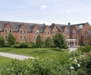
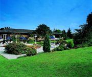
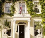
If you need a hotel, we compiled a list of available hotels close to the map centre further down the page.
While being here, you might want to pay a visit to some of the following locations: Swindon Village, Uckington, Churchdown, Gloucester and Shipton. To further explore this place, just scroll down and browse the available info.
Local weather forecast
Todays Local Weather Conditions & Forecast: 17°C / 62 °F
| Morning Temperature | 9°C / 48 °F |
| Evening Temperature | 10°C / 51 °F |
| Night Temperature | 9°C / 48 °F |
| Chance of rainfall | 3% |
| Air Humidity | 59% |
| Air Pressure | 1005 hPa |
| Wind Speed | Gentle Breeze with 7 km/h (5 mph) from North-East |
| Cloud Conditions | Few clouds, covering 23% of sky |
| General Conditions | Light rain |
Monday, 6th of May 2024
16°C (61 °F)
12°C (53 °F)
Light rain, light breeze, broken clouds.
Tuesday, 7th of May 2024
14°C (58 °F)
11°C (51 °F)
Light rain, light breeze, overcast clouds.
Wednesday, 8th of May 2024
16°C (60 °F)
13°C (56 °F)
Light rain, light breeze, overcast clouds.
Hotels and Places to Stay
Ellenborough Park
Wyastone
CHELTENHAM CHASE HOTEL-QHOTELS
Jurys Inn Cheltenham
Hilden Lodge
DoubleTree by Hilton Cheltenham
Cotswold Grange
No 38 The Park
Cheltenham Townhouse
Clarence Court Hotel
Videos from this area
These are videos related to the place based on their proximity to this place.
Network SouthEast 50017 and British Rail 50007 passing Cheltenham Spa
Network SouthEast 50017 and British Rail 50007 passing Cheltenham Spa.
To Cheltenham Railway Station
This is about a 5 minute walk from the flat. Bus stops both sides of the road outside together with a taxi rank, Tesco Express, Co-op and Post Office.
FULL WILTON HOUSE CLASSIC SUPERCAR 2014 MOVIE!!!
Sup Guys, finally, it's here... The Wilton House Classic Supercar 2014 Full Movie!! This years event was a huge success, with Shmee down there (with both the 12C and the three-wheeler) and...
Honeybourne Railway Line
A short video taken with my GoPro Hero 3 mounted on my Frontier X5. This is a walk down the disused Honeybourne Railway Line in Cheltenham, which has been turned into a cycle route & footpath.
Rail trip to Cheltenham Spa Part Four - Cheltenham Spa and Gloucester Stations
This section is filmed at Cheltenham Spa and a very short clip at Gloucester. It includes Arriva Trains Wales, Cross Country, and First Great Western.
The Honeybourne Line - From The Prince of Wales Stadium to Cheltenham Spa Station
http://www.daniel-baker.eu A time-lapse style trip along the Honeybourne line cycle route, from the Prince of Wales Stadium to Cheltenham Spa Railway Station. A beautiful hidden gem of Cheltenham.
Water Fasting Challenge for Weight Loss!
Height: 177cm 5'10" Starting weight: 162.2 Lb Fast Started from: 24th Octobor 0:00 GMT Hey guys If you haven't seen my last fat loss transformation please go watch that where I managed...
Videos provided by Youtube are under the copyright of their owners.
Attractions and noteworthy things
Distances are based on the centre of the city/town and sightseeing location. This list contains brief abstracts about monuments, holiday activities, national parcs, museums, organisations and more from the area as well as interesting facts about the region itself. Where available, you'll find the corresponding homepage. Otherwise the related wikipedia article.
Hesters Way
Hesters Way is an area in the western part of Cheltenham, Gloucestershire, England. It is home to Gloucestershire College's Cheltenham campus (formerly Gloscat) and Pate's Grammar School. According to the last Census the district has a population of 5,605 and an average unemployment rate of 4.75% of people who are of economically active age (16-74).
Cheltenham (UK Parliament constituency)
Cheltenham /ˈtʃɛlʔ. nəm/ or /ˈtʃɛlt. nəm/ is a constituency represented in the House of Commons of the UK Parliament since 2005 by Martin Horwood, a Liberal Democrat.
Cavendish House
Cavendish House is Cheltenham's oldest and leading department store (established in 1823), located on The Promenade. Its establishment was of great significance for Cheltenham's future reputation as a leading shopping centre. Known as 'Cavendish House' from its early days, its name was officially adopted with the registration of a limited liability company in 1883. The store became part of the House of Fraser group in 1969.
Dean Close School
Dean Close School is a leading co-educational day and boarding public school in Cheltenham, Gloucestershire, England. The School is divided into pre-prep, preparatory and senior schools located on separate but adjacent sites outside Cheltenham town centre, occupying the largest private land area in the town. Pupils may be enrolled as young as 3 in the pre-preparatory school, and continue through to 18 at the senior school.
Cheltenham Ladies' College
The Cheltenham Ladies' College is an independent boarding and day school for girls aged 11 to 18 in Cheltenham, Gloucestershire, England. In the Financial Times' Secondary School ranking, the Cheltenham Ladies College placed at 34 in 2011 and 14 in 2010. Having introduced the International Baccalaureate in 2010, school rankings have yet to reflect this change. The Tatler's School Guide 2012 noted that the school is "a rigorous academic place".
Benhall, Cheltenham
Benhall is a small district within the town of Cheltenham, Gloucestershire. It lies south-west of the town centre, just south of the main road to Gloucester, and north of the district of Up Hatherley. It falls mainly within the Anglican parish of St Mark.
St Philip and St James Church, Leckhampton
St Philip & St James, Leckhampton is a parish in south Cheltenham, in the English county of Gloucestershire. Part of the Anglican Diocese of Gloucester, the church has been centre for worship for more than 150 years and has a present congregational roll of over 200.
Montpellier, Cheltenham
Montpellier is a district of Cheltenham, Gloucestershire, at the end of the Promenade south of the town centre. Originally developed in the 1830s in conjunction with the spas, it is now known for its bars, cafés, restaurants and range of specialist shops. In April 2008 Montpellier was one of the most expensive areas in Cheltenham to buy property, with apartments ranging from £300,000 to over £1,000,000, townhouses from around £400,000, and houses over £4,000,000.
Rowanfield
Rowanfield is a neighbourhood in Cheltenham, England. It consists primarily of a social housing estate of Wimpey no-fines houses and low-rise flats, built around 1953, with Rowanfield School and a playing field to the West separating it from Hesters Way and also the older Rowanfield Road to the East. To the south-west Rowanfield borders the district of St Mark's. Rowanfield is located 1.5 miles west of the centre of Cheltenham.
Swindon Village
Swindon Village is both a village and a suburb in the spa town of Cheltenham, Gloucestershire, England. It is located northwest of Arle. Features of Swindon Village include: A large park and playing field. This includes several football pitches, a cricket pitch and two pavilions. St. Lawrence's Church, which is located in the centre of the village. This dates from the 12th Century. Its bell tower has six unequally sized walls. The Village Hall.
Cheltenham Town Hall
Cheltenham Town Hall is an early-20th century assembly rooms in Cheltenham, England. Unlike most town halls, it is a public venue and not the seat of the borough council, which is housed in the nearby municipal offices. The town hall was built in 1902-03, in order to provide a venue for social events, replacing the old Assembly Rooms in High Street which had been demolished to build a bank. The site chosen was part of Imperial Square.
Cheltenham Minster, St Mary's
Cheltenham Minster, St Mary's is a minster and the parish church of Cheltenham.
Alstone, Cheltenham
Alstone is a district of the English town of Cheltenham. Once a distinct village (it was listed in the Domesday Book with two mills on the River Chelt) and later informally called Alstone Spa as the result of the mineral waters there, Alstone was subsumed into the 19th-century expansion of the town of Cheltenham.
Cheltenham Art Gallery & Museum
Cheltenham Art Gallery and Museum in Cheltenham, Gloucestershire was opened in 1899. It offers free admission, and has a programme of special exhibitions. The museum is housed in a Regency building on Clarence Street, designed as the Cheltenham Public Library by architect William Hill Knight, who also designed the Cheltenham Synagogue and Montpellier Walk.
St. Pauls, Cheltenham
St. Pauls is one of a number of areas of the Cotswold town Cheltenham, Gloucestershire, England. St. Pauls is home to the Francis Close Hall, a campus of the University of Gloucestershire, St. Paul's Church, and many leisure facilities. Numerous stories exist of the gallows that were once housed there when the area was characterized by fields rather than housing. The area of St. Pauls takes its name from St. Paul’s Church at its centre. St.
Cheltenham High Street Halt railway station
Cheltenham High Street Halt was a railway station on the Great Western Railway's Honeybourne Line between Cheltenham and Birmingham via Stratford-upon-Avon. It opened in 1908 and closed in 1917 due to the First World War, never to be reopened.
Le Champignon Sauvage
Le Champignon Sauvage is a restaurant located in Cheltenham, Gloucestershire, England. As of 2008, the restaurant holds two stars in the Michelin Guide.
Cheltenham Spa Malvern Road railway station
Cheltenham Spa Malvern Road railway station was a station in the town of Cheltenham.
Cheltenham Spa St. James railway station
Cheltenham Spa St. James railway station was a station in the town of Cheltenham.
Cheltenham High Street railway station
Cheltenham High Street railway station was built by the Midland Railway to serve the north-western part of Cheltenham.
Everyman Theatre, Cheltenham
The Everyman Theatre, also known as "Gloucestershire's Theatre" is based in Regent Street, Cheltenham. There are two stages - the 658 seat main stage and the 60 seat Richardson Studio, named after Ralph Richardson. The Grade II listed building was designed in 1891 by Frank Matcham and was originally called "The Opera House". It was opened by Lilly Langtry. The Cheltenham Corporation ran it after World War II until 1960, when it became a community theatre and was renamed to the Everyman.
Montpellier Rotunda
Montpellier Rotunda is a Grade I listed building in Montpellier, Gloucestershire. It is currently a Lloyds TSB bank. In 1809, Henry Thompson constructed a wooden pavilion with a colonnade and by 1817 it was rebuilt in stone as Montpellier Spa became more and more popular. He employed the architect G. A. Underwood, who completed the building with a statue of crouching lion on the parapet.
All Saints' Academy, Cheltenham
All Saints' Academy is an academy in Cheltenham, England. The Academy is a church school, in cooperation with the Roman Catholic Diocese of Clifton and the Church of England Diocese of Gloucester. Construction started in April 2010. The Academy opened in September 2011. The project will cost nearly £25 million with £2 million on IT equipment. The school replaced Christ College, which opened as recently as 2007 as the county's first joint Roman Catholic and Church of England school.
The Bacon Theatre, Cheltenham
The Bacon Theatre is a medium-scale venue on the site of Dean Close School, Cheltenham. The theatre provides a teaching and leisure resource for the school as well as being available to hire for local community groups and providing a full programme of professional events.
Prince of Wales Stadium
The Prince of Wales Stadium is a multi-sport stadium in Cheltenham, Gloucestershire, England, with a running track and athletics facilities. The stadium is home to the Cheltenham Tigers rugby union club who use the ground for training and home games. It is also home to Cheltenham & County Harriers. From 2013, the Gloucestershire All-Golds rugby league club will play in Championship 1 at the Prince of Wales Stadium.


