Safety Score: 3,0 of 5.0 based on data from 9 authorites. Meaning we advice caution when travelling to United Kingdom.
Travel warnings are updated daily. Source: Travel Warning United Kingdom. Last Update: 2024-04-28 08:22:10
Delve into Toldish
Toldish in Cornwall (England) is located in United Kingdom about 223 mi (or 358 km) west of London, the country's capital town.
Current time in Toldish is now 08:55 PM (Sunday). The local timezone is named Europe / London with an UTC offset of one hour. We know of 10 airports close to Toldish, of which 3 are larger airports. The closest airport in United Kingdom is Newquay Cornwall Airport in a distance of 4 mi (or 7 km), North-West. Besides the airports, there are other travel options available (check left side).
There is one Unesco world heritage site nearby. It's Cornwall and West Devon Mining Landscape in a distance of 23 mi (or 37 km), South-East. Also, if you like playing golf, there is an option about 12 mi (or 19 km). away. If you need a hotel, we compiled a list of available hotels close to the map centre further down the page.
While being here, you might want to pay a visit to some of the following locations: Roche, Tregoney, Padstow, Newquay and Truro. To further explore this place, just scroll down and browse the available info.
Local weather forecast
Todays Local Weather Conditions & Forecast: 11°C / 52 °F
| Morning Temperature | 7°C / 45 °F |
| Evening Temperature | 9°C / 49 °F |
| Night Temperature | 7°C / 44 °F |
| Chance of rainfall | 0% |
| Air Humidity | 71% |
| Air Pressure | 1009 hPa |
| Wind Speed | Moderate breeze with 11 km/h (7 mph) from South-East |
| Cloud Conditions | Scattered clouds, covering 40% of sky |
| General Conditions | Light rain |
Monday, 29th of April 2024
10°C (51 °F)
11°C (51 °F)
Moderate rain, strong breeze, overcast clouds.
Tuesday, 30th of April 2024
11°C (51 °F)
9°C (48 °F)
Heavy intensity rain, fresh breeze, overcast clouds.
Wednesday, 1st of May 2024
12°C (54 °F)
8°C (46 °F)
Light rain, gentle breeze, overcast clouds.
Hotels and Places to Stay
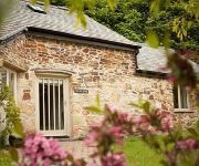
The Plume of Feathers
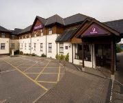
The Smugglers Inn Hotel
Newquay (A30/Fraddon)
Videos from this area
These are videos related to the place based on their proximity to this place.
Ancient World title screen
After being set a challenge David (The guy behind the web-series ancient world) wanted me to think out the box without shifting from the ancient theme. After a lot of thought whilst waiting...
Martin Jennings Run 2009
The 2009 Martin Jennings Run filmed from a bridge over the A30 before Indian Queens. A bike run dedicated to the memory of Martin Jennings raising money every year for local charities.
Retallack Resorts - Holiday Home Investment Opportunities
https://www.amatis.co.uk - Promo video created for Retallack Resorts for use on thewir website. Shot in one day, Amatis wrote the script, filmed, edited, voiced and produced the final output...
Landing at Newquay Cornwall Airport, Runway 30 (Cockpit View) [HD]
Cockpit view of Skybus Britten-Norman BN-2 Islander (G-SBUS) landing on Runway 30 at Newquay Airport, Cornwall (NQY) following a flight from St. Mary's Airport, Isles of Scilly (ISC)
Flowrider at Retallack Resort and Spa, Cornwall
Body boarding with instructor on the Flowrider @RetallackResort near Padstow in Cornwall lots of fun:-)
Cornish Birds of Prey Cornwall
I AM MOVING THIS TO MY NEW CHANNEL PLEASE FIND IT AT http://www.youtube.com/user/richcovephoto/videos This is a great place to visit when you are in Cornwall. The people that own this ...
Ryanair landing at Newquay from Stansted
subscribe for more, 40/50 videos since this was posted ^^^) A Ryanair Boeing 737-800 flying over London, Southampton and the Jurassic coast on its way from London Stansted for a Landing at...
The approach, landing and shut down at Newquay Cornwall Airport (GoPro Hero 2) [HD]
We flew from Bournemouth down to Newquay airport in Cornwall and this video comprises of a few scenes of the approach, landing and shut down. Not sure if it's visible but there was a Chinook...
Mark Morcom Driving through Fraddon and Indian Queens 1994
Driving through Fraddon and Indian Queens 1994 found this on my old video camera From Mark Morcom.
Videos provided by Youtube are under the copyright of their owners.
Attractions and noteworthy things
Distances are based on the centre of the city/town and sightseeing location. This list contains brief abstracts about monuments, holiday activities, national parcs, museums, organisations and more from the area as well as interesting facts about the region itself. Where available, you'll find the corresponding homepage. Otherwise the related wikipedia article.
St Columb Road
St Columb Road (Cornish: Fordh Sen Kolomm) is a small village near Fraddon and Indian Queens in Cornwall, England, UK. It lies half a mile from the A30 road. St Columb Road railway station is still open on the branch line from Par to Newquay. In 2007 following the world record pub quiz, the title of the brightest pub in Cornwall was awarded to the Queen and Railway at St Columb Road. However the pub had the fewest and smallest teams but the highest average score per person.
Fraddon
Fraddon is a village in central Cornwall, England, United Kingdom, in the parish of St Enoder. It is roughly midway between Newquay and St Austell and is south of the linked villages of St Columb Road and Indian Queens. Fraddon was formerly on the A30 road but a dual carriageway bypass now carries traffic south of the village. Fraddon is the home of Dick Cole, Leader of Mebyon Kernow and Cornwall Councillor for St Enoder. Just south of Fraddon is the settlement of Blue Anchor.
St Austell and Newquay (UK Parliament constituency)
St Austell and Newquay is a constituency represented in the House of Commons of the UK Parliament since its 2010 creation by Stephen Gilbert, a Liberal Democrat .
Ruthvoes
Ruthvoes is a settlement in central Cornwall, England, United Kingdom. It is in the parish of St Columb Major, about two miles (3 km) south of St Columb Major town and 6+⁄2 miles east of Newquay. The village lies on the northwest edge of Goss Moor near the A30 dual carriageway trunk road. The Par to Newquay branch railway passes south of the settlement. Ruthvoes is the location of the holy well of Saint Columba the virgin and, according to legend, is where she was beheaded.
Springfields Fun Park
Springfields Fun Park is a small theme park in Cornwall, United Kingdom. It is situated just over one mile south of St Columb Major and advertises itself as Springfields Fun Park and Pony Centre.
Trevarren
Trevarren is a hamlet north of Indian Queens in Cornwall, United Kingdom.
Toldish Tunnel
Toldish Tunnel was built by Joseph Treffry as part of his mineral tramway from Newquay (Newquay to St. Dennis) which opened in 1849. This line was built to carry trams. In 1874 the line was taken over by the Cornwall Minerals Railway and the line from Newquay was extended to Par railway station. At this time the line from Newquay to Par was converted to standard gauge which was needed for the larger passenger carrying trains.
Retew
Retew was a village near St Austell in Cornwall, England, UK, that was demolished in the early 1960s when the nearby Wheal Remfrey china clay quarry and waste heaps were expanded. The village was small, containing 24 houses and a factory, and stood on land owned by the quarry owners, English China Clays. The fate of the village had been expected and the residents were rehoused by the company.


!['Landing at Newquay Cornwall Airport, Runway 30 (Cockpit View) [HD]' preview picture of video 'Landing at Newquay Cornwall Airport, Runway 30 (Cockpit View) [HD]'](https://img.youtube.com/vi/qKMD0sQYKe4/mqdefault.jpg)


!['The approach, landing and shut down at Newquay Cornwall Airport (GoPro Hero 2) [HD]' preview picture of video 'The approach, landing and shut down at Newquay Cornwall Airport (GoPro Hero 2) [HD]'](https://img.youtube.com/vi/7VizXNJmYJw/mqdefault.jpg)

