Safety Score: 3,0 of 5.0 based on data from 9 authorites. Meaning we advice caution when travelling to United Kingdom.
Travel warnings are updated daily. Source: Travel Warning United Kingdom. Last Update: 2024-04-25 08:17:04
Delve into Thriplow
Thriplow in Cambridgeshire (England) with it's 488 habitants is a city located in United Kingdom about 42 mi (or 67 km) north of London, the country's capital town.
Current time in Thriplow is now 08:36 AM (Friday). The local timezone is named Europe / London with an UTC offset of one hour. We know of 9 airports closer to Thriplow, of which 5 are larger airports. The closest airport in United Kingdom is Duxford Airport in a distance of 2 mi (or 3 km), East. Besides the airports, there are other travel options available (check left side).
There are several Unesco world heritage sites nearby. The closest heritage site in United Kingdom is Blenheim Palace in a distance of 36 mi (or 58 km), South-West. Also, if you like playing golf, there are some options within driving distance. We saw 1 points of interest near this location. In need of a room? We compiled a list of available hotels close to the map centre further down the page.
Since you are here already, you might want to pay a visit to some of the following locations: Grantchester, Barton, Cambridge, Whaddon and Wimpole. To further explore this place, just scroll down and browse the available info.
Local weather forecast
Todays Local Weather Conditions & Forecast: 9°C / 49 °F
| Morning Temperature | 0°C / 32 °F |
| Evening Temperature | 9°C / 49 °F |
| Night Temperature | 4°C / 40 °F |
| Chance of rainfall | 0% |
| Air Humidity | 63% |
| Air Pressure | 1004 hPa |
| Wind Speed | Gentle Breeze with 6 km/h (4 mph) from South-West |
| Cloud Conditions | Broken clouds, covering 55% of sky |
| General Conditions | Broken clouds |
Saturday, 27th of April 2024
8°C (47 °F)
7°C (45 °F)
Moderate rain, moderate breeze, overcast clouds.
Sunday, 28th of April 2024
8°C (47 °F)
5°C (42 °F)
Light rain, gentle breeze, overcast clouds.
Monday, 29th of April 2024
13°C (56 °F)
7°C (45 °F)
Sky is clear, moderate breeze, clear sky.
Hotels and Places to Stay
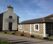
Coach House Flintcross
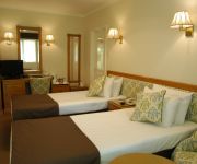
DUXFORD LODGE HOTEL AND RESTAU
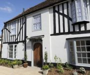
Red Lion
JCT.10 Holiday Inn Express CAMBRIDGE-DUXFORD M11
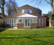
Ayah Villa Guest House
Aylesbray Lodge
Sorrento
The Kings Head
Videos from this area
These are videos related to the place based on their proximity to this place.
Kerala Egg omlette
Kerala Egg Omlette is very different to other omlettes, due to the curry leaves added and prepared in virgin coconut oil. Try it you will enjoy it.
SugarFingers jam's in Wisbech, Cambridgehire, little Red Rooster blues Jam
Hangin' out for my last Two days in the U.K. Went to a birthday bash in the Fens, Wisbech. Was my mates Les Wither's birthday (Bass player), nuff respec to you Les! We had good fun!. This...
Duxford Focke Wulf 190 and Messerschmitt 109 WW2 Fighter
Focke-Wulf and Me 109 display German ww2 Fighters Flying Legends - 11th July 2009 Flying Legends - two words which instantly evoke the very best of classic aircraft displaying at Duxford...
The Horsemen at Duxford 10. July 2009.
The P-51 Mustang aerobatics team "The Horsemen" practise before the Flying Legends airshow 2009. Aircraft flown by Jim Beasley (lead), Dan Friedkin (#2) and Ed Shipley (#3).
Duxford Car Show 2013
Few of the cars that Attended the Duxford Spring Car Show 2013, Brand new camera so not very good at using it yet but at least you can hear the engines! The Pontiac at the end flicked up...
Imperial War Museum Duxford Military Vehicles Day Photos
My photos from the Imperial War Museum Duxford Military Vehicles Day. The two main events for the MVs was the cavalcade round the runway for the wheeled vehicles and then demo in the Land ...
Videos provided by Youtube are under the copyright of their owners.
Attractions and noteworthy things
Distances are based on the centre of the city/town and sightseeing location. This list contains brief abstracts about monuments, holiday activities, national parcs, museums, organisations and more from the area as well as interesting facts about the region itself. Where available, you'll find the corresponding homepage. Otherwise the related wikipedia article.
South Cambridgeshire
South Cambridgeshire is a mostly rural local government district of Cambridgeshire, England. It was formed on 1 April 1974 by the merger of Chesterton Rural District and South Cambridgeshire Rural District. It surrounds the city of Cambridge, which is administered separately from the district by Cambridge City Council. On the abolition of South Herefordshire and Hereford districts to form the unitary Herefordshire in 1998, it became the only English district to completely encircle another.
Imperial War Museum Duxford
Imperial War Museum Duxford (commonly referred to simply as "Duxford") is a branch of the Imperial War Museum near the village of Duxford in Cambridgeshire, England. Britain's largest aviation museum, Duxford houses the museum's large exhibits, including nearly 200 aircraft, military vehicles, artillery and minor naval vessels in seven main exhibitions buildings.
Rowley's Hill
Rowley's Hill is a hill in Cambridgeshire, near the villages of Harston and Newton. Although of only moderate height (50 m/164 ft), it has a relatively large prominence due to it being surrounded on all sides by a 'moat' of much lower land. It therefore stands separate from the other hills in the region and has a distinctive appearance. The hill has a north east top, St Margaret's Mount, on top of which is an obelisk.
South Cambridgeshire Rural District
South Cambridgeshire was a rural district in Cambridgeshire, England from 1934 to 1974. It was formed in 1934 under a County Review Order. It was formed by merger of Linton Rural District and Melbourn Rural District and part of Caxton and Arrington Rural District. In 1965 it became part of the new administrative county of Cambridgeshire and the Isle of Ely.
Melbourn Rural District
Melbourn was a rural district in Cambridgeshire, England, from 1894 to 1934. It was formed in 1894 under the Local Government Act 1894, from that part of the Royston rural sanitary district which was in Cambridgeshire (the rest being part of Hertfordshire and in the Ashwell Rural District). The three parishes historically in Essex were part of Melbourn RD.
Duxford Aerodrome
Duxford Aerodrome is located 8 NM south of Cambridge, within the Parish of Duxford, Cambridgeshire, England and nearly 1-mile west of the village. The airfield is owned by the Imperial War Museum (IWM) and it is the site of Imperial War Museum Duxford and the American Air Museum, which is conveniently located there, quite near to the Cambridge American Cemetery and Memorial between Madingley and Coton, west of Cambridge City and only 9 mi north of Duxford.
Gregory Wale
Gregory Wale (1668 – 5 June 1739) was a Cambridgeshire gentleman, a Justice of the Peace for Cambridgeshire and Conservator of the River Cam.
Harston railway station
Harston was a railway station on the Hitchin-Cambridge Line, which served the village of Harston in Cambridgeshire. The station opened on 1 April 1852, and closed on 17 June 1963. A small part of the former northbound platform remains in situ but otherwise all remains of the station have gone. However, the Hitchin-Cambridge Line, which formerly served the station, remains an increasingly busy commuter line connecting the East Coast Main Line to the West Anglia Main Line.


