Safety Score: 2,8 of 5.0 based on data from 9 authorites. Meaning we advice caution when travelling to Canada.
Travel warnings are updated daily. Source: Travel Warning Canada. Last Update: 2024-04-29 08:03:39
Explore Chestnut Hills
The district Chestnut Hills of Humber Valley Village in Ontario is located in Canada about 224 mi south-west of Ottawa, the country's capital.
If you need a place to sleep, we compiled a list of available hotels close to the map centre further down the page.
Depending on your travel schedule, you might want to pay a visit to some of the following locations: Toronto, Milton, Lockport, Buffalo and Woodstock. To further explore this place, just scroll down and browse the available info.
Local weather forecast
Todays Local Weather Conditions & Forecast: 9°C / 48 °F
| Morning Temperature | 8°C / 46 °F |
| Evening Temperature | 12°C / 53 °F |
| Night Temperature | 9°C / 48 °F |
| Chance of rainfall | 4% |
| Air Humidity | 98% |
| Air Pressure | 1012 hPa |
| Wind Speed | Light breeze with 4 km/h (3 mph) from West |
| Cloud Conditions | Overcast clouds, covering 100% of sky |
| General Conditions | Moderate rain |
Wednesday, 1st of May 2024
15°C (59 °F)
12°C (53 °F)
Broken clouds, gentle breeze.
Thursday, 2nd of May 2024
20°C (68 °F)
13°C (55 °F)
Overcast clouds, light breeze.
Friday, 3rd of May 2024
15°C (58 °F)
14°C (57 °F)
Light rain, gentle breeze, overcast clouds.
Hotels and Places to Stay
DELSUITES NUVO
OLD MILL INN AND SPA
Toronto Airport Marriott Hotel
Sheraton Toronto Airport Hotel & Conference Centre
Crowne Plaza TORONTO AIRPORT
Delta Hotels Toronto Airport & Conference Centre
DoubleTree by Hilton Toronto Airport
BEST WESTERN PREMIER TORONTO
Courtyard Toronto Airport
Inverness High Park Bed & Breakfast
Videos from this area
These are videos related to the place based on their proximity to this place.
Village Trattoria
Village Trattoria is located in the heart of Old Islington Village in Etobicoke, Toronto, Canada. Come taste authentic southern mediterranean cuisine form Italy inspired by various other european...
Fun Flying My Sab Goblin 700 RC Helicopter, Deep Inside The City Of Toronto... 2013.
Shot This Video On Aug. 24, 2013. * Best viewed in 720 or 1080p * Prior to making this video, I hadn't flown much in the weeks before this flight...This was just a simple case of temporary...
Waste Management Incorporated 6:30 AM in Etobicoke Toronto Noise By-Law issue repeated.
6:30 am Friday September 12th 2014 Goodwill 4975 Dundas St W, Etobicoke Waste Management Incorporated City of Toronto Noise by-law contravention. at the rear of the Goodwill location in...
Прогулки по Торонто с компанией Felix Tours: Etobicoke
История Islington Village в настенной живописи: незабываемые истории гида Феликса Шустера. Вы прекрасно проведете...
3 Michael Power Place 2404, Etobicoke
Welcome to Etobicoke. The investors last chance for below market prices are only on Michael Power Place. This 680 sq2 one plus den condo boasts stainless steel appliances and grantie counter...
5 Michael Power Place #2008, Etobicoke
A rare 2 bedroom 2 bathroom 820 sq2 corner unit condominium in the heart of Islington Village. Includes a balcony with an unobstructed view of the lake and the downtown core. Within walking...
Toronto Homes: 144 Perry Crescent, Etobicoke
http://www.rebeccalaing.ca presents homes in Toronto. Welcome to 144 Perry Crescent in the Islington Heights neighbourhood of Etobicoke. For more information, please contact Rebecca Laing,...
Plumbing, Drain Cleaning and Emergency Plumber in Etobicoke | Rooter Group Inc
http://rootergroupinc.ca/ Can't flush? We Rush! When you need a qualified plumber to help you with residential or commercial plumbing needs, call Rooter Group Inc. Our team is dedicated to...
Humber Valley House - Just Sold
http://www.peterrussellrealestate.com/index.php Humber Valley 5 + 1 bedroom family home on quiet street. Move-in ready. Nothing to do but unpack and enjoy. Bright and spacious - 3970 square...
17 Michael Power Place #201, Etobicoke
In The Heart Of Islington Village 'Port Royal Place'. Enjoy A Stroll To The Neighbourhood Shops And Cafes. Tired Of Paying For Rising Gas Prices - The Bloor/Islington Subway, Kipling Subway...
Videos provided by Youtube are under the copyright of their owners.
Attractions and noteworthy things
Distances are based on the centre of the city/town and sightseeing location. This list contains brief abstracts about monuments, holiday activities, national parcs, museums, organisations and more from the area as well as interesting facts about the region itself. Where available, you'll find the corresponding homepage. Otherwise the related wikipedia article.
The Kingsway
The Kingsway is a residential neighbourhood of Toronto, Ontario, Canada. It is located in the former City of Etobicoke, an area that became the west end of Toronto upon amalgamation in 1998. It is bounded by Bloor Street to the south, Dundas Street to the north, the Mimico Creek to the west and the Humber River to the east. While the area was first known as "Kingsway Park", popular usage drifted to "The Kingsway", that being the name of the main road which winds through the heart of the area.
Baby Point
Baby Point is a residential neighbourhood in west end of Toronto, Ontario, Canada. It was formerly in the City of York, and was two independent municipalities prior to that. It is bounded on the west by the Humber River from south of Baby Point Crescent to St. Marks Road, east to Jane Street and Jane Street south to Raymond Avenue and Raymond Avenue west to the Humber. It is within the city-defined neighbourhood of 'Lambton-Baby Point.
Kipling (TTC)
Kipling is the western terminus of the Bloor–Danforth line in Toronto, Canada. The station is served by buses and subway trains operated by the Toronto Transit Commission and is adjacent to Kipling GO Station on the Milton line. It is located in the Islington-Six Points area on St. Albans Road at Aukland Road, just west of the overpass of Kipling Avenue, after which it is named. The Toronto Parking Authority operates three commuter parking lots near the station.
Islington (TTC)
Islington is a station on the Bloor–Danforth line of the subway system in Toronto, Canada. It is located at 3286 Bloor Street West at Islington Avenue. A central platform serves trains running in both directions.
Old Mill (TTC)
Old Mill is a station on the Bloor–Danforth line of the subway system in Toronto, Canada. It is located at 2672 Bloor Street West at Old Mill Terrace/Humber Boulevard. The station is built into the side of the Humber River valley. Its west end is underground, while the east end of the train platform is on a bridge that takes the line across the river. Glass walls at the train platform's east end provide a view of the riverside park.
Royal York (TTC)
Royal York is a station on the Bloor–Danforth line of the subway system in Toronto, Canada. It is located at 3012 Bloor Street West at Royal York Road.
Kipling GO Station
Kipling GO Station is a GO Transit railway station along the Milton line rail corridor in the Greater Toronto Area, Ontario, Canada. It is located at 27 St. Albans Road in the historic Islington neighbourhood of Toronto, near Dundas Street. It is connected to the TTC's Kipling station on the Bloor-Danforth subway line which is right underneath it. A pair of tracks serve the station, with a single island platform between them, but GO trains generally use the south tracks.
Richview Collegiate Institute
Richview Collegiate Institute is a secondary school in Etobicoke, in the west end of Toronto, Ontario. It is in the Toronto District School Board. The school was founded in 1958. Richview’s Latin motto, "Monumentum Aere Perennius" means "a monument more lasting than bronze". Its traditional rivals are the Etobicoke Collegiate Institute "Rams" to the south. Richview's current Principal is Sam Miceli, and the two Vice Principals are Julie Ardell and Lucie Kletke.
Etobicoke Collegiate Institute
Etobicoke Collegiate Institute (E.C.I. ) is a large high school located at the former centre of Etobicoke in the historic Islington neighbourhood in Toronto's west end, and is overseen by the Toronto District School Board. It was founded in the fall of 1928 and is one of Toronto's oldest schools and the first and traditionally central school for Etobicoke, having celebrated its 75th anniversary in 2003. The high school has about 1450 students and over 100 teachers. E.C.
Montgomery's Inn
Montgomery's Inn is a historic home and inn in the Islington neighbourhood of Etobicoke in the city of Toronto, Ontario, Canada. Built in 1832 in a Georgian style with later additions, the inn has been restored to an 1847 period, and operates as a museum of the City of Toronto. It is named for innkeeper Captain Thomas Montgomery (1790-1877). Once in danger of demolition, it is a cherished remnant of colonial times in Upper Canada.
Islington-City Centre West
Islington-City Centre West (also known as Six Points or Etobicoke City Centre) is a neighbourhood in Toronto, Ontario, Canada. It is one of Toronto's CBDs located in the former City of Etobicoke. Islington is bounded on the north by Rathburn Road, on the east by Kipling Avenue, Mimico Creek, and Islington Avenue, on the south by the Gardiner Expressway, and on the west by Etobicoke Creek and Highway 427.
Lambton, Toronto
Lambton is a neighbourhood in the city of Toronto, situated on the east bank of the Humber River north and south of Dundas Street West. It is bounded on the north by Black Creek, on the east by Jane Street and on the south by St. Mark's Road. The area west of Gooch Road is also known as "Warren Park", the name of the housing sub-division built in the 1950s. The portion south of Dundas Street is within the 'Lambton Baby Point' neighbourhood as defined by the City of Toronto.
Lambton Golf Club
Lambton Golf and Country Club is a private golf and tennis club in Toronto, Ontario, Canada. The Club is located in the eastern banks of the Humber River, west of Jane Street. It was established in 1902, designed by George Cumming, with input from George Lyon, who became its best-known member.
Thorncrest Village
Thorncrest Village is a neighbourhood in northwestern Toronto. It is a collection of tree-lined streets north of Rathburn Road, between Kipling and Islington avenues, in what used to be part of Etobicoke. Designed by architect and town planner Eugene Faludi, the village was considered one of Toronto's first modern suburbs. Village residents own three parkettes and a park with a clubhouse, tennis courts, a swimming pool and a playground.
Bishop Allen Academy
Bishop Allen Academy (officially Bishop Allen Academy Catholic Secondary School, alternatively as Bishop Allen, Bishop Allen Academy CSS, BAA, BAACSS, or Allen) is a high school located in the The Queensway – Humber Bay neighbourhood of Toronto, Ontario, Canada. It is managed by the Toronto Catholic District School Board.
Scarlett Heights Entrepreneurial Academy
Scarlett Heights Entrepreneurial Academy (SHEA) is a secondary school within the Toronto District School Board whose curriculum is broadened through a Student Leadership Development Program. This program extends the base curriculum. In the September 2006 issue of Toronto Life, Scarlett Heights was named “Best For Business” in the rating of the “10 Best Schools In Toronto”.
Princess Gardens
Princess Gardens is a neighbourhood in Toronto, Ontario, Canada. It is located in the western area of Toronto that was formerly the City of Etobicoke. Its boundaries are Eglinton Avenue to the north, Martin Grove to the west, Islington to the east, and Rathburn Road to the south. The southeastern part of this area is the separate neighbourhood of Thorncrest Village. The neighbourhood is divided into two areas.
St. George's Golf and Country Club
St. George's Golf and Country Club (originally The Royal York Golf Club) is a golf course and country club located in Etobicoke, Toronto, Ontario in the west end neighbourhood of Islington. The club was established originally in 1909 by Robert Home Smith from Stratford-upon-Avon, England who originally purchased the area of land which was located on the banks of the Humber River.
Royal York Road
Royal York Road, historically known as Church Street or New Church Street, is a north-south arterial road in Toronto, Ontario, Canada. It is a concession road, 5 concessions (10 km) west of Yonge Street, and runs through many residential neighbourhoods, most notably Mimico and the Kingsway. It is classified as a "minor arterial" by the city of Toronto. The road begins in the south near the shoreline of Lake Ontario, just south of Lake Shore Blvd.
Lambton House
Lambton House is a historic former inn in Toronto, Ontario, Canada. It is the last remaining building from the former village of Lambton Mills along the Humber River in the 19th century.
Old Mill Inn & Spa
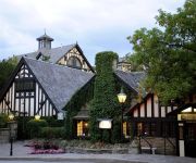
The Old Mill Inn and Spa is an English-style inn and restaurant in The Kingsway neighbourhood of the Toronto suburb of Etobicoke. It is located off Bloor Street, overlooking the Humber River along 2.5 hectares, at 21 Old Mill Road. The Old Mill subway station is a short distance away. The Old Mill restaurant and conference centre had hosted wedding receptions and corporate events for decades, but a hotel and spa opened in October 2001, with 47 rooms and 13 suites.
Islington Junior Middle School
Islington JMS is a public elementary school in the historic Islington neighbourhood of Etobicoke, Ontario, Canada. It is part of the Toronto District School Board and is located close to the intersection of Burnhamthorpe Road and Dundas Street West. Founded in 1832, it is the oldest school in Etobicoke and one of the oldest in Toronto.
Park Lawn Cemetery
Park Lawn Cemetery is a large cemetery in the western Etobicoke section of Toronto, Canada. In the heart of the city’s west end is one of Canada’s most historically significant cemeteries. Park Lawn Cemetery & Mausoleum opened in 1892 and is the final resting place for many of Canada’s prominent citizens. With over 73 acres of rolling park-like grounds, it is not just a beautiful cemetery but also a tranquil retreat to visit for a walk; a place for peaceful reflection.
Lambton Mills
The Village of Lambton Mills was a settlement at the crossing of Dundas Street and the Humber River. The settlement was on both sides of the Humber River, in both the former Etobicoke Township and York Township, within today's City of Toronto, Ontario, Canada. It extended as far west as Royal York Road at Dundas, as far north as the still-existing CPR rail line north of Dundas, as far east as Scarlett Road and as far south as today's Queen Anne Road.
Our Lady of Sorrows Roman Catholic Church, Kingsway
Our Lady of Sorrows is a Roman Catholic church in Toronto's western district of Etobicoke, in the neighbourhood of The Kingsway. The parish includes the central section of Etobicoke where two much earlier Catholic missions once served as the first Roman Catholic places of worship in Etobicoke.


