Safety Score: 2,8 of 5.0 based on data from 9 authorites. Meaning we advice caution when travelling to Canada.
Travel warnings are updated daily. Source: Travel Warning Canada. Last Update: 2024-04-19 08:03:45
Delve into Runnymede
Runnymede in Ontario is located in Canada about 222 mi (or 357 km) south-west of Ottawa, the country's capital town.
Current time in Runnymede is now 05:45 AM (Friday). The local timezone is named America / Toronto with an UTC offset of -4 hours. We know of 9 airports close to Runnymede, of which 5 are larger airports. The closest airport in Canada is Downsview Airport in a distance of 5 mi (or 8 km), North. Besides the airports, there are other travel options available (check left side).
Also, if you like playing golf, there are some options within driving distance. We encountered 2 points of interest near this location. If you need a hotel, we compiled a list of available hotels close to the map centre further down the page.
While being here, you might want to pay a visit to some of the following locations: Toronto, Milton, Lockport, Buffalo and Albion. To further explore this place, just scroll down and browse the available info.
Local weather forecast
Todays Local Weather Conditions & Forecast: 10°C / 50 °F
| Morning Temperature | 8°C / 46 °F |
| Evening Temperature | 11°C / 52 °F |
| Night Temperature | 8°C / 46 °F |
| Chance of rainfall | 5% |
| Air Humidity | 81% |
| Air Pressure | 1010 hPa |
| Wind Speed | Moderate breeze with 11 km/h (7 mph) from East |
| Cloud Conditions | Overcast clouds, covering 100% of sky |
| General Conditions | Moderate rain |
Friday, 19th of April 2024
8°C (46 °F)
5°C (41 °F)
Light rain, moderate breeze, overcast clouds.
Saturday, 20th of April 2024
11°C (52 °F)
8°C (47 °F)
Few clouds, moderate breeze.
Sunday, 21st of April 2024
11°C (51 °F)
7°C (45 °F)
Light rain, gentle breeze, few clouds.
Hotels and Places to Stay
Holiday Inn TORONTO-YORKDALE
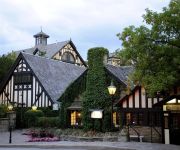
OLD MILL INN AND SPA
JJ Furnished Apartments Downtown Toronto: King's Luxury Loft
Drake Hotel
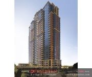
DELSUITES NUVO
Inverness High Park Bed & Breakfast
Spadina 11 Guesthouse
Urban Living Suites
Toronto Escape - The Quartz Townhouse
Rose Garden Bed and Breakfast
Videos from this area
These are videos related to the place based on their proximity to this place.
Episode 3: Bicycle Trip Phoenix - El Paso: Gear
Epsiode 3 in the 500 mile/d day bike trip Phoenix-El Paso http://www.bernieschmidt.com/cycle-blog. This.
Canadian Pacific Christmas Holiday Train December 01 2009 at West Toronto.
The spectaculary lit Canadian Pacific Holiday Train pulls into West Toronto on the evening of December 01,2009. Engine 9815 pulling a variety of box cars,a stage car,power car,office car,and...
Canadian Pacific Holiday Train 2008 - TORONTO CANADA
Please rate this video and thanks for watching. Canadian Pacific Holiday Train arriving in Toronto, Ontario - CPR Lambton (Stockyards) - December 2nd, 2008 at approx. 1830 hrs. The lead...
Village by High Park
March 06-10: A visit to the site see the roof is on the east end of the first tower and about 3 more floor for the east section Some time before the other towers get close to the top. The street...
2009 CP Holiday Train (a Fan Video)
The 2009 CP Holiday Train All Photos and Video By CP9712 French Version: http://www.youtube.com/watch?v=Hd6D0ukUnfQ.
CP Canadian Holiday Train 2012.MP4
Holiday Train Making a difference, one stop at a time The Canadian Pacific Holiday Train has hit the rails again and will be visiting over 150 communities across our network. Each event features...
Canadian Pacifc Holiday Train 2008 - TORONTO -[HQ][16:9]
Please rate this video and thanks for watching. Canadian Pacific Holiday Train arriving in Toronto, Ontario - CPR Lambton (Stockyards) - December 2nd, 2008 at approx. 1830 hrs. The lead...
[Select START] Super Mario Sunshine (Part 29) ~ Battles for Eelantis and Manta City
Check out the rest of our awesome content at http://www.IXIstudios.ca. Ichida za Zeal and Cell Saga hunt down Shadows. Wait, this isn't Persona...
66 Baby Point Road Toronto Motria Dzulynsky
Motria Dzulynsky Sales Representative Office: (416) 236-1241 Fax: (416) 231-0563 RE/MAX Professionals Inc., Brokerage 270 The Kingsway Suite 200 Toronto, ON M9A 3T7 Powered by ...
Videos provided by Youtube are under the copyright of their owners.
Attractions and noteworthy things
Distances are based on the centre of the city/town and sightseeing location. This list contains brief abstracts about monuments, holiday activities, national parcs, museums, organisations and more from the area as well as interesting facts about the region itself. Where available, you'll find the corresponding homepage. Otherwise the related wikipedia article.
CPR Lambton Yard
Lambton Yard is a freight marshalling yard for the Canadian Pacific Railway in Toronto, Ontario, Canada, and is located to the west of and contiguous with the West Toronto Yard on the Galt Subdivision. The two were the main freight marshalling yard complex for the CPR in Toronto until replaced by the modern CPR Toronto Yard in Agincourt in April 1964. Built from 1912 to 1913, Lambton served as mechanical and freight facilities. It also had a roundhouse facility from 1913 to 1960.
Western Technical-Commercial School
Western Technical-Commercial School (WTCS) is a high school in the High Park North neighbourhood of Toronto, Canada. It shares the same building with Ursula Franklin Academy and The Student School. Originally two schools when it was opened, Western Technical and Western Commercial, the present school is now the product of the merger between the two schools. The main building was constructed in 1927, with the addition being constructed in 1967-1970.
Runnymede Collegiate Institute
Runnymede Collegiate Institute is a high school located on Jane Street in Toronto, Ontario, Canada. The school first opened in 1927 and is operated by the Toronto District School Board. The school principal is Paul Edwards. The school has been certified as a bronze eco-school for its environmental endeavors. The school's yearbook is known as the Magna Carta. This stems from the name of the document signed by King John at Runnymede, England, in 1215.
Lambton, Toronto
Lambton is a neighbourhood in the city of Toronto, situated on the east bank of the Humber River north and south of Dundas Street West. It is bounded on the north by Black Creek, on the east by Jane Street and on the south by St. Mark's Road. The area west of Gooch Road is also known as "Warren Park", the name of the housing sub-division built in the 1950s. The portion south of Dundas Street is within the 'Lambton Baby Point' neighbourhood as defined by the City of Toronto.
CPR West Toronto Yard
West Toronto Yard is a small marshalling yard for Canadian Pacific Railway on the Galt Subdivision in Toronto, Ontario, Canada. The yard was built in 1882 to relieve stress at the Parkdale Yard and is located near Keele Street and Dundas Street West in The Junction. It was once the main yards for Toronto, but was replaced in that role in April 1964 by the CPR Toronto Yard in Agincourt. The roundhouse was demolished in 1998.
Archbishop Romero Catholic Secondary School
Archbishop Romero Catholic Secondary School (acronym as ARCSS, Archbishop Romero, Archbishop Romero CSS, or in short Romero) is a Catholic high school located in York, Ontario, a municipality of Toronto. It belongs to the Toronto Catholic District School Board. It is named after Salvadoran archbishop Oscar Romero, who was assassinated in 1980.
Humberside Collegiate Institute
Humberside Collegiate Institute is a public high school located in Toronto, Ontario, Canada. It serves the Bloor West Village, Baby Point, High Park North and Junction neighbourhoods. Humberside was established in 1892 and has an academic program for students in grades 9 through 12. In addition to the regular curriculum, the school has a strong music program, as well as an Extended French and French Immersion program.
George Harvey Collegiate Institute
George Harvey Collegiate Institute is a high school in Toronto, Ontario, Canada located at 1700 Keele Street. It is a school focused on technology and offers a STEPS to University program as well as a program called Cybridge E3. It is also the first TDSB school to provide netbooks to students.
Runnymede Park
Runnymede Park is a medium-sized public park located in The Junction neighbourhood of Toronto, Canada, one block east of Runnymede Road. Its southern boundary is the West Toronto Yard used by the Canadian Pacific Railway, its northern boundary is Ryding Avenue, while a laneway and parking lot make up the western and eastern boundaries respectively. It is relatively flat, and features many soaring mature oak trees.
Ravina Gardens
Ravina Gardens was an ice hockey arena located in Toronto, Ontario, Canada. It supported amateur hockey, and professional hockey briefly in the 1920s. The location of the demolished arena is parkland, and is known as Ravina Gardens. It was located at the foot of Rowland Street, southeast of Annette Street and Evelyn Avenue in West Toronto Junction.
Runnymede, Toronto
Runnymede is a neighbourhood in Toronto, Ontario, Canada located north of Bloor Street West between Jane Street and Runnymede Road north to Dundas Street West. It is located directly north of the former village of Swansea and west of the High Park North neighbourhood. The immediate area around Bloor Street is commonly known as Bloor West Village after the shopping area along Bloor Street, whereas the area to the north is considered the Runnymede neighbourhood.
St. Paul The Apostle Church (Toronto)
St. Paul The Apostle is a Roman Catholic church in Toronto, Canada. It is located at Dundas Street West in the The Junction neighbourhood. The church was primarily build in 1930 by the Maltese-Canadian community of Toronto. A larger, new church was build on the ground by the same community in 1956.





!['Canadian Pacifc Holiday Train 2008 - TORONTO -[HQ][16:9]' preview picture of video 'Canadian Pacifc Holiday Train 2008 - TORONTO -[HQ][16:9]'](https://img.youtube.com/vi/fVhe0fiYpCk/mqdefault.jpg)
!['[Select START] Super Mario Sunshine (Part 29) ~ Battles for Eelantis and Manta City' preview picture of video '[Select START] Super Mario Sunshine (Part 29) ~ Battles for Eelantis and Manta City'](https://img.youtube.com/vi/V1_oFqZQz4w/mqdefault.jpg)


