Safety Score: 2,7 of 5.0 based on data from 9 authorites. Meaning we advice caution when travelling to United States.
Travel warnings are updated daily. Source: Travel Warning United States. Last Update: 2024-05-08 08:04:21
Explore Kiptopeke
Kiptopeke in Northampton County (Virginia) is located in United States about 135 mi (or 217 km) south-east of Washington DC, the country's capital.
Local time in Kiptopeke is now 07:26 PM (Wednesday). The local timezone is named America / New York with an UTC offset of -4 hours. We know of 8 airports in the wider vicinity of Kiptopeke, of which 5 are larger airports. The closest airport in United States is Norfolk International Airport in a distance of 21 mi (or 34 km), South-West. Besides the airports, there are other travel options available (check left side).
There is one Unesco world heritage site nearby. It's Monticello and the University of Virginia in Charlottesville in a distance of 104 mi (or 168 km), North-West. Also, if you like golfing, there are multiple options in driving distance. We found 1 points of interest in the vicinity of this place. If you need a place to sleep, we compiled a list of available hotels close to the map centre further down the page.
Depending on your travel schedule, you might want to pay a visit to some of the following locations: Eastville, Virginia Beach, Poquoson, Hampton and Norfolk. To further explore this place, just scroll down and browse the available info.
Local weather forecast
Todays Local Weather Conditions & Forecast: 27°C / 80 °F
| Morning Temperature | 20°C / 67 °F |
| Evening Temperature | 27°C / 80 °F |
| Night Temperature | 21°C / 69 °F |
| Chance of rainfall | 7% |
| Air Humidity | 62% |
| Air Pressure | 1007 hPa |
| Wind Speed | Gentle Breeze with 8 km/h (5 mph) from South-East |
| Cloud Conditions | Broken clouds, covering 84% of sky |
| General Conditions | Moderate rain |
Wednesday, 8th of May 2024
25°C (77 °F)
20°C (68 °F)
Heavy intensity rain, fresh breeze, overcast clouds.
Thursday, 9th of May 2024
22°C (71 °F)
18°C (64 °F)
Light rain, moderate breeze, overcast clouds.
Friday, 10th of May 2024
19°C (66 °F)
18°C (64 °F)
Few clouds, fresh breeze.
Hotels and Places to Stay
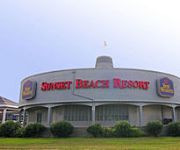
SUNSET BEACH INN
Shore Stay Suites
Videos from this area
These are videos related to the place based on their proximity to this place.
Cape Charles Parade
Cape Charles 125th Anniversary Celebration Parade down Mason Avenue in Cape Charles Virginia, Saturday 6 August 2011.
Eastern Shore Railroad Train Goes Down Bad Track
This is a video I made while on the Eastern Shore Of Virginia of a rare catch of the Eastern Shore Railroad in action. Only a couple of trains per week go down this 75 miles of privately owned...
Bay Creek Railway for Dinner Pizza & Charter
Restored 1913 Interurban Railcar - Dinner & Pizza Excursions - Available for Private Charters - located in Cape Charles, Virginia on the Eastern Shore.
Tour an LEED Platinum home on Va.'s Eastern Shore
L.J. Kellam Construction LLC is the first builder on Virginia's Eastern Shore to achieve the Platinum Leadership in Energy and Environmental Design (LEED) Certification by the United States...
A Big Chesapeake Bay Striper
I caught this big Bass in December 2012. She was 46" and had to be at least 40 lbs. After I hooked her, except for a short pause in the beginning, she ran off line for just over a full minute....
Kiptopeke October Surf Fest 2010
A group of ten got together to rent a lodge at Kiptopeke State Park close to the Virginia Barrier Islands on the southern tip of the DelMarVa Penninsula. The first day we paddled out of Oyster,...
Kiptopeke State Park Kayaking Ride 135 Max Angler
I spent an afternoon trying to catch stripers at Kiptopeke State Park on the eastern shore in VA. While I didn't manage any fish on this day I had a good time playing around in the new Wilderness...
Videos provided by Youtube are under the copyright of their owners.
Attractions and noteworthy things
Distances are based on the centre of the city/town and sightseeing location. This list contains brief abstracts about monuments, holiday activities, national parcs, museums, organisations and more from the area as well as interesting facts about the region itself. Where available, you'll find the corresponding homepage. Otherwise the related wikipedia article.
Kiptopeke State Park
Kiptopeke State Park is a state park located in the southern end of the Eastern Shore of Virginia. From 1949, the site was owned by the Virginia Ferry Corporation and used through 1964 as the northern terminus for the Little Creek-Cape Charles Ferry service. The park has a number of recreational amenities, including yurts which are half tent half cabin.
Bulls Landing, Virginia
Bulls Landing is an unincorporated community in Northampton County, Virginia, United States.
Kiptopeke, Virginia
Kiptopeke is an unincorporated community in Northampton County, Virginia, United States.
Magotha, Virginia
Magotha is an unincorporated community in Northampton County, Virginia, United States.
Cape Charles (headland)
Cape Charles is a headland, or cape, in Northampton County, Virginia. Located at the southern tip of Northampton County, it forms the northern side of the entrance to the Chesapeake Bay. Cape Henry, which forms the southern side of the entrance to the Chesapeake Bay, and Cape Charles are collectively known as the Virginia Capes.
Cape Charles Air Force Station
Cape Charles Air Force Station is a closed United States Air Force General Surveillance Radar station. It is located 3.6 miles south of Townsend, Virginia. It was closed in 1981.


