Safety Score: 2,7 of 5.0 based on data from 9 authorites. Meaning we advice caution when travelling to United States.
Travel warnings are updated daily. Source: Travel Warning United States. Last Update: 2024-04-26 08:02:42
Touring Columbia
Columbia in Lancaster County (Pennsylvania) with it's 10,388 residents is a town located in United States about 84 mi (or 135 km) north of Washington DC, the country's capital place.
Time in Columbia is now 07:45 PM (Friday). The local timezone is named America / New York with an UTC offset of -4 hours. We know of 10 airports nearby Columbia, of which 4 are larger airports. The closest airport in United States is Lancaster Airport in a distance of 13 mi (or 20 km), North-East. Besides the airports, there are other travel options available (check left side).
There is one Unesco world heritage site nearby. It's Independence Hall in a distance of 88 mi (or 141 km), East. Also, if you like the game of golf, there are several options within driving distance. We collected 1 points of interest near this location. Need some hints on where to stay? We compiled a list of available hotels close to the map centre further down the page.
Being here already, you might want to pay a visit to some of the following locations: Lancaster, York, Lebanon, Harrisburg and Bel Air. To further explore this place, just scroll down and browse the available info.
Local weather forecast
Todays Local Weather Conditions & Forecast: 14°C / 58 °F
| Morning Temperature | 3°C / 38 °F |
| Evening Temperature | 12°C / 54 °F |
| Night Temperature | 6°C / 42 °F |
| Chance of rainfall | 0% |
| Air Humidity | 46% |
| Air Pressure | 1030 hPa |
| Wind Speed | Gentle Breeze with 8 km/h (5 mph) from North-West |
| Cloud Conditions | Clear sky, covering 0% of sky |
| General Conditions | Sky is clear |
Friday, 26th of April 2024
11°C (51 °F)
9°C (49 °F)
Moderate rain, gentle breeze, overcast clouds.
Saturday, 27th of April 2024
21°C (70 °F)
17°C (62 °F)
Light rain, gentle breeze, broken clouds.
Sunday, 28th of April 2024
27°C (80 °F)
19°C (65 °F)
Light rain, gentle breeze, scattered clouds.
Hotels and Places to Stay
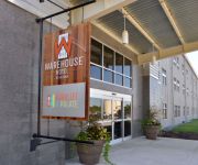
WAREHOUSE HOTEL
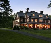
Olde Square Inn Bed and Breakfast
Cameron Estate Inn & Restaurant
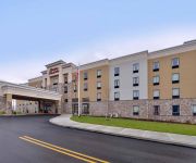
Hampton Inn - Suites Mount Joy-Lancaster West PA
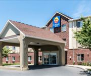
Comfort Inn Lancaster County
Sleep Inn & Suites of Lancaster County
MainStay Suites of Lancaster County
Comfort Suites Manheim - Lancaster
Videos from this area
These are videos related to the place based on their proximity to this place.
Columbia on the Susquehanna: An Overview
An introductory overview of Columbia, Pennsylvania. Bravo Group's Creative Director Jerry Musser shot this over a 3-week period using a drone video camera system.
Amtrak Autumn Express, Entering Columbia Industrial
The Amtrak Autumn express -- a circle trip from Philadelphia to Port Deposit, Md., to Enola and Harrisburg Pa., and return -- was operated Saturday, Nov. 2, and Sunday, Nov. 3.The return trip...
Asphalt Milling in Columbia Boro
Shiloh Paving and Excavating, Inc. recently has gotten a new milling machine to meet the demands of Township and Municipal customers looking to have their roads milled and resurfaced. The...
Amtrak Autumn Express Westbound Through Columbia
The Amtrak Autumn Express tiptoes westbound through Columbia, Pa., past Cola Interlocking on Norfolk Southern's freight-only Port Road at 25 mph on Sunday, Nov. 3, 2013 at 11:32 a.m. The return...
Janet Sierk: Columbia Home Tour
Call Janet Sierk for more information on this property or to schedule a tour: (717) 360-1840 • Need a mortgage for this or any property? Contact Mark Pontz at (717) 475-4444 or email mark@markpon...
2012 Columbia Memorial Day parade
Columbia Memorial Day parade in Lancaster County, Pa. View article at http://lancasteronline.com/article/local/657043.
Making fastnachts at Holy Trinity Church in Columbia
Making fastnachts at Holy Trinity Church in Columbia View article at http://lancasteronline.com/article/local/813960.
Egg hunt delights crowd in Columbia
Egg hunt delights crowd in Columbia View article at http://lancasteronline.com/article/local/832407.
Columbia Pa's 4th of July Fireworks 2012
Columbia Pa's 4th of July Fireworks 2012 set off by pyotecnico on 7/7/2012 hope you enjoy and check out my other videos.
Volunteers clean up Mount Bethel Cemetery in Columbia
Volunteers clean up Mount Bethel Cemetery in Columbia View article at http://lancasteronline.com/article/local/790969.
Videos provided by Youtube are under the copyright of their owners.
Attractions and noteworthy things
Distances are based on the centre of the city/town and sightseeing location. This list contains brief abstracts about monuments, holiday activities, national parcs, museums, organisations and more from the area as well as interesting facts about the region itself. Where available, you'll find the corresponding homepage. Otherwise the related wikipedia article.
West Hempfield Township, Lancaster County, Pennsylvania
West Hempfield Township is a township in west central Lancaster County, Pennsylvania, United States. The population was 15,128 at the 2000 census.
Columbia–Wrightsville Bridge
The Columbia–Wrightsville Bridge, officially the Veterans Memorial Bridge, spans the Susquehanna River between Columbia and Wrightsville, Pennsylvania. Built originally as the Lancaster-York Intercounty Bridge, construction began in 1929, and the bridge opened September 30, 1930. On November 11, 1980, it was officially dedicated as Veterans Memorial Bridge, though it is still referenced locally as the Columbia-Wrightsville Bridge. Designed by James B.
Wright's Ferry Bridge
The Wright's Ferry Bridge carries U.S. Route 30 over the Susquehanna River between Columbia, Pennsylvania and Wrightsville, Pennsylvania and commemorates the first ferry crossing the Susquehanna is therefore (historically) considered a Columbia-Wrightsville Bridge, the fifth, though the fourth Columbia-Wrightsville Bridge it augments (and might have replaced) is still carrying the Lincoln Highway, unusually, according to local naming.
Pennsylvania Railroad Bridge (Columbia, Pennsylvania)
The Pennsylvania Railroad Bridge once carried the York Branch of the Pennsylvania Railroad across the Susquehanna River between Columbia and Wrightsville, Pennsylvania and is therefore considered a Columbia-Wrightsville Bridge. It and its predecessors were a vital commercial and passenger linkage between Philadelphia and Baltimore for over 100 years.
Philadelphia and Lancaster Turnpike
The Philadelphia and Lancaster Turnpike, first used in 1795, is the first long-distance paved road built in the United States, according to engineered plans and specifications. It links Lancaster, Pennsylvania, and Philadelphia at 34th Street, stretching for sixty-two miles. However, the western terminus was actually at the Susquehanna River in Columbia. The route is designated PA 462 from the western terminus to US 30, where that route takes over for the majority of the route.
Chickies Ridge
Chickies Ridge is a long hill in West Hempfield Township, Lancaster County, Pennsylvania, terminating at the west end in an outcropping overlooking the Susquehanna River, known as Chickies Rock.
National Watch and Clock Museum
The National Watch and Clock Museum (USA) (NWCM), located in Columbia, Pennsylvania, is one of a very few museums in the United States dedicated solely to horology, which is the history, science and art of timekeeping and timekeepers. Like its subsidiary institution, the NAWCC Library & Research Center, the National Watch and Clock Museum is operated by the National Association of Watch and Clock Collectors (NAWCC), a non-profit organization with about 21,000 members and an educational mission.
Kreutz Creek
Kreutz Creek is a 17.8-mile-long tributary of the Susquehanna River in York County, Pennsylvania in the United States. Kreutz Creek joins the Susquehanna River at the borough of Wrightsville.


