Safety Score: 2,7 of 5.0 based on data from 9 authorites. Meaning we advice caution when travelling to United States.
Travel warnings are updated daily. Source: Travel Warning United States. Last Update: 2024-04-28 08:22:10
Explore Dilkes Mills
Dilkes Mills in Gloucester County (New Jersey) is a city in United States about 110 mi (or 177 km) north-east of Washington DC, the country's capital.
Local time in Dilkes Mills is now 02:19 AM (Monday). The local timezone is named America / New York with an UTC offset of -4 hours. We know of 12 airports in the vicinity of Dilkes Mills, of which 5 are larger airports. The closest airport in United States is Philadelphia International Airport in a distance of 10 mi (or 16 km), North. Besides the airports, there are other travel options available (check left side).
There are two Unesco world heritage sites nearby. The closest heritage site in United States is Independence Hall in a distance of 27 mi (or 44 km), North-East. Also, if you like golfing, there are multiple options in driving distance. We found 1 points of interest in the vicinity of this place. If you need a place to sleep, we compiled a list of available hotels close to the map centre further down the page.
Depending on your travel schedule, you might want to pay a visit to some of the following locations: Woodbury, Media, Salem, Philadelphia and Camden. To further explore this place, just scroll down and browse the available info.
Local weather forecast
Todays Local Weather Conditions & Forecast: 27°C / 80 °F
| Morning Temperature | 16°C / 61 °F |
| Evening Temperature | 27°C / 81 °F |
| Night Temperature | 20°C / 68 °F |
| Chance of rainfall | 0% |
| Air Humidity | 52% |
| Air Pressure | 1017 hPa |
| Wind Speed | Gentle Breeze with 6 km/h (3 mph) from East |
| Cloud Conditions | Broken clouds, covering 58% of sky |
| General Conditions | Light rain |
Monday, 29th of April 2024
26°C (78 °F)
20°C (69 °F)
Light rain, gentle breeze, overcast clouds.
Tuesday, 30th of April 2024
22°C (72 °F)
11°C (52 °F)
Light rain, gentle breeze, broken clouds.
Wednesday, 1st of May 2024
18°C (64 °F)
11°C (51 °F)
Scattered clouds, gentle breeze.
Hotels and Places to Stay
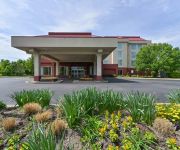
Hampton Inn Philadelphia-Bridgeport
TownePlace Suites Swedesboro Philadelphia
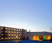
Holiday Inn PHILADELPHIA SOUTH-SWEDESBORO
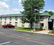
MOTEL 6 GIBBSTOWN NJ
Videos from this area
These are videos related to the place based on their proximity to this place.
Amish Market at Mullica Hill Christmas 2010
The centerpiece of a delicious holiday dinner - serve a fresh turkey, wonderfully marbled prime rib or a locally smoked ham with a full flavor - can be yours when you visit the Amish Market...
527 SHADOWBROOK TRL, MULLICA HILL, NJ Presented by Nancy Kowalik.
Click to see more: http://www.searchallproperties.com/listings/1951789/527--SHADOWBROOK-TRL-MULLICA-HILL-NJ/auto?reqpage=video 527 SHADOWBROOK TRL MULLICA HILL, NJ 08062 ...
24 EARLINGTON AVE, MULLICA HILL, NJ Presented by Nancy Kowalik.
Click to see more: http://www.searchallproperties.com/listings/1310865/24--EARLINGTON-AVE-MULLICA-HILL-NJ/auto?reqpage=video 24 EARLINGTON AVE MULLICA HILL, NJ 08062 Contact ...
116 Crestview Court, Mullica Hill, NJ Presented by Nancy Kowalik.
Click to see more: http://www.searchallproperties.com/listings/2058310/116-Crestview-Court-Mullica-Hill-NJ/auto?reqpage=video 116 Crestview Court Mullica Hill, NJ 08062 Contact Nancy Kowalik...
104 HICKORY CT, MULLICA HILL, NJ Presented by Nancy Kowalik.
Click to see more: http://www.searchallproperties.com/listings/1989592/104--HICKORY-CT-MULLICA-HILL-NJ/auto?reqpage=video 104 HICKORY CT MULLICA HILL, NJ 08062 Contact Nancy Kowalik ...
1322 COMMISSIONERS RD, MULLICA HILL, NJ Presented by Nancy Kowalik.
Click to see more: http://www.searchallproperties.com/listings/1866671/1322--COMMISSIONERS-RD-MULLICA-HILL-NJ/auto?reqpage=video 1322 COMMISSIONERS RD MULLICA HILL, NJ 08062 ...
L:4 MULLICA HILL RD, MULLICA HILL, NJ Presented by Nancy Kowalik.
Click to see more: http://www.searchallproperties.com/listings/1917720/L:4--MULLICA-HILL-RD-MULLICA-HILL-NJ/auto?reqpage=video L:4 MULLICA HILL RD MULLICA HILL, NJ 08062 Contact ...
1320 KINGS HWY, SWEDESBORO, NJ Presented by Nancy Kowalik.
Click to see more: http://www.searchallproperties.com/listings/1962728/1320--KINGS-HWY-SWEDESBORO-NJ/auto?reqpage=video 1320 KINGS HWY SWEDESBORO, NJ 08085 Contact Nancy ...
34 QUAIL CT, SWEDESBORO, NJ Presented by Nancy Kowalik.
Click to see more: http://www.searchallproperties.com/listings/1976385/34--QUAIL-CT-SWEDESBORO-NJ/auto?reqpage=video 34 QUAIL CT SWEDESBORO, NJ 08085 Contact Nancy Kowalik for ...
105 GLEN ECHO AVE, SWEDESBORO, NJ Presented by Nancy Kowalik.
Click to see more: http://www.searchallproperties.com/listings/1982377/105--GLEN-ECHO-AVE-SWEDESBORO-NJ/auto?reqpage=video 105 GLEN ECHO AVE SWEDESBORO, NJ 08085 Contact ...
Videos provided by Youtube are under the copyright of their owners.
Attractions and noteworthy things
Distances are based on the centre of the city/town and sightseeing location. This list contains brief abstracts about monuments, holiday activities, national parcs, museums, organisations and more from the area as well as interesting facts about the region itself. Where available, you'll find the corresponding homepage. Otherwise the related wikipedia article.
Swedesboro, New Jersey
Swedesboro is a borough in Gloucester County, New Jersey, United States. As of the 2010 United States Census, the borough's population was 2,584, reflecting an increase of 529 (+25.7%) from the 2,055 counted in the 2000 Census, which had in turn increased by 31 (+1.5%) from the 2,024 counted in the 1990 Census. Swedesboro was formed as a borough by an Act of the New Jersey Legislature on April 9, 1902, from portions of Woolwich Township.
South Harrison Township, New Jersey
South Harrison Township is a township in Gloucester County, New Jersey, United States. As of the 2010 United States Census, the township's population was 3,162, reflecting an increase of 745 (+30.8%) from the 2,417 counted in the 2000 Census, which had in turn increased by 498 (+26.0%) from the 1,919 counted in the 1990 Census. South Harrison was formed as a township by an Act of the New Jersey Legislature on March 2, 1883, from portions of Harrison Township.
Raccoon Creek (New Jersey)
Raccoon Creek, also called the Raccoon River, is a 22.6-mile-long tributary of the Delaware River in southern New Jersey in the United States.
WGLS-FM
WGLS-FM, known as Rowan Radio, is a college radio station licensed to Rowan University that broadcasts on 89.7MHz. The studios are located in the College of Communication on the campus of Rowan University in Glassboro, New Jersey. WGLS-FM is Gloucester County's only FM radio station. WGLS's programming features a variety of music, sports, cultural, educational programs focused towards the interest of the Rowan University and South Jersey communities.
Kingsway Regional High School
Kingsway Regional High School is a four-year comprehensive public high school serving students in ninth through twelfth grade from five communities in Gloucester County, New Jersey, United States, operating as part of the Kingsway Regional School District. The school serves students from East Greenwich Township, Logan Township, South Harrison Township, Swedesboro and Woolwich Township.
Trinity Church Cemetery, Swedesboro
Trinity Church Cemetery (also known as Trinity Episcopal "Old Swedes" Church Cemetery) is located behind Trinity Church (Swedesboro, New Jersey) on the corner of Church Street and Kings Highway, in the town of Swedesboro, in Gloucester County, New Jersey.
Locke Avenue Bridge
Locke Avenue Bridge is located on Locke Avenue roadway. That roadway is a two-lane rural route/ minor collector roadway located at the northwest corner of Swedesboro in Gloucester County, New Jersey. This roadway runs north and south and connects Kings Highway (County Route 551) with U.S. Route 322. The posted speed limit on Locke Avenue is 40 mph.
St. Joseph Cemetery (Swedesboro, New Jersey)
St. Joseph Cemetery is a cemetery located in Swedesboro, New Jersey. One person of note interred there is baseball player Earl Rapp. It was built in the 1860s by the now defunct St. Joseph Church.


