Safety Score: 3,0 of 5.0 based on data from 9 authorites. Meaning we advice caution when travelling to United Kingdom.
Travel warnings are updated daily. Source: Travel Warning United Kingdom. Last Update: 2024-04-28 08:22:10
Discover Llanfihangel-ty’n-Sylwy
Llanfihangel-ty’n-Sylwy in Anglesey (Wales) is a city in United Kingdom about 209 mi (or 337 km) north-west of London, the country's capital city.
Local time in Llanfihangel-ty’n-Sylwy is now 03:30 AM (Monday). The local timezone is named Europe / London with an UTC offset of one hour. We know of 12 airports in the vicinity of Llanfihangel-ty’n-Sylwy, of which 5 are larger airports. The closest airport in United Kingdom is Anglesey Airport in a distance of 17 mi (or 27 km), West. Besides the airports, there are other travel options available (check left side).
There are several Unesco world heritage sites nearby. The closest heritage site in United Kingdom is Castles and Town Walls of King Edward in Gwynedd in a distance of 20 mi (or 33 km), South-East. Also, if you like golfing, there is an option about 12 mi (or 20 km). away. Looking for a place to stay? we compiled a list of available hotels close to the map centre further down the page.
When in this area, you might want to pay a visit to some of the following locations: Llangoed, Moelfre, Aber, Bethesda and Llanberis. To further explore this place, just scroll down and browse the available info.
Local weather forecast
Todays Local Weather Conditions & Forecast: 10°C / 50 °F
| Morning Temperature | 9°C / 48 °F |
| Evening Temperature | 10°C / 50 °F |
| Night Temperature | 10°C / 50 °F |
| Chance of rainfall | 15% |
| Air Humidity | 86% |
| Air Pressure | 1006 hPa |
| Wind Speed | Moderate breeze with 11 km/h (7 mph) from North |
| Cloud Conditions | Overcast clouds, covering 100% of sky |
| General Conditions | Moderate rain |
Tuesday, 30th of April 2024
13°C (56 °F)
9°C (49 °F)
Moderate rain, fresh breeze, overcast clouds.
Wednesday, 1st of May 2024
14°C (58 °F)
10°C (49 °F)
Light rain, light breeze, overcast clouds.
Thursday, 2nd of May 2024
10°C (50 °F)
9°C (49 °F)
Moderate rain, gentle breeze, overcast clouds.
Hotels and Places to Stay
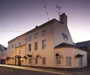
Ye Olde Bulls Head
The Management Centre
Bulkeley
Videos from this area
These are videos related to the place based on their proximity to this place.
Introducing Bangor University
Founded in 1884, Bangor University is located in North Wales in the UK. Rated amongst the top 10 universities in the UK for student satisfaction, Bangor is a friendly, convenient and student-centre...
School of Sport, Health and Exercise Sciences at Bangor University
Interested in studying Sport Science but not sure which University to choose? Watch our video to find out what makes Sport, Health and Exercise Sciences at Bangor Uni so special. Visit the...
School of Healthcare Sciences Wrexham Campus
Bangor University's Wrexham campus offers courses in nursing and radiography. Find out more at http://www.bangor.ac.uk/healthcaresciences.
The OCTAGON Video No27 1988
The OCTAGON Disco & Nightclub, Bangor North Wales UK. Internal Promotional Video No27 1988.
Video 2 - Bangor 24.01.2015
El Garth Pier es una estructura protegida en Bangor, Gwynedd, Cymru. Con 460 m de longitud, es el segundo muelle más largo en Gales.
Sailing Four go mad in Menai
Sailing from Menai Bridge to Conwy on a sunny Sunday with some of the boys.
Rib Riding Anglesey
Fantastic last day on Anglesey and finished a fantastic half term family adventure in style with a Rib Ride along the Menai Straits in Beaumaris, Anglesey. Absolutely Awesome!
The OCTAGON Video No23 1988
The OCTAGON Disco & Nightclub, Bangor North Wales UK. Internal Promotional Video No23 1988.
Dolphins in Red Wharf Bay (1)
These dolphins came to show off to us off Benllech, Red Wharf Bay, Anglesey.
Red Wharf Bay, Anglesey, Wales
Panoramic video of Red Wharf Bay, on Anglesey, Wales, 26 December 2009.
Videos provided by Youtube are under the copyright of their owners.
Attractions and noteworthy things
Distances are based on the centre of the city/town and sightseeing location. This list contains brief abstracts about monuments, holiday activities, national parcs, museums, organisations and more from the area as well as interesting facts about the region itself. Where available, you'll find the corresponding homepage. Otherwise the related wikipedia article.
Fedw Fawr
Fedw Fawr is an area on the east coast of Anglesey, North Wales, situated just under four miles north of Beaumaris. It is part of the Arfordir Gogleddol Penmon Site of Special Scientific Interest and is managed by the National Trust. The site covers 20 hectares most of which is made up of peaty gley soil. The cliffs at Fedw Fawr support the only Black Guillemot colony in Wales.
Llanddona transmitting station
The Llanddona transmitting station is a broadcasting and telecommunications facility, situated at Llanddona, near Beaumaris, on the isle of Anglesey, Wales. It comprises a 106.7 metres guyed mast with antennas attached at various heights. It is owned and operated by Arqiva.
Llanddona
Llanddona is a village famous for its beach in Ynys Môn, North Wales. Located between Benllech and Beaumaris, it is popular as a holiday destination on Anglesey, particularly for families. The beach is a good size without being bleakly huge, shelves at a decent but not alarming rate and has an abundance of clean yellow sand. Llanddona has no shops, however it has a riding school and a pub. The Llanddona transmitting station is located approximately one mile to the north east of the village.
Baron Hill (house)
Baron Hill is an estate in Beaumaris, Anglesey, Wales, named after the hill on which it stands. It was established in 1618, in preparation for Prince Henry of Wales's progress to Ireland, by Sir Richard Bulkeley as the family seat of the influential Bulkeley family. During the English Civil War, Richard's successor, Colonel Thomas Bulkeley, is said to have invited King Charles I to take possession of the house and set up his court there.
Llanfihangel Din Sylwy
Llanfihangel Din Sylwy (spelling variants include Llanfihangel Din Silwy and Llanfihangel Tyn Sylwy) is a small, coastal (former) parish in the commote of Dindaethwy in north-east Anglesey, three miles north-northwest of Beaumaris. A scattered settlement, it is distinguished by a hill fort known as Din Sylwy or Bwrdd Arthur and by a late medieval church dedicated to St. Michael. The hill fort constitutes a relatively flat but partly overgrown area, 600 yards from the Irish Sea.
St Iestyn's Church, Llaniestyn
St Iestyn's Church, Llaniestyn is a medieval church in Llaniestyn, Anglesey, in north Wales. A church is said to have been founded here by St Iestyn in the 7th century, with the earliest parts of the present building dating from the 12th century. The church was extended in the 14th century, with further changes over the coming years. It contains a 12th-century font and a 14th-century memorial stone to Iestyn, from the same workshop as the stone to St Pabo at St Pabo's Church, Llanbabo.
St Dona's Church, Llanddona
St Dona's Church, Llanddona is a small 19th-century parish church in the village of Llanddona, in Anglesey, north Wales. The first church on this site was built in 610. The present building on the site dates from 1873, and was designed by the rector at the time. It reuses earlier material including a decorated 15th-century doorway and a 17th-century bell. The church is still used for worship by the Church in Wales, and is one of seven churches in a combined parish.
Bwrdd Arthur
Bwrdd Arthur (Arthur's Table in English), also known as Din Sylwy is flat topped limestone hill on the island of Anglesey. It is noteworthy from the evidence of pre-historic occupation and as a site of scientific interest designated for its botanical interest.


