Safety Score: 3,0 of 5.0 based on data from 9 authorites. Meaning we advice caution when travelling to United Kingdom.
Travel warnings are updated daily. Source: Travel Warning United Kingdom. Last Update: 2024-05-07 07:59:51
Explore Cherington
Cherington in Warwickshire (England) with it's 373 inhabitants is a city in United Kingdom about 72 mi (or 115 km) north-west of London, the country's capital.
Local time in Cherington is now 05:10 PM (Tuesday). The local timezone is named Europe / London with an UTC offset of one hour. We know of 7 airports in the vicinity of Cherington, of which 5 are larger airports. The closest airport in United Kingdom is Oxford (Kidlington) Airport in a distance of 17 mi (or 27 km), South-East. Besides the airports, there are other travel options available (check left side).
There are several Unesco world heritage sites nearby. The closest heritage site in United Kingdom is Blenheim Palace in a distance of 42 mi (or 68 km), East. Also, if you like golfing, there are multiple options in driving distance. We found 1 points of interest in the vicinity of this place. If you need a place to sleep, we compiled a list of available hotels close to the map centre further down the page.
Depending on your travel schedule, you might want to pay a visit to some of the following locations: Hanwell, Warwick, Coventry, Berkswell and Barston. To further explore this place, just scroll down and browse the available info.
Local weather forecast
Todays Local Weather Conditions & Forecast: 18°C / 64 °F
| Morning Temperature | 10°C / 49 °F |
| Evening Temperature | 15°C / 59 °F |
| Night Temperature | 9°C / 49 °F |
| Chance of rainfall | 2% |
| Air Humidity | 66% |
| Air Pressure | 1023 hPa |
| Wind Speed | Gentle Breeze with 6 km/h (4 mph) from South-West |
| Cloud Conditions | Broken clouds, covering 65% of sky |
| General Conditions | Light rain |
Wednesday, 8th of May 2024
17°C (62 °F)
13°C (55 °F)
Overcast clouds, light breeze.
Thursday, 9th of May 2024
18°C (64 °F)
13°C (55 °F)
Light rain, light breeze, overcast clouds.
Friday, 10th of May 2024
19°C (66 °F)
14°C (57 °F)
Light rain, light breeze, overcast clouds.
Hotels and Places to Stay
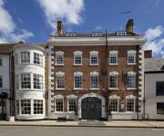
The George Inn
The George Townhouse
Crown and Cushion Hotel
Chipping Norton
Videos from this area
These are videos related to the place based on their proximity to this place.
Rollright Stones 2013
Rollright Stones, Oxfordshire 2013. This video is an edited version. The full version is 30 minutes and includes the full Celtic Handfasting. If you would like to view it, please email me .....
Chipping Norton Farmers' Market
This is a monthly market run by the Thames Valley Farmers' Market Co-operative www.tvfm.org.uk. The short documentary centres on interviews with several of the regular stallholders at Chipping...
Experience Chipping Norton - Civic Meeting Jan 23rd 2015
The challenge is set. Prime Minister David Cameron has given Chippy's traders a resounding call to arms in a bid to keep his home town thriving. After a stunning attendance at ECN's unique...
Triumph ride: Cotwolds - Charlbury TT Part 1
Cotswolds ride May 2014. 2010 Street Triple and 2013 Thruxton. A mixture of film, mostly from the street triple. Part 1 is as far as Chipping Norton from On Yer Bike near Aylesbury. Apologies...
Experimental Landscapes In Watercolour With Ann Blockley Trailer
Official trailer for two hour DVD available from www.townhousefilms.co.uk.
LED Street Lights - More Light, Less Energy
LED Street Lights http://www.deslamps.co.uk/commercial-lighting-led-street-lights-c-1672_1674.html Are you looking to replace your old street light fixtures with something more efficient and...
barrows and stewart portable engine at the george hotel brailes sodem road run 10.11.12
barrows and stewart portable engine at the george hotel brailes sodem road run 10.11.12.
Frozen | Behind The Scenes | BTS
Places I would like to visit and would like to add to my bucket list. Visit my tumblr: www.findinghakunamatata.tumblr.com.
Videos provided by Youtube are under the copyright of their owners.
Attractions and noteworthy things
Distances are based on the centre of the city/town and sightseeing location. This list contains brief abstracts about monuments, holiday activities, national parcs, museums, organisations and more from the area as well as interesting facts about the region itself. Where available, you'll find the corresponding homepage. Otherwise the related wikipedia article.
Long Compton
Long Compton is a village and civil parish in Warwickshire, England near the extreme southern tip of Warwickshire, and close to the border with Oxfordshire. It is part of the district of Stratford-on-Avon and in the 2001 census had a population of 705. The village is in the Cotswolds and is located on the A3400 (formerly the A34) from Oxford to Stratford-upon-Avon. As the name implies it is a long village.
Barcheston
Barcheston is a village and civil parish in the Stratford district of Warwickshire, England. It is on the east bank of the River Stour, opposite Shipston-on-Stour. According to the 2001 census it had a population of 134. The first English tapestry factory was the Sheldon Looms, established here in Warwickshire by William Sheldon about the middle of the 16th century. The tapestries produced here compare well with the finest contemporary Flemish weavings.
Shipston-on-Stour Rural District
Shipston on Stour was a rural district in England from 1894 to 1974. http://www. visionofbritain. org. uk/relationships. jsp;jsessionid=D49AE9F79F7BD0630E8C81B1C2C84296?u_id=10061921 The district covered an area around Shipston-on-Stour. Originally it was a detached part of Worcestershire, but in 1931 it was transferred to the jurisdiction of Warwickshire, and was expanded by the abolition of Brailes Rural District.
Whichford
Whichford is a small village and civil parish in the south of the English county of Warwickshire.
Willington, Warwickshire
Willington is a village in Warwickshire, England. {{#invoke:Coordinates|coord}}{{#coordinates:52|03|12|N|1|36|54|W| |primary |name= }} The origin of the place-name is from Old English tun (homestead or farm) of Wulfāf's or Wīglāf's people, and appears as Ullavintone in the Domesday Book and as Wullavington in 1287.
Evolution of Worcestershire county boundaries
The boundaries of Worcestershire, England, have been fluid for over 150 years since the first major changes in 1844. Although the continual expansion of Birmingham and the Black Country during and after the Industrial Revolution altered the county map considerably, even up to the later part of the 20th century.


