Safety Score: 3,0 of 5.0 based on data from 9 authorites. Meaning we advice caution when travelling to United Kingdom.
Travel warnings are updated daily. Source: Travel Warning United Kingdom. Last Update: 2024-05-07 07:59:51
Discover Barcheston
Barcheston in Warwickshire (England) is a town in United Kingdom about 74 mi (or 119 km) north-west of London, the country's capital city.
Current time in Barcheston is now 11:41 AM (Tuesday). The local timezone is named Europe / London with an UTC offset of one hour. We know of 7 airports near Barcheston, of which 5 are larger airports. The closest airport in United Kingdom is Oxford (Kidlington) Airport in a distance of 20 mi (or 31 km), South-East. Besides the airports, there are other travel options available (check left side).
There are several Unesco world heritage sites nearby. The closest heritage site in United Kingdom is Blenheim Palace in a distance of 44 mi (or 71 km), East. Also, if you like playing golf, there are a few options in driving distance. We discovered 1 points of interest in the vicinity of this place. Looking for a place to stay? we compiled a list of available hotels close to the map centre further down the page.
When in this area, you might want to pay a visit to some of the following locations: Warwick, Hanwell, Berkswell, Barston and Coventry. To further explore this place, just scroll down and browse the available info.
Local weather forecast
Todays Local Weather Conditions & Forecast: 16°C / 62 °F
| Morning Temperature | 10°C / 49 °F |
| Evening Temperature | 15°C / 59 °F |
| Night Temperature | 10°C / 49 °F |
| Chance of rainfall | 0% |
| Air Humidity | 72% |
| Air Pressure | 1022 hPa |
| Wind Speed | Gentle Breeze with 6 km/h (4 mph) from South-West |
| Cloud Conditions | Overcast clouds, covering 99% of sky |
| General Conditions | Light rain |
Wednesday, 8th of May 2024
17°C (62 °F)
11°C (51 °F)
Light rain, gentle breeze, broken clouds.
Thursday, 9th of May 2024
17°C (63 °F)
14°C (56 °F)
Light rain, light breeze, overcast clouds.
Friday, 10th of May 2024
19°C (66 °F)
15°C (58 °F)
Moderate rain, light breeze, overcast clouds.
Hotels and Places to Stay
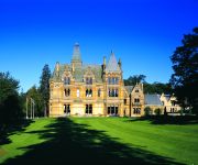
Ettington Park
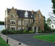
Ettington Chase Hotels
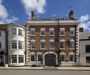
The George Townhouse
The George Inn
Videos from this area
These are videos related to the place based on their proximity to this place.
Moreton Park | Phase 4 | Moreton in Marsh | Gloucestershire | CALA Homes
Set near one of the Cotswolds' most desirable villages, Moreton Park Phase 4 brings together a stunning collection of three and four bedroom detached homes. Inside, every aspect has been...
Waterscherm oefening op het Fire Service College
oefening op het Fire Service College in Moreton-in-Marsh.
Newbold-on-Stour - Berryfields Lane (ORPA & Bridleway, S-N)
Subscribe for the love of motorcycles and the great outdoors: http://www.youtube.com/subscription_center?add_user=wiltshirebyways Please click 'S H O W M O R E' for route info: ↓↓↓↓↓↓...
Newbold-on-Stour - Moss Lane (Bridleway, E-W)
Subscribe for the love of motorcycles and the great outdoors: http://www.youtube.com/subscription_center?add_user=wiltshirebyways Please click 'S H O W M O R E' for route info: ↓↓↓↓↓↓...
Rollright Stones 2013
Rollright Stones, Oxfordshire 2013. This video is an edited version. The full version is 30 minutes and includes the full Celtic Handfasting. If you would like to view it, please email me .....
English Language Course Feedback (in Russian)
Video feedback from Pavel, our Russian student from Moscow. Filmed in the world famous Stratford on Avon, England. Pavel studied English with one of our online British teachers on Skype for...
Midland offroad club,Parkfarm Challenge may 2007
MOC 4x4 challenge open to all 4x4s.All events are run in the midlands area.
Videos provided by Youtube are under the copyright of their owners.
Attractions and noteworthy things
Distances are based on the centre of the city/town and sightseeing location. This list contains brief abstracts about monuments, holiday activities, national parcs, museums, organisations and more from the area as well as interesting facts about the region itself. Where available, you'll find the corresponding homepage. Otherwise the related wikipedia article.
Barcheston
Barcheston is a village and civil parish in the Stratford district of Warwickshire, England. It is on the east bank of the River Stour, opposite Shipston-on-Stour. According to the 2001 census it had a population of 134. The first English tapestry factory was the Sheldon Looms, established here in Warwickshire by William Sheldon about the middle of the 16th century. The tapestries produced here compare well with the finest contemporary Flemish weavings.
Shipston-on-Stour Rural District
Shipston on Stour was a rural district in England from 1894 to 1974. http://www. visionofbritain. org. uk/relationships. jsp;jsessionid=D49AE9F79F7BD0630E8C81B1C2C84296?u_id=10061921 The district covered an area around Shipston-on-Stour. Originally it was a detached part of Worcestershire, but in 1931 it was transferred to the jurisdiction of Warwickshire, and was expanded by the abolition of Brailes Rural District.
Willington, Warwickshire
Willington is a village in Warwickshire, England. {{#invoke:Coordinates|coord}}{{#coordinates:52|03|12|N|1|36|54|W| |primary |name= }} The origin of the place-name is from Old English tun (homestead or farm) of Wulfāf's or Wīglāf's people, and appears as Ullavintone in the Domesday Book and as Wullavington in 1287.
Ellen Badger Hospital
The Ellen Badger is a small community NHS hospital located within the town of Shipston on Stour in Warwickshire, England. It is operated and funded by the South Warwickshire Primary Care Trust. Its facilities include a rehabilitation unit with on site physiotherapy, occupattional therapy, x-ray, out-patient clinics and a 24-hour minor injury unit. There is a day unit attached to the hospital together with community nursing services and social services
Honington Hall
Honington Hall is a privately owned 17th century country house at Honington, near Stratford on Avon, Warwickshire. It has Grade I listed building status. The Manor of Honington was in the ownership of the Priory of Coventry until the Dissolution of the Monasteries in the 16th century. In 1540 it was granted by the Crown to Robert Gibbes. The estate was sold by the Gibbes family in about 1670 to Henry Parker who in 1696 succeeded to the Parker Baronetcy and an estate at Melford Hall, Suffolk.
Shipston-on-Stour Rugby Football Club
Shipston-on-Stour Rugby Football Club is an English rugby union team based in Shipston-on-Stour Warwickshire. Formed in 1963 by a group of teachers and old pupils from Shipston High School, the first squad came from wide across the region. During their first season, the 'Rams' were forced to be a nomadic club with no pitch of their own to use. Instead they relied on the facilities at the school and using some local pubs for post-match refreshments.
Honington, Warwickshire
Honington, Warwickshire is an English hamlet and parish in the Brailes division of the hundred of Kington, roughly two miles north of Shipston-on-Stour. The village consists of approximately 60 houses that are contained within the Parish boundary. The River Stour flows past the vilage on the western side and has a 5 arched 17th century bridge crossing it.
Evolution of Worcestershire county boundaries
The boundaries of Worcestershire, England, have been fluid for over 150 years since the first major changes in 1844. Although the continual expansion of Birmingham and the Black Country during and after the Industrial Revolution altered the county map considerably, even up to the later part of the 20th century.


