Safety Score: 3,0 of 5.0 based on data from 9 authorites. Meaning we advice caution when travelling to United Kingdom.
Travel warnings are updated daily. Source: Travel Warning United Kingdom. Last Update: 2024-04-28 08:22:10
Discover West Pennard
West Pennard in Somerset (England) with it's 670 citizens is a place in United Kingdom about 112 mi (or 180 km) west of London, the country's capital city.
Current time in West Pennard is now 07:38 PM (Sunday). The local timezone is named Europe / London with an UTC offset of one hour. We know of 9 airports near West Pennard, of which 5 are larger airports. The closest airport in United Kingdom is RNAS Yeovilton in a distance of 9 mi (or 15 km), South. Besides the airports, there are other travel options available (check left side).
There are several Unesco world heritage sites nearby. The closest heritage site in United Kingdom is Blaenavon Industrial Landscape in a distance of 45 mi (or 73 km), North. Also, if you like playing golf, there are a few options in driving distance. We encountered 1 points of interest in the vicinity of this place. If you need a hotel, we compiled a list of available hotels close to the map centre further down the page.
While being here, you might want to pay a visit to some of the following locations: East Harptree, Compton Martin, Blagdon, Burrington and Clutton. To further explore this place, just scroll down and browse the available info.
Local weather forecast
Todays Local Weather Conditions & Forecast: 11°C / 52 °F
| Morning Temperature | 4°C / 39 °F |
| Evening Temperature | 9°C / 49 °F |
| Night Temperature | 3°C / 38 °F |
| Chance of rainfall | 23% |
| Air Humidity | 67% |
| Air Pressure | 1008 hPa |
| Wind Speed | Moderate breeze with 11 km/h (7 mph) from South |
| Cloud Conditions | Overcast clouds, covering 100% of sky |
| General Conditions | Heavy intensity rain |
Monday, 29th of April 2024
11°C (52 °F)
11°C (52 °F)
Light rain, fresh breeze, overcast clouds.
Tuesday, 30th of April 2024
12°C (54 °F)
8°C (46 °F)
Light rain, fresh breeze, overcast clouds.
Wednesday, 1st of May 2024
10°C (49 °F)
7°C (44 °F)
Moderate rain, gentle breeze, overcast clouds.
Hotels and Places to Stay
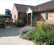
Honeysuckle Farm Cottages
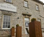
The Sherston Inn
The George & Pilgrim Relaxinnz
The Glastonbury Town House
Wookey Hole
TRAVELODGE GLASTONBURY
Wells (Somerset)
WHITE HART HOTEL
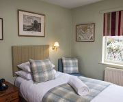
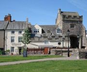
ANCIENT GATEHOUSE
Beryl
Videos from this area
These are videos related to the place based on their proximity to this place.
Glastonbury Tor and Glastonbury Abbey - Our Pictures
There's nowhere more spiritual in this green and pleasant land to visit.
Mother hen and Chicks Paddington Farm Glastonbury Dec 7 2010
Stern mother hen has a go at a naughty chick who runs away and hides loudly protesting! it finds another chick also hiding and they have a good grumble, anyone who understands chickspeak is...
Sunset Time Laps on Glastonbury Tor
Time laps of the sun setting from Glastonbury Tor taken on the 18/01/2015.
Glastonbury Tor — A 360° View
A panoramic 360° view from the top of Glastonbury Tor, England, ending with St Michael's Tower. The sound you here is the wind. — August 2011.
Fording the Redlake River in North Wootton, Somerset
Subscribe for the love of motorcycles and the great outdoors: http://www.youtube.com/subscription_center?add_user=wiltshirebyways Please click 'S H O W M O R E' for route info: ↓↓↓↓↓↓...
North Wootton - Church View (ORPA, S-N)
Subscribe for the love of motorcycles and the great outdoors: http://www.youtube.com/subscription_center?add_user=wiltshirebyways Please click 'S H O W M O R E' for route info: ↓↓↓↓↓↓...
The Old Wiggly Track
You may have heard about the Old Straight Track, here's the Old Wiggly Track. Exploring the footpaths and trails near where I live Wick Hollw, Bulwarks lane,...
English Cricket @ Butliegh Court Country House
A beautiful Summer's evening, what better then a game of Cricket on the Lawn..... Filmed by Avalon Independent on Location at Butliegh Court, in Somerset, Summer of 2009.
Here is the Weather Forecast 1978
My first video documentary, made in Spring 1978 for my GCE Modern Communications examination. I think they would call this "Media Studies" or "Television Studies" today... Shot in the Millfield...
Browsing through my old photo's
Browsing through my old photo's again Starting with Wick Hollow in Glastonbury leading into Maidencroft lane then images of the countryside around Glastonbury tor with Chalice hill and views...
Videos provided by Youtube are under the copyright of their owners.
Attractions and noteworthy things
Distances are based on the centre of the city/town and sightseeing location. This list contains brief abstracts about monuments, holiday activities, national parcs, museums, organisations and more from the area as well as interesting facts about the region itself. Where available, you'll find the corresponding homepage. Otherwise the related wikipedia article.
West Pennard railway station
West Pennard railway station was a station on the Highbridge branch of the Somerset and Dorset Joint Railway. Opened on 3 February 1862, it was reduced to halt status on 25 June 1962. Originally the S&DJR main line, the railway was reduced to branch status when the extension to Bath was built. A passing point on the single line, the station was adjacent to a level crossing on the A361 road from Shepton Mallet to Glastonbury. The station closed with the railway on 7 March 1966.


