Safety Score: 3,0 of 5.0 based on data from 9 authorites. Meaning we advice caution when travelling to United Kingdom.
Travel warnings are updated daily. Source: Travel Warning United Kingdom. Last Update: 2024-04-16 08:26:06
Explore Wookey
Wookey in Somerset (England) with it's 810 inhabitants is located in United Kingdom about 113 mi (or 181 km) west of London, the country's capital.
Local time in Wookey is now 08:11 PM (Tuesday). The local timezone is named Europe / London with an UTC offset of one hour. We know of 10 airports in the wider vicinity of Wookey, of which 5 are larger airports. The closest airport in United Kingdom is Bristol International Airport in a distance of 12 mi (or 19 km), North. Besides the airports, there are other travel options available (check left side).
There are several Unesco world heritage sites nearby. The closest heritage site in United Kingdom is Blaenavon Industrial Landscape in a distance of 40 mi (or 65 km), North. Also, if you like golfing, there are multiple options in driving distance. We found 2 points of interest in the vicinity of this place. If you need a place to sleep, we compiled a list of available hotels close to the map centre further down the page.
Depending on your travel schedule, you might want to pay a visit to some of the following locations: Compton Martin, East Harptree, Blagdon, Burrington and Butcombe. To further explore this place, just scroll down and browse the available info.
Local weather forecast
Todays Local Weather Conditions & Forecast: 12°C / 54 °F
| Morning Temperature | 8°C / 46 °F |
| Evening Temperature | 9°C / 49 °F |
| Night Temperature | 3°C / 37 °F |
| Chance of rainfall | 1% |
| Air Humidity | 64% |
| Air Pressure | 1015 hPa |
| Wind Speed | Fresh Breeze with 16 km/h (10 mph) from East |
| Cloud Conditions | Broken clouds, covering 56% of sky |
| General Conditions | Light rain |
Wednesday, 17th of April 2024
8°C (47 °F)
3°C (37 °F)
Light rain, moderate breeze, broken clouds.
Thursday, 18th of April 2024
10°C (51 °F)
7°C (45 °F)
Few clouds, moderate breeze.
Friday, 19th of April 2024
11°C (52 °F)
4°C (40 °F)
Overcast clouds, moderate breeze.
Hotels and Places to Stay
Wookey Hole
The Sherston Inn
Godney Post House
The George & Pilgrim Relaxinnz
The Glastonbury Town House
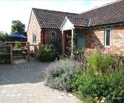
Honeysuckle Farm Cottages
TRAVELODGE GLASTONBURY
Wells (Somerset)
WHITE HART HOTEL
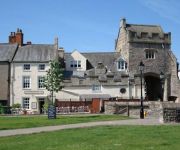
ANCIENT GATEHOUSE
Videos from this area
These are videos related to the place based on their proximity to this place.
The Reindeer Parade in Wells, 2012.
This video is about the Reindeer Parade, which takes place in Wells every year.
Air ambulance touches down at A371 Wells by Tincknell roundabout after incident
Traffic was closed after a woman was hurt in an incident on the A371 this evening. See the story at Wells Journal - http://ow.ly/vGU3w.
Wells, Somerset - Somewhere I Once Lived
An old life long school chum, Phil Lancaster kindly offered to drive me Wells, Somerset to experience a nostalgic visit to the place I once lived in the 1950's. Supposedly I was evacuated there...
St Cuthbert's Wells by Sheila 2012.mp4
This church stands boldly within the near centre of Wells--its tower dominating the skyline--reminding people of its existence as it could easily fall within the shadow of the vast Wells Cathedral....
Inside Wells Cathedral By Sheila 2012.wmv
I am lost for words--the images say it all--remarkable architecture and engineering, art, culture, Spiritual Awareness, history and medieval characters,greatness and space and a connection...
Glebe Cottage Helpful Holidays Review
So we went on a helpful holidays week. We stayed at Glebe Cottage which is in Wells Somerset. On the helpful holidays site it's E64: Wookey, Somerset, Glebe Cottage, Vicarage Lane, Wookey,...
Wookey Hole Caves
Revamped, restored and totally remarkable, the new Wookey Hole experience is bursting onto the 2008 holiday scene in an explosive mix of History, Mystery and Fun. This video was filmed...
UBSS in St Cuthbert's Swallet.mp4
A trip with students of Bristol University to Gour Hall in St. Cuthberts Swallet.
Glencot Gardens
Glencot House Hotel is Nestled at the foot of the Mendip Hills, just where the River Axe emerges from the fathomless darkness of Wookey Hole, Glencot House creeps from the shadows to capture...
Videos provided by Youtube are under the copyright of their owners.
Attractions and noteworthy things
Distances are based on the centre of the city/town and sightseeing location. This list contains brief abstracts about monuments, holiday activities, national parcs, museums, organisations and more from the area as well as interesting facts about the region itself. Where available, you'll find the corresponding homepage. Otherwise the related wikipedia article.
Wookey Hole Caves
Wookey Hole Caves is a show cave and tourist attraction in the village of Wookey Hole on the southern edge of the Mendip Hills near Wells in Somerset, England. Wookey Hole cave was formed through erosion of the limestone hills by the River Axe. Before emerging at Wookey Hole the water enters underground streams and passes through other caves such as Swildon's Hole and St Cuthbert's Swallet.
Wells City F.C
Wells City F.C. are a football club based in Wells, Somerset, England. The club is affiliated to the Somerset County FA. The club plays in the Western League Premier Division.
Polsham railway station
Polsham was a railway station on the Somerset and Dorset Railway in the village of Polsham, Somerset in England. Opening in December 1861 on the Somerset Central Railway, which was at that time worked by the Bristol and Exeter Railway, it was the only intermediate station on the short branch from Glastonbury to Wells (Priory Road) railway station, which had opened in 1859. The station consisted of one short platform with a station building, with a single siding for freight.
Wells (Priory Road) railway station
Wells (Priory Road) was a railway station on the Somerset and Dorset Joint Railway at Wells in the county of Somerset in England. Opening on 15 March 1859 as Wells, on the Somerset Central Railway, at that time a broad-gauge line operated by the Bristol and Exeter Railway, prior to that Company's amalgamation with the Dorset Central Railway to form the Somerset & Dorset, it was the terminus of the branch from Glastonbury.
Lodge Hill railway station
Lodge Hill railway station was a station on the Bristol and Exeter Railway's Cheddar Valley line in Somerset. The station served the village of Westbury-sub-Mendip, but was not named Westbury because of the potential for confusion with Westbury, Wiltshire.
Wells East Somerset railway station
Wells station in the Somerset city of Wells was the terminus of the East Somerset Railway line from Witham and opened when the line was extended from Shepton Mallet in 1862. The station was only 100 yards or so from Wells' first station, the terminus of the Somerset Central Railway branch from Glastonbury, which had opened in 1859, and which would later be renamed as Wells (Priory Road). The East Somerset Railway, though nominally independent, was controlled by the Great Western Railway.
Wells Rural District
Wells was a rural district in Somerset, England, from 1894 to 1974. It was created in 1894 under the Local Government Act 1894. In 1974 it was abolished under the Local Government Act 1972 when it became part of Mendip district. The parishes which were part of the Rural District included Baltonsborough, Butleigh, Chewton Mendip, Godney, Meare, North Wootton, Priddy, Rodney Stoke, Sharpham, St Cuthbert Out, Walton, West Pennard, Westbury and Wookey.
Rowdens Road Cricket Ground, Wells
Rowdens Road is a former first-class cricket ground located in Wells, Somerset. The ground was an early home to Wells Cricket Club, though the club no longer plays there. Between 1935–1939 and 1946–1951, the ground hosted annual Somerset County Cricket Club matches. In the first first-class match at the ground in 1935, Somerset were dismissed by Worcestershire for just 56; a factor may have been that the match was played under what Wisden Cricketers' Almanack termed "novel conditions".


