Safety Score: 3,0 of 5.0 based on data from 9 authorites. Meaning we advice caution when travelling to United Kingdom.
Travel warnings are updated daily. Source: Travel Warning United Kingdom. Last Update: 2024-05-04 08:22:41
Explore Adforton
Adforton in Herefordshire (England) is a city in United Kingdom about 130 mi (or 210 km) north-west of London, the country's capital.
Local time in Adforton is now 12:28 AM (Sunday). The local timezone is named Europe / London with an UTC offset of one hour. We know of 9 airports in the vicinity of Adforton, of which 5 are larger airports. The closest airport in United Kingdom is Gloucestershire Airport in a distance of 43 mi (or 69 km), South-East. Besides the airports, there are other travel options available (check left side).
There are several Unesco world heritage sites nearby. The closest heritage site in United Kingdom is Blaenavon Industrial Landscape in a distance of 39 mi (or 62 km), South. Also, if you like golfing, there is an option about 21 mi (or 34 km). away. If you need a place to sleep, we compiled a list of available hotels close to the map centre further down the page.
Depending on your travel schedule, you might want to pay a visit to some of the following locations: Wigmore, Downton, Lingen, Burrington and Kinsham. To further explore this place, just scroll down and browse the available info.
Local weather forecast
Todays Local Weather Conditions & Forecast: 14°C / 57 °F
| Morning Temperature | 8°C / 47 °F |
| Evening Temperature | 13°C / 56 °F |
| Night Temperature | 8°C / 47 °F |
| Chance of rainfall | 3% |
| Air Humidity | 71% |
| Air Pressure | 1010 hPa |
| Wind Speed | Gentle Breeze with 7 km/h (4 mph) from North-East |
| Cloud Conditions | Broken clouds, covering 69% of sky |
| General Conditions | Moderate rain |
Sunday, 5th of May 2024
15°C (60 °F)
9°C (49 °F)
Light rain, gentle breeze, scattered clouds.
Monday, 6th of May 2024
16°C (60 °F)
10°C (49 °F)
Light rain, gentle breeze, overcast clouds.
Tuesday, 7th of May 2024
15°C (59 °F)
10°C (50 °F)
Light rain, gentle breeze, overcast clouds.
Hotels and Places to Stay
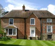
Old Downton Lodge
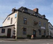
Mortimers Cross Inn
Videos from this area
These are videos related to the place based on their proximity to this place.
Kinsham Raceway - Presteigne - DJI Phantom 2
So a bunch of us went to Kinsham Raceway in Presteigne and had a ton of fun. The guys there were awesome and we'll be going again for sure. Really cannot recommend these guys enough! I took...
Minimoto Jr Club - Kinsham Raceway - 11 July 2010
The club does it's best to get the kids on outdoor tracks once a month for a bit of fun, variety and help build confidence in preperation for racing, Kinsham is one of our favourites, its...
Go Karting with the DJI Inspire 1
I took my DJI Inspire 1 out to Kinsham Raceway in Presteigne today - it was my Sister's Partner's Birthday and we all went along. Awesome weather, if a little windy with 20mph gusts. The Inspire...
VIRB0009
Heat race from trevski's birthday at kinsham raceway. recorded on a garmin virb elite stuck to me lid :)
Castanea sativa - Sweet Chestnut - Tamme Kastanje
Castanea sativa - Sweet chestnut - Tamme kastanje England-Wales 2007-2008 by (c) Henk van Boeschoten.
Croft Castle Oak - 1000 years old!
largest sessile oak tree in the uk!!! Croft Castle is perhaps one of the best sites for finding funguys in the area. Its huge range and diversity is second to none and there is always something...
Red Arrows over Windermere
Kate Whiteside captures the Red Arrows flying over Windermere in the Lake District during the Airshow.
Driffield land rover spring adventure 2008
109 6 cylinder '79 recovery vehicle at the driffield army off-road course. nice and clean the day before for the 60 years of land rover line up photo, now covered in mud...how it should be!!!
Videos provided by Youtube are under the copyright of their owners.
Attractions and noteworthy things
Distances are based on the centre of the city/town and sightseeing location. This list contains brief abstracts about monuments, holiday activities, national parcs, museums, organisations and more from the area as well as interesting facts about the region itself. Where available, you'll find the corresponding homepage. Otherwise the related wikipedia article.
Battle of Mortimer's Cross
The Battle of Mortimer's Cross was fought on 2 February 1461 near Wigmore, Herefordshire, not far from the Welsh border. It was a major battle of the Wars of the Roses. The opposing forces were an army led by nobles loyal to the King Henry VI of the House of Lancaster, his Queen Margaret of Anjou and their seven year-old son Edward, Prince of Wales on one side, and the army of Edward, Earl of March.
Adforton
Adforton is a small village and civil parish in north Herefordshire, England. It has a church which doubles as a community hall. It is situated on the A4110 main road approximately 22 miles north of Hereford.
Wigmore Abbey
Wigmore Abbey Parish is a parish with nine village churches in northwest Herefordshire. {{#invoke:Coordinates|coord}}{{#coordinates:52.335084|-2.864963|source:geograph. co. uk_region:GB_type:landmark|||||| |primary |name= }} Wigmore Abbey was an Augustinian abbey with a grange, from 1179 to 1530, situated about a mile (2 km) north of the village of Wigmore, Herefordshire, England. Only ruins of the abbey now remain.
Walford, Letton and Newton
Walford, Letton and Newton is a civil parish in north Herefordshire, England, close to the border with Shropshire. Walford village lies just south of the River Teme about 2 km southwest of Leintwardine and 2 km northeast of Letton. The post town is Craven Arms and postcodes start with SY7. The A4113 Bromfield to Knighton road runs through the village. At the time of the Domesday Survey Walford was known as 'Waliforde', which may mean 'ford of the Welshmen'.
A4113 road
The A4113 road is a single-carriageway road that runs from Knighton in Powys to Bromfield in Shropshire, passing through north Herefordshire. From Knighton it heads east along the southern side of the Teme valley (heading downstream), crossing the Wales — England border into Herefordshire, then across the River Teme via Leintwardine Bridge (at 119 metres above sea level). The route then follows a Roman Road north through the Roman village of Leintwardine, leaving the Teme behind.
Lower Todding
Lower Todding is a hamlet in the English county of Herefordshire. Lower Todding is located at the junction of the old carriage road and the A4113 road about half a mile north and east of Leintwardine. It is part of The Toddings. The Jolly Frog fish restaurant and pub is located at Lower Todding.
Sun Inn
The Sun Inn is a Grade II listed, National Inventory listed parlour pub in Leintwardine, Herefordshire, UK. The 200+ year old establishment, one of the UK's last remaining parlour pubs, had been owned and operated by resident Flossie Lane, who was born in the Sun Inn in 1914, and took over ownership more than 70 years ago, until her death in June 2009 at 95 years old.
Jay, Herefordshire
Jay is a hamlet in north Herefordshire, England. It lies in the civil parish of Leintwardine, on the other side of the River Clun 1 mile northwest of that village. The lane between Jay and Leintwardine is called Jay Lane and the bridge over the Clun is Jay Bridge. The minor River Redlake passes Jay and then joins the Clun just south of Jay Bridge.


!['JOHN RAMBO[piotr78]' preview picture of video 'JOHN RAMBO[piotr78]'](https://img.youtube.com/vi/1F54Ln4wicc/mqdefault.jpg)


