Safety Score: 3,0 of 5.0 based on data from 9 authorites. Meaning we advice caution when travelling to United Kingdom.
Travel warnings are updated daily. Source: Travel Warning United Kingdom. Last Update: 2024-04-29 08:03:39
Explore Worminghall
Worminghall in Buckinghamshire (England) with it's 534 inhabitants is located in United Kingdom about 44 mi (or 72 km) north-west of London, the country's capital.
Local time in Worminghall is now 01:25 PM (Monday). The local timezone is named Europe / London with an UTC offset of one hour. We know of 12 airports in the wider vicinity of Worminghall, of which 5 are larger airports. The closest airport in United Kingdom is RAF Benson in a distance of 11 mi (or 17 km), South. Besides the airports, there are other travel options available (check left side).
There are several Unesco world heritage sites nearby. The closest heritage site in United Kingdom is Blenheim Palace in a distance of 19 mi (or 31 km), East. Also, if you like golfing, there are multiple options in driving distance. If you need a place to sleep, we compiled a list of available hotels close to the map centre further down the page.
Depending on your travel schedule, you might want to pay a visit to some of the following locations: Oxford, Aylesbury, Remenham, Upper Basildon and Frilford. To further explore this place, just scroll down and browse the available info.
Local weather forecast
Todays Local Weather Conditions & Forecast: 13°C / 55 °F
| Morning Temperature | 5°C / 41 °F |
| Evening Temperature | 11°C / 52 °F |
| Night Temperature | 8°C / 46 °F |
| Chance of rainfall | 0% |
| Air Humidity | 71% |
| Air Pressure | 1014 hPa |
| Wind Speed | Fresh Breeze with 14 km/h (9 mph) from North |
| Cloud Conditions | Overcast clouds, covering 85% of sky |
| General Conditions | Overcast clouds |
Tuesday, 30th of April 2024
13°C (56 °F)
10°C (50 °F)
Light rain, fresh breeze, overcast clouds.
Wednesday, 1st of May 2024
14°C (58 °F)
8°C (47 °F)
Light rain, gentle breeze, overcast clouds.
Thursday, 2nd of May 2024
9°C (48 °F)
8°C (46 °F)
Moderate rain, moderate breeze, overcast clouds.
Hotels and Places to Stay
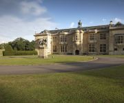
Belmond Le Manoir aux Quat' Saisons
Hartwell House & Spa
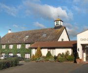
THE OXFORD BELFRY- QHOTELS
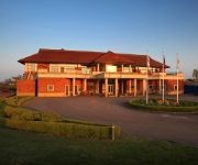
Best Western Plus Magnolia Park Hotel Golf and Country Club
The Oxfordshire
TRAVELODGE OXFORD WHEATLEY
TRAVELODGE THAME
Ramada Oxford Days Inn Oxford Welcome Break
Videos from this area
These are videos related to the place based on their proximity to this place.
Rally Days Worminghall Buckinghamshire Rally Driving Experience Venue
A semi sealed surface rally days stage close to the M40 in Buckinghamshire with plenty of gravel, dust and mud to encourage sideways driving and room to explore the cars and your limits. Try...
Great Milton Church fete [circa 1989]
This old VHS video recording of the Annual Great Milton Church fete [circa 1989], was recently discovered by the Great Milton History Society when they moved their archives into a new location...
Hubsan X4 H107 Test Flight
Hubsan X4 H107 Test Flight over Oakley, Bucks Its a great quadcopter and very easy to fly.
Abarthisti: The Ragley Hall Convoy
A short video of the Abarthisti Convoy, from Oxford Services to Ragley Hall, Warickshire.
Late Decisions to Leave Motorway - M40 21st May 2014
First clip Car shoots in from the fast lane..... then, two junctions later, M40 J8A (Oxford Services) Golf flies in at the last minute and nearly gets taken out by Silver car in centre lane...
Close Shave Oxford Services M40 - Range Rover at fault
The Range Rover Driver couldn't hold back, behind the truck, for just a few seconds...... causes car in middle lane to brake very hard..... could have been a serious accident !!
CVRT Spartan 48AT56 on Low Loader - Seen Today - M40 North near Oxford
CVRT Spartan 48AT56 on Low Loader - Seen Today - M40 North near Oxford 11th Nov 2013.
Badger Hit on M40.... It was a draw.... Badger and Car Dead !!
Chrysler 300C Touring ( Dodge Magnum in the USA ) Hits a Badger at 63mph. Substantial damage to car.... lower front panel... Radiator... car went into emergency "limp home" mode. ETC...
Flight over former RAF Oakley 1st March 09
Changing the audio again as the "ahhhahhh" women was driving me mad lol* Flight over former RAF Oakley [my secondary flying site] filmed with a FlyCamOne V2 .
Videos provided by Youtube are under the copyright of their owners.
Attractions and noteworthy things
Distances are based on the centre of the city/town and sightseeing location. This list contains brief abstracts about monuments, holiday activities, national parcs, museums, organisations and more from the area as well as interesting facts about the region itself. Where available, you'll find the corresponding homepage. Otherwise the related wikipedia article.
Great Train Robbery (1963)
The Great Train Robbery is the name given to a £2.6 million train robbery (the equivalent of £41 million today) committed on 8 August 1963 at Bridego Railway Bridge, Ledburn near Mentmore in Buckinghamshire, England. The bulk of the stolen money was not recovered. Three robbers were never found, two convicted robbers escaped. One convicted was most likely never involved, and died in prison. Though there were no firearms involved, the standard judgment was 30 years.
Bernwood Forest
Bernwood Forest was one of several forests of the ancient kingdom of England and was a Royal hunting forest. It is thought to have been set aside as Royal hunting land when the Anglo-Saxon kings had a palace at Brill and church in Oakley, in the 10th century and was a particularly favoured place of Edward the Confessor, who was born in nearby Islip. From about 1217 through to the 17th century the forest went through a gradual period of deforestation.
RAF Oakley
RAF Oakley was a Royal Air Force airfield between Oakley and Worminghall, Buckinghamshire, England . It was located in a flat, damp wooded area.
Tiddington-with-Albury
Tiddington with Albury is a civil parish in South Oxfordshire. It includes the village of Albury (Ordnance Survey grid reference SP655051) and the larger village of Tiddington (OS Grid ref. SP649051). It was formed by a merger of the civil parishes of Albury and Tiddington in 1932.
Waterperry with Thomley
Waterperry with Thomley is a civil parish in South Oxfordshire. It includes the village of Waterperry (Ordnance Survey grid reference SP626066) and the abandoned former village of Thomley (OS Grid ref. SP629091). Thomley and Wateperry were separate civil parishes in 1957. The current single civil parish was formed at some time thereafter.
Hundred of Hormer
Hormer was an ancient hundred of Berkshire, England. It consisted of the area immediately west of Oxford within the bend of the River Thames, all of which was transferred to Oxfordshire in 1974. It included the ancient parishes of Abingdon Besselsleigh Cumnor North Hinksey South Hinksey Radley Seacourt Sunningwell Wootton Wytham St.


!['Great Milton Church fete [circa 1989]' preview picture of video 'Great Milton Church fete [circa 1989]'](https://img.youtube.com/vi/DIKqCDf3OA8/mqdefault.jpg)


