Safety Score: 3,0 of 5.0 based on data from 9 authorites. Meaning we advice caution when travelling to United Kingdom.
Travel warnings are updated daily. Source: Travel Warning United Kingdom. Last Update: 2024-05-05 08:24:42
Delve into Ludgershall
Ludgershall in Buckinghamshire (England) with it's 409 habitants is a town located in United Kingdom about 46 mi (or 74 km) north-west of London, the country's capital town.
Time in Ludgershall is now 02:10 PM (Sunday). The local timezone is named Europe / London with an UTC offset of one hour. We know of 12 airports closer to Ludgershall, of which 5 are larger airports. The closest airport in United Kingdom is Oxford (Kidlington) Airport in a distance of 12 mi (or 19 km), West. Besides the airports, there are other travel options available (check left side).
There are several Unesco world heritage sites nearby. The closest heritage site in United Kingdom is Blenheim Palace in a distance of 17 mi (or 28 km), East. Also, if you like the game of golf, there are some options within driving distance. We saw 1 points of interest near this location. In need of a room? We compiled a list of available hotels close to the map centre further down the page.
Since you are here already, you might want to pay a visit to some of the following locations: Aylesbury, Oxford, Calverton, Stony Stratford and Shenley Church End. To further explore this place, just scroll down and browse the available info.
Local weather forecast
Todays Local Weather Conditions & Forecast: 15°C / 59 °F
| Morning Temperature | 8°C / 47 °F |
| Evening Temperature | 13°C / 55 °F |
| Night Temperature | 10°C / 51 °F |
| Chance of rainfall | 0% |
| Air Humidity | 66% |
| Air Pressure | 1008 hPa |
| Wind Speed | Gentle Breeze with 7 km/h (4 mph) from North |
| Cloud Conditions | Scattered clouds, covering 43% of sky |
| General Conditions | Scattered clouds |
Monday, 6th of May 2024
13°C (55 °F)
11°C (53 °F)
Moderate rain, gentle breeze, overcast clouds.
Tuesday, 7th of May 2024
16°C (61 °F)
11°C (51 °F)
Light rain, gentle breeze, broken clouds.
Wednesday, 8th of May 2024
15°C (58 °F)
11°C (52 °F)
Broken clouds, gentle breeze.
Hotels and Places to Stay
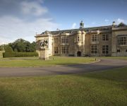
Hartwell House & Spa
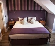
Best Western Plus Magnolia Park Hotel Golf and Country Club
Videos from this area
These are videos related to the place based on their proximity to this place.
How to get your (hacked) torn city account back !!!
Awsome howto movie please watch it !!!!!! comment or write to me on how you thought how specific it was mail me if you need me to be anymore specific otherwise please enjoy the movie dont...
David Starkey teaches panel lessons from history- Question Time 01/03/12.
David Starkey patiently explains why invading foreign nations to 'protect' the people in them is never a good idea. "People don't like being freed, they mistake liberators for conquerors......
Chute en VTT - Gopro HD
Crash at 0:20 Chute de vélo dans le Kent en voyage scolaire, j'ai perdu l'avant en freinant ! Heureusement rien de cassé. Nice bike crash during a school trip through Kent in England, The...
RC Helicopter Walkera 36 Flying in School Hall
My first trip to try flying in an enclosed building. I managed to get the Dance Hall at Marriotts School this time. Did some good flying, but was nervous of breaking the mirrors! Even Sarah...
Hiring a motorhome
http://www.motorhomesdirect.co.uk/2010/08/30/hiring-a-motorhome/ Hiring a motorhome is not just a summer activity, nearly all motorhomes are 'winterized' so you can enjoy motorhoming all...
Londres, Barcelona... : 4 - Trabalho & Dinheiro
Documentário em vídeo com 45 minutos, foi produzido em 2005, com filmagens de minha viagem pela Inglaterra e Espanha (e estrada da França). Foi constituído principalmente de diversas entrevista.
Belt CP Video 1
Me flying my newly aquired christmas present around my school hall doing nose in and nose out any questions just post comments below! Yes i do have funny curly hair :)
Videos provided by Youtube are under the copyright of their owners.
Attractions and noteworthy things
Distances are based on the centre of the city/town and sightseeing location. This list contains brief abstracts about monuments, holiday activities, national parcs, museums, organisations and more from the area as well as interesting facts about the region itself. Where available, you'll find the corresponding homepage. Otherwise the related wikipedia article.
Brill railway station
Brill railway station was the terminus of a small railway line in Buckinghamshire, England, known as the Brill Tramway. Built and owned by the Duke of Buckingham, it was later operated by London's Metropolitan Railway, and in 1933 briefly became one of the two north-western termini of the London Underground, despite being 45 miles and over two hours travelling time from the City of London.
Dorton Spa
Dorton Spa is a Chalybeate spring located between the villages of Dorton and Brill in Buckinghamshire, England in a wood called Spa Wood. Chalybeate is defined as "a water or other liquor containing iron", the word's origin is Greek chalyps; chalybos, meaning steel; Chalyps being an ancient nation in Pontus famous for its steel.
Wood Siding railway station
Wood Siding railway station was a small halt in Bernwood Forest, Buckinghamshire, England. It was opened in 1871 as a terminus of a short horse-drawn tramway built to assist the transport of goods from and around the Duke of Buckingham's extensive estates in Buckinghamshire and to connect the Duke's estates to the Aylesbury and Buckingham Railway at Quainton Road.
Ashfold School
Ashfold School is a private day and boarding preparatory school for about 270 boys and girls aged 3 to 13. It is situated in a Grade 1 Listed Jacobean Mansion named Dorton House in the village of Dorton near the cities of Oxford, Bicester and Aylesbury in the English county of Buckinghamshire.
Dorton House, Buckinghamshire
Dorton House is a Grade I Listed Jacobean country house near the village of Dorton in Buckinghamshire, England. The house was built between 1596 and 1626 by Sir John Dormer on the site of a previous house. The house is in a Gothic Style and is in a horseshoe shape. The house was built from bricks made from local clay fired at the bottom of Brill Hill. The house was sold in 1783 to Sir John Fletcher and remained in his family till 1928 when it was sold to Major Michael Beaumont.
Wotton House
Wotton House, or Wotton, in Wotton Underwood (Buckinghamshire, UK), was built between 1704 and 1714, to a design very similar to that of the contemporary version of Buckingham House. The house is an example of English Baroque and a Grade I listed building. The grounds were laid out by London & Wise with a formal parterre and a double elm avenue leading down to a lake.
Brill and Ludgershall railway station
Brill and Ludgershall railway station was a railway station serving the villages of Brill and Ludgershall in Buckinghamshire. It was on what is now known as the Chiltern Main Line.
Dorton Halt railway station
Dorton Halt railway station was a railway station serving the village of Dorton in Buckinghamshire. It was on what is now known as the Chiltern Main Line. The station was geographically nearer to Brill than Brill and Ludgershall railway station.


