Safety Score: 3,0 of 5.0 based on data from 9 authorites. Meaning we advice caution when travelling to Italy.
Travel warnings are updated daily. Source: Travel Warning Italy. Last Update: 2024-05-05 08:24:42
Delve into Cargnach
Cargnach in Provincia di Belluno (Veneto) with it's 15 habitants is located in Italy about 293 mi (or 471 km) north of Rome, the country's capital town.
Current time in Cargnach is now 02:57 AM (Monday). The local timezone is named Europe / Rome with an UTC offset of 2 hours. We know of 9 airports close to Cargnach, of which 3 are larger airports. The closest airport in Italy is Belluno Airport in a distance of 11 mi (or 17 km), East. Besides the airports, there are other travel options available (check left side).
There are several Unesco world heritage sites nearby. The closest heritage site in Italy is The Dolomites in a distance of 35 mi (or 56 km), North. If you need a hotel, we compiled a list of available hotels close to the map centre further down the page.
While being here, you might want to pay a visit to some of the following locations: San Gregorio nelle Alpi, Santa Giustina, Sospirolo, Sedico and Cesiomaggiore. To further explore this place, just scroll down and browse the available info.
Local weather forecast
Todays Local Weather Conditions & Forecast: 17°C / 62 °F
| Morning Temperature | 14°C / 57 °F |
| Evening Temperature | 16°C / 60 °F |
| Night Temperature | 12°C / 53 °F |
| Chance of rainfall | 3% |
| Air Humidity | 85% |
| Air Pressure | 1012 hPa |
| Wind Speed | Light breeze with 4 km/h (3 mph) from North |
| Cloud Conditions | Overcast clouds, covering 100% of sky |
| General Conditions | Light rain |
Tuesday, 7th of May 2024
16°C (62 °F)
13°C (55 °F)
Moderate rain, light breeze, overcast clouds.
Wednesday, 8th of May 2024
16°C (60 °F)
12°C (54 °F)
Moderate rain, light breeze, overcast clouds.
Thursday, 9th of May 2024
20°C (68 °F)
14°C (57 °F)
Light rain, light breeze, overcast clouds.
Hotels and Places to Stay
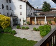
Palazzo Cappello
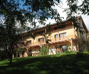
Campo di Cielo
Videos from this area
These are videos related to the place based on their proximity to this place.
Erica Boschiero: 3 e 32
Erica Boschiero: voce e chitarra Mauro Martello: flauto Testo e Musica di Erica Boschiero Registrato a Sospirolo il 17 agosto 2012.
Agriturismo Dagai - Seminario teatrale La Fortezza e l'attesa
Presentazione Seminario Teatrale condotto da Monica Bonomi presso l'agriturismo Dagai a Sospirolo (BL) a partire dal 6 Settembre 2009 sino al 12 settebmbre 2009 per info e contatti ...
Al Forment (parte 3).mpg
Dal frumento al pane: il naturale ciclo del grano come avveniva nella tradizione di un tempo nella vallata feltrina.
Ktm EXC 125 - The ascent [GoPro Hero 3 HD]
Ciao a tutti :D ecco finalmente il secondo video, con un ritardo di tre mesi. Ci scusiamo, ma la connessione per caricare il video era una ***** :P Spero vi divertiate e buona visione :) iscrivetev...
Il Molino di Santa Libera / The Old Mill of Santa Libera
This beautifully restored old mill is located in the town of Santa Giustina, in the Valbelluna of Belluno Province, in the Veneto Region of Italy. It dates from the 1500's and returned to function...
Grandma's Feather Bed (Live) - John Denver Project Band
Versione LIVE del brano Grandma's Feather Bed eseguito da John Denver Project Band https://www.facebook.com/JohnDenverTributeBellunoItaly.
Ring from Roncoi to the Refuge Casera Ere mp4
22-05-20014. Hike in the Belluna Valley. A round trip of the camping Palia and climb to Mount Piz. From the Roer parking, you have to follow, for a short distance, the CAI path n. 851 for the...
Circonvallazione Santa Giustina [03]- Tracciato del Comune di Rimini (LO SCEMPIO)
Il filmato descrive il tracciato preliminare approvato dal comune di Rimini in data 6/02/2015 denominato LO SCEMPIO per l'enorme danno che recherà all'area rurale del paese di Santa Giustina...
Atterraggio e decollo di un elicottero Ulm CH7
Atterraggio e decollo presso l' Aviosuperficie Air Fant di Santa Giustina Belluno.
Videos provided by Youtube are under the copyright of their owners.
Attractions and noteworthy things
Distances are based on the centre of the city/town and sightseeing location. This list contains brief abstracts about monuments, holiday activities, national parcs, museums, organisations and more from the area as well as interesting facts about the region itself. Where available, you'll find the corresponding homepage. Otherwise the related wikipedia article.
Pizzocco
Pizzocco is a mountain of the Veneto, Italy. It has an elevation of 2187 metres.


!['Ktm EXC 125 - The ascent [GoPro Hero 3 HD]' preview picture of video 'Ktm EXC 125 - The ascent [GoPro Hero 3 HD]'](https://img.youtube.com/vi/zHENBK9448s/mqdefault.jpg)


!['Circonvallazione Santa Giustina [03]- Tracciato del Comune di Rimini (LO SCEMPIO)' preview picture of video 'Circonvallazione Santa Giustina [03]- Tracciato del Comune di Rimini (LO SCEMPIO)'](https://img.youtube.com/vi/QM-6BeOT9L8/mqdefault.jpg)


