Safety Score: 4,2 of 5.0 based on data from 9 authorites. Meaning please reconsider your need to travel to Israel.
Travel warnings are updated daily. Source: Travel Warning Israel. Last Update: 2024-04-26 08:02:42
Explore West Jerusalem
The district West Jerusalem of Jerusalem in Jerusalem with it's 400,000 inhabitants West Jerusalem is located in Israel and is a district of the nations capital.
If you need a place to sleep, we compiled a list of available hotels close to the map centre further down the page.
Depending on your travel schedule, you might want to pay a visit to some of the following locations: Jericho, Ramla, Karney Shomron, Ash Shunah al Janubiyah and Al `Arid. To further explore this place, just scroll down and browse the available info.
Local weather forecast
Todays Local Weather Conditions & Forecast: 25°C / 77 °F
| Morning Temperature | 15°C / 59 °F |
| Evening Temperature | 21°C / 69 °F |
| Night Temperature | 17°C / 62 °F |
| Chance of rainfall | 0% |
| Air Humidity | 49% |
| Air Pressure | 1008 hPa |
| Wind Speed | Fresh Breeze with 13 km/h (8 mph) from East |
| Cloud Conditions | Overcast clouds, covering 100% of sky |
| General Conditions | Overcast clouds |
Saturday, 27th of April 2024
18°C (65 °F)
15°C (60 °F)
Overcast clouds, moderate breeze.
Sunday, 28th of April 2024
21°C (70 °F)
15°C (60 °F)
Scattered clouds, gentle breeze.
Monday, 29th of April 2024
21°C (70 °F)
16°C (61 °F)
Moderate rain, moderate breeze, overcast clouds.
Hotels and Places to Stay
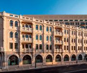
Waldorf Astoria Jerusalem
Koresh Hotel Koresh Hotel Jerusalem
HILLEL 11 HOTEL
Shani Hotel
Jerusalem Tower Hotel
JERUSALEM INN
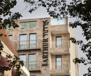
Arthur Hotel - An Atlas Boutique Hotel
Habira
Abraham Hostel
Montefiore Hotel
Videos from this area
These are videos related to the place based on their proximity to this place.
גילי'ז סקייטשופ מציגים: תחרות הטריק הטוב ביותר 2008
צולם בירושלים, גן הסוס/בור שיבר/גן מנורה/כיכר משה ברעם.
Jerusalem old city - Free tour 1/6
1st part of tour with touristguide "Kobi" to the secrets of old city of Jerusalem.
jerusalem center
Jerusalem is situated on the southern spur of a plateau in the Judean Mountains, which include the Mount of Olives (East) and Mount Scopus (North East). The elevation of the Old City is approximate...
Elad Tzur Israel tour guide trip planner private family FIT Eshkol Jerusalem day kids trips children
http://insite-israel-tour.com/Israelguide zurelad@gmail.com Shalom, I'll be happy to hear from you and share with you some useful information about trips to Israel. contact me now! I plan...
Israëlische politie geweld 2014
Jongste slachtoffer van de Israëlische politie geweld de 15-jarige Palestijns-Amerikaanse jongen die werd aangepakt vrijdag door Israëlische veiligheidstroepen, hard veroordeeld tot negen...
מרגש,ההורים של הבנים החטופים אומרים קדיש
On 12 June 2014, three Israeli teenagers were kidnapped in Gush Etzion, in the West Bank, as they were hitchhiking to their homes. The three teens were Naftali Fraenkel (16, from Nof Ayalon),...
Fruits and vegetables in the Arab market in East Jerusalem (Damascus Gate, Jerusalem)
Zahi Shaked A tour guide in Israel and his camera zahigo25@walla.com 9726905522 tel סיור עם מורה הדרך ומדריך הטיולים צחי שקד 0546905522 My name is Zahi...
Buying fresh figs in the Arab market in East Jerusalem (near the Damascus Gate, Jerusalem)
Zahi Shaked A tour guide in Israel and his camera zahigo25@walla.com 9726905522 tel סיור עם מורה הדרך ומדריך הטיולים צחי שקד 0546905522 My name is Zahi...
Abraham Hostel Jerusalem
http://jerusalemexperience.com This Video is about The Abraham Hostel Jerusalem. Abraham is known as the father of monotheism and was the first backpacker traveling throughout the Middle...
Videos provided by Youtube are under the copyright of their owners.
Attractions and noteworthy things
Distances are based on the centre of the city/town and sightseeing location. This list contains brief abstracts about monuments, holiday activities, national parcs, museums, organisations and more from the area as well as interesting facts about the region itself. Where available, you'll find the corresponding homepage. Otherwise the related wikipedia article.
Operation Kilshon
From May 13, 1948 until May 18, 1948 Jewish forces from the Haganah and Irgun executed Operation Kilshon ("Operation Pitchfork"). Its aim was to capture the Jewish suburbs of Jerusalem particularly Talbiya in central Jerusalem. At midnight on Friday May 14, the British declared its civil and military authority in Jerusalem to be at an end. In the morning they evacuated the city in two large convoys, one moved north towards Haifa and the other south towards Bethlehem.
Sbarro restaurant suicide bombing
The Sbarro restaurant suicide bombing was a Palestinian terrorist attack on a pizzeria in downtown Jerusalem, Israel, on 9 August 2001, in which 15 civilians were killed, including 7 children and a pregnant woman, and 130 wounded.
Ticho House
Ticho House is a historical home in Jerusalem, Israel, now a museum. It was one of the first homes built outside the Old City walls at the end of the nineteenth century.
West Jerusalem
West Jerusalem refers to the section of Jerusalem that is in Israeli territory in reference to the borders usually accepted by the international community and that fit to the ceasefire lines of the First Arab-Israeli War.
Russian Compound
The Russian Compound is one of the oldest districts in central Jerusalem, including a large Russian Orthodox church and several former pilgrim hostels which are used as government buildings and for the Museum of Underground Prisoners. The compound covers 68 dunams (68,000 m² or roughly 17 acres) between Jaffa Road, Shivtei Israel Street, and Street of the Prophets.
1929 Safed pogrom
The 1929 Safed pogrom was the Arab massacre of Jewish residents of Safed on August 29, 1929, during the 1929 Palestine riots.
Nahalat Shiv'a
1 Hillel Street 2 Ben Sira 3 Yafo 4 Shamai 5 Ben Yehuda 6 Generali B Kikar Tzion]] Nahalat Shiv'a is a neighborhood in central Jerusalem, Israel. Nahalat Shiv'a was the third neighborhood built outside the Old City of Jerusalem in the 1860s. Today it is a crowded pedestrian promenade lined with sidewalk cafes.
Ben Yehuda Street (Jerusalem)
Ben Yehuda Street, known as the "Midrachov" is a major street in downtown Jerusalem, Israel. It is now a pedestrian mall and closed to vehicular traffic. The street runs from the intersection of King George Street to Zion Square and Jaffa Road. The street is named after the founder of Modern Hebrew, Eliezer Ben-Yehuda.
Zion Square
Zion Square is a public square at the east end of the Ben Yehuda Street Pedestrian Mall in downtown Jerusalem. It abuts Jaffa Road, Herbert Samuel Street and Yoel Moshe Salomon Street as well. In August 2012, it was the site of the Zion Square assault.
Mamilla Cemetery
Mamilla Cemetery is an historic Muslim cemetery located just to the west of the walls of the Old City of Jerusalem. The cemetery, at the center of which lies the Mamilla Pool, contains the remains of figures from the early Islamic period, several Sufi shrines and Mamluk-era tombs. The cemetery grounds also contain the bodies of thousands of Christians killed in the pre-Islamic era, as well as several tombs from Crusader times.
Hillel Street
Hillel Street is one of the central streets of Jerusalem. It connects King George Street to the small Ben Sira Street and the Mamilla neighbourhood and is parallel to Ben Yehuda Street. The lower part of the road is between Independence Park and the Nahalat Shiva neighborhood. The street was named for Hillel the Elder, and a street parallel to it is called Shammai Street. Most of the buildings on the street date from the British Mandate period and follow the architectural style of that time.
King George Street (Jerusalem)
King George Street is a street in central Jerusalem, Israel which joins Ben-Yehuda Street and Jaffa Road to form the "downtown triangle. " The street was named in honor of King George V on December 9, 1924.
Bikur Holim Hospital
Bikur Holim Hospital is a 200-bed general hospital in Jerusalem, Israel. It is best known for its obstetrics and cardiac departments. The hospital also operates a modern neonatal intensive care unit, a pediatrics department, and bariatric and plastic surgery units. Bikur Holim treats some 60,000 patients annually. With 700 administrators, doctors, nurses, technicians and cleaners, it is one of Jerusalem's largest downtown employers.
Tabor House (Jerusalem)
Tabor House is a landmark building in Jerusalem, Israel. Tabor House was built in 1882 by archaeologist, missionary and architect Conrad Schick as a home for his family. The building is located at 58 Street of the Prophets. The name was taken from Psalm 89:12: "The north and the south, Thou has created them; Tabor and Hermon shall rejoice in Thy name. " Palm leaves with the carved Greek letters Alpha and Omega decorate the facade. Schick lived in the house until his death in 1901.
Zion Square refrigerator bombing
The Zion Square refrigerator bombing was a terrorist attack in downtown Jerusalem, Israel on Friday, July 4, 1975 in which 15 civilians were killed and 77 wounded.
Central Post Office Building (Jerusalem)
The Central post office building of Jerusalem is an architectural structure in Jaffa Street, Jerusalem. The building was built as General Post Office during the British Mandate, one of three government buildings in this area. Construction was between 1934 and 1938 to the design of the main architect of the public works department of the British Mandate, Austen Harrison and the Government architect Percy Harold Winter.
Street of the Prophets
Street of the Prophets is an east-west axis road in Jerusalem beginning outside Damascus Gate and ending at Davidka Square. Located to the north of Jaffa Road, it bisects the neighborhood of Musrara. During its heyday in the late 19th century and early 20th century, Street of the Prophets was a favorite address for hospitals, churches, monasteries, hospices, government offices, foreign consulates, and wealthy Christian, Jewish and Arab residents.
Café Hillel bombing
The Café Hillel bombing was a Palestinian suicide bombing carried out on September 9, 2003 in a coffee shop in the German Colony neighborhood in Jerusalem. Seven people were killed in the attack and over 50 were injured. A few hours prior to the Café Hillel bombing, Palestinian militants carried out a suicide attack in a bus stop next to the military base Tzrifin.
Lifshitz College of Education
Lifshitz College of Education ("Michlelet Lifshitz" - מכללת ליפשיץ - המכללה האקדמית הדתית לחינוך) is a religious teacher training college in Jerusalem, Israel. The school credo is "integrating modernity and Jewish life. " The college was founded in 1921 by Rabbi Eliezer Meir Lifshitz with the support of Rabbi Abraham Isaac Kook. It was one of the first institutions of its kind in Jerusalem. It was originally called Beit Midrash Mizrachi for Teachers.
Mamilla Pool
Mamilla Pool is one of several ancient reservoirs that supplied water to the inhabitants of the Old City of Jerusalem. It is located outside the walls of the Old City about 700 yards northwest of Jaffa Gate in the centre of the Mamilla Cemetery. With a capacity of 30,000 cubic metres, it is connected by an underground channel to Hezekiah's Pool in the Christian Quarter of the Old City. It is possible that it has received water via an aqueduct from Solomon's Pools.
2002 Jaffa Street bombing
The 2002 Jaffa Street bombing was a suicide bombing which occurred on January 27, 2002 in which Wafa Idris, an 28-year-old Palestinian female suicide bomber, blew herself up in the center of Jerusalem, killing one person and injuring about 100 people.
Frumin House
Froumine House or "Frumin House" was the temporary abode of the Israeli Parliament, the Knesset, from 1950 to 1966. The building is located at 24 King George Street in downtown Jerusalem. The first to the fifth Knesset sessions were conducted there.
Nebi Akasha Mosque
Nebi Akasha Mosque, also Okasha mosque or Ukasha mosque, is a historic mosque located in Jerusalem, Israel.
Swedish Theological Institute
The Swedish Theological Institute (STI) is an institute in Jerusalem supported by the Church of Sweden. Christian students of theology can gain a deeper understanding of Judaism at the Institute, and also of Christianity and Islam.
Beit David
Beit David was the fourth Jewish neighborhood outside the walls of Jerusalem. This courtyard neighborhood was established in in 1873.


