Safety Score: 4,2 of 5.0 based on data from 9 authorites. Meaning please reconsider your need to travel to Israel.
Travel warnings are updated daily. Source: Travel Warning Israel. Last Update: 2024-04-25 08:17:04
Discover Romema
The district Romema of Jerusalem in Jerusalem is a subburb in Israel and is a district of the nations capital.
If you need a hotel, we compiled a list of available hotels close to the map centre further down the page.
While being here, you might want to pay a visit to some of the following locations: Jericho, Ramla, Karney Shomron, Ash Shunah al Janubiyah and Al `Arid. To further explore this place, just scroll down and browse the available info.
Local weather forecast
Todays Local Weather Conditions & Forecast: 24°C / 76 °F
| Morning Temperature | 17°C / 63 °F |
| Evening Temperature | 19°C / 66 °F |
| Night Temperature | 18°C / 64 °F |
| Chance of rainfall | 0% |
| Air Humidity | 45% |
| Air Pressure | 1010 hPa |
| Wind Speed | Fresh Breeze with 14 km/h (9 mph) from East |
| Cloud Conditions | Overcast clouds, covering 99% of sky |
| General Conditions | Overcast clouds |
Saturday, 27th of April 2024
22°C (71 °F)
17°C (63 °F)
Overcast clouds, moderate breeze.
Sunday, 28th of April 2024
21°C (69 °F)
17°C (63 °F)
Light rain, gentle breeze, overcast clouds.
Monday, 29th of April 2024
23°C (74 °F)
20°C (67 °F)
Light rain, gentle breeze, overcast clouds.
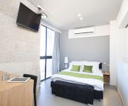
Hotels and Places to Stay
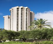
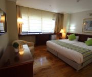
Crowne Plaza JERUSALEM
RAMADAJERUSALEM HOTEL
HILLEL 11 HOTEL
Jerusalem Gardens Hotel and Spa
JERUSALEM GATE HOTEL
Bezalel Hotel - an Atlas Boutique Hotel
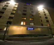
CAESAR PREMIER JERUSALEM
Shani Hotel
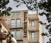
Arthur Hotel - An Atlas Boutique Hotel
Abraham Hostel
Videos from this area
These are videos related to the place based on their proximity to this place.
Matzoh Baking 2012
Shiur Gimel of Yeshivas Chemdas Hatorah of Ramat Beit Shemesh A visits the "Brisker Chabura" run of matzos at a factory in Jerusalem Israel on 13-Mar-12.
Beautiful houses in Jerusalem - Hospital Shaarei Tzedek - the old building (now home to the IBA)
Zahi Shaked A tour guide in Israel and his camera zahigo25@walla.com 9726905522 tel סיור עם מורה הדרך ומדריך הטיולים צחי שקד 0546905522 My name is Zahi...
Allenby Citadel
Jerusalem Citadel - A unique sheltered residence project in Jerusalem including 120 rooms and public facilities for the residence welfare designed by Tito Architects ; Entrepreneur: B. Yair....
Jerusalem old city - Free tour 1/6
1st part of tour with touristguide "Kobi" to the secrets of old city of Jerusalem.
Jerusalem old city - Free tour 2/6
2nd part of walkingtour with guide "Kobi" to the secrets of old city of Jerusalem.
Jerusalem old city - Free tour 4/6
Part nr 4 of walkingtour with guide "Kobi" to the secrets of old city of Jerusalem.
The Second Temple Model of Jerusalem
Second Temple Era Model of Jerusalem. The model reconstructs the topography and architectural character of the city as it was prior to 66 CE, the year in which the Great Revolt against the...
What Torah Offers Us ~ TORAH GEM w/R Daniel Kohn ~ Please Share!!
This Torah Gem w/R. Daniel Kohn was brought to you by Sulam Yaakov ~ Integrating Torah ~ Sulam Yaakov ~ Sulam Yaakov is the Nachlaot Community Beit Midrash for Leadership Development.
Videos provided by Youtube are under the copyright of their owners.
Attractions and noteworthy things
Distances are based on the centre of the city/town and sightseeing location. This list contains brief abstracts about monuments, holiday activities, national parcs, museums, organisations and more from the area as well as interesting facts about the region itself. Where available, you'll find the corresponding homepage. Otherwise the related wikipedia article.
Belz (Hasidic dynasty)
Belz is a Hasidic dynasty named for the town of Belz in Western Ukraine, near the Polish border. The town has existed since at least the 10th century, with the Jewish community being established during the 14th century. The town became home to Hasidic Judaism in the early 19th century. At the beginning of World War II, Belz had 6,100 inhabitants, of which 3,600 were Jewish.
Jerusalem Central Bus Station
The Jerusalem Central Bus Station is the main bus depot in Jerusalem, Israel and one of the busiest bus stations in the country. Located on Jaffa Road near the entrance to the city, it serves Egged, Superbus and Dan intercity bus routes. City buses pick up and discharge passengers across the street on Jaffa Road and on Zalman Shazar Boulevard, which can be accessed via an underground pedestrian passageway.
Kiryat Mattersdorf
Kiryat Mattersdorf is a Haredi neighborbood in Jerusalem, Israel. It is located on the northern edge of the mountain plateau on which central Jerusalem lies. It is named after Mattersburg (formerly Mattersdorf), a town in Austria with a long Jewish history. It borders Unsdorf and Romema. The main thoroughfare is Panim Meirot Street.
Mercaz HaRav Kook
Mercaz HaRav Kook Hebrew: מרכז הרב קוק (lit. Rabbi Kook Institute), is a national-religious yeshiva in Jerusalem, Israel, founded in 1924 by Rabbi Abraham Isaac Kook. It has become the most prominent religious-Zionist yeshiva in the world and synonymous with Kook's teachings. Many Religious Zionist educators and leaders have studied at the Mercaz HaRav Kook.
Central Zionist Archives
The Central Zionist Archives is the official archives of the institutions of the Zionist Movement: the World Zionist Organization, the Jewish Agency, the Jewish National Fund, and Keren Hayesod/the United Israel Appeal as well as the archives of the World Jewish Congress. The CZA preserves the files created in the course of the activities of these bodies and the secondary bodies created by them.
Tiferet Yisrael Synagogue
Tiferet Yisrael Synagogue was one of the most outstanding synagogues in the Old City of Jerusalem in the 19th and 20th centuries. It was destroyed by the Arab Legion during the 1948 Arab-Israeli War and left as ruins by the Israeli government after the recapture of the Old City in Six-Day War. Named after Rabbi Yisroel of Ruzhin, founder of the Ruzhin Hasidic dynasty, it was also known as the Nissan Beck Shul,, after its founder, Rabbi Nissan Beck.
Belz Great Synagogue
The Belz Great Synagogue is the largest synagogue in Israel. It was built by the Belz Hasidic community with financial help from its supporters and admirers around the world.
Romema
This article is about the neighborhood in Jerusalem. For the Haifa neighborhood, see Romema (Haifa). Romema (lit. Uplifted) is a neighbourhood in northwest Jerusalem, Israel, just off the Tel Aviv-Jerusalem highway at the main entrance to the city. It occupies the highest hill in Jerusalem. Romema is bordered by Kiryat Mattersdorf and Mekor Baruch.
Jerusalem Chords Bridge
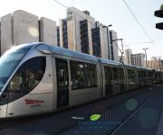
The Jerusalem Chords Bridge or Jerusalem Bridge of Strings, also called the Jerusalem Light Rail Bridge is a cantilever spar cable-stayed bridge at the entrance to the city of Jerusalem, Israel, designed by the Spanish architect and engineer Santiago Calatrava. The bridge is used by Jerusalem Light Rail's Red Line, which began service on August 19, 2011.
International Convention Center (Jerusalem)
The International Convention Centre, commonly known as Binyenei HaUma, is a concert hall and conventional center in Giv'at Ram in Jerusalem, Israel. It is the largest convention center in the Middle East.
Jaffa Road
Jaffa Road is one of the longest and oldest major streets in Jerusalem, Israel. crosses the city from east to west, from the Old City walls to downtown Jerusalem, the western portal of Jerusalem and the Jerusalem-Tel Aviv highway. It is lined with shops, businesses and restaurants.
Allenby Square
Allenby Square, a name commemorating Field Marshal Edmund Allenby who commanded the British forces which captured Palestine in the First World War, has been bestowed at different times on two different squares in Jerusalem. This divergent naming was connected both to prestige struggles within the British forces entering Jerusalem in late 1917, leading to what became known as "the multiple surrenders", and to later vicissitudes of the struggle between Israelis and Arabs for control of the city.
Jerusalem Binyanei HaUma Railway Station
Jerusalem Binyanei HaUma Railway Station is a future railway station on the future high-speed railway to Jerusalem near Binyanei HaUma in Jerusalem, Israel. The station is currently under construction and will be mostly underground, 60–80 m deep. It is located adjacent to the Jerusalem Central Bus Station as well as next to a station of the Jerusalem Light Rail.
Diskin Orphanage
The Diskin Orphanage was an orphanage in the Old City of Jerusalem, established in 1881 by Yehoshua Leib Diskin. From the Jewish Quarter, it moved to Street of the Prophets outside the walls of the Old City. In 1927, it moved to a new building in the Kiryat Moshe neighborhood, near the main entrance to the city from the west.
Mercaz HaRav massacre
The Mercaz HaRav massacre, also called the Mercaz HaRav shooting, was an attack that occurred on 6 March 2008, in which a lone Palestinian gunman shot multiple students at the Mercaz HaRav yeshiva, a religious school in Jerusalem, Israel, after which the gunman himself was shot dead. Eight students and the perpetrator were killed. Eleven more were wounded, five of them placed in serious to critical condition. The attack began at 8:36 p.m. local time and ended about twenty minutes later.
Yashlatz
Yashlatz - Yeshivat Yerushalayim L’Tzeirim (in Hebrew - Jerusalem Yeshiva for teenagers) - is a National Religious Yeshiva High School in Jerusalem, Israel. It was founded in 1964 by Rabbi Yaakov Filber, one of the foremost students of Rav Tzvi Yehuda HaCohen Kook, to serve as institution of choice for teenage boys of the Mercaz Harav community.
Jerusalem bulldozer attack
The Jerusalem bulldozer attack occurred on July 2, 2008, when an Arab resident of east Jerusalem identified as Hussam Taysir Duwait (also referred to as Hussam Duwiyat, Hossam Dawyyat, or erroneously as Jabr Duwait), attacked several cars on Jaffa Road in Jerusalem, Israel using a front-end loader (erroneously referred to as a bulldozer in the media), killing three people and wounding at least thirty other pedestrians, before being shot to death.
Mekor Baruch
Mekor Baruch also spelled Makor Baruch, is a neighborhood in Jerusalem, Israel. The neighborhood is bordered by Malkhei Yisrael Street to the north, Sarei Yisrael Street to the west, Jaffa Road to the south, and the Zikhron Moshe neighborhood to the east.
Unsdorf
Unsdorf is a Haredi Jewish neighborhood in Jerusalem, Israel. It is located on the northern edge of the mountain plateau on which central Jerusalem lies. Unsdorf is bordered by Kiryat Sanz, Kiryat Belz, and Kiryat Mattersdorf. The main thoroughfare is Sorotzkin Street, named after Rabbi Zalman Sorotzkin.
Israel Postal Company
Israel Postal Company, formerly the Israel Postal Authority, is a government-owned corporation that handles postal services in Israel. The Israel Postal Company has 7,000 employees, among them 1,650 mail delivery staff and 2,000 postal clerks manning 700 post office branches around the country. It has a network of 4,262 mail boxes and 1,000 mail trucks. Some 2.5 million postal items are sorted every day.
Schneller Orphanage
This article is about the Jerusalem orphanage that became known as Camp Schneller; for other uses, see Schneller Schneller Orphanage, also called the Syrian Orphanage, was a German Protestant orphanage that operated in Jerusalem from 1860 to 1940. It was one of the first structures to be built outside the Old City of Jerusalem and paved the way for the expansion of Jerusalem in the 19th century.
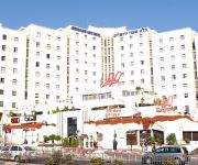
Jerusalem Gate Hotel
The Jerusalem Gate Hotel is a hotel located at the western entrance to Jerusalem, Israel. The hotel is attached to the shopping mall, Centre One. The hotel was constructed in 1988 by Heftsiba. In April 2006, the hotel was bought by American investor Morris Wilner. The hotel focuses on the Haredi, and Orthodox Jewish demographic. To this end the hotel has a mikvah on site.
2011 Jerusalem bus stop bombing
The 2011 Jerusalem bus bombing was a bomb attack carried out in a bus station in downtown Jerusalem, near the Jerusalem International Convention Center compound on 23 March 2011 at 15:00. The bomb was placed near a bus stop, and detonated when Egged bus No.74 passed the station. The explosion killed a British national: 59-year-old Mary Jean Gardner, a Scottish Christian Bible translator who was studying Hebrew at the Hebrew University of Jerusalem's Rothberg International School.
Kiryat HaLeom
Kiryat HaLeom, also known as Kiryat HaUma and referred to in English as the National Quarter, is the official label of a complex in central Jerusalem that includes Kiryat HaMemshala, the Knesset, Sacher Park, the Menorah garden, Wohl Rose Park and Binyanei HaUma. It was traditionally considered to be the northern part of the Givat Ram Neighborhood. The project was started in the 1990s and the compound is planned to include all government institutions of the State of Israel.
Rova Mevo Ha'ir
Rova Mevo Ha'ir, is a project establishing the main entrance to Jerusalem from road 1 is supposed to also connect to the Jerusalem Central Bus Station, and the railway station behind, and the Jerusalem Light Rail with Jerusalem Chords Bridge in which a central entrance to Jerusalem. The program is designed to further the establishment of many towers for commercial and residential, including construction of two towers to expand International Convention Center.


