Safety Score: 4,2 of 5.0 based on data from 9 authorites. Meaning please reconsider your need to travel to Israel.
Travel warnings are updated daily. Source: Travel Warning Israel. Last Update: 2024-04-16 08:26:06
Delve into Newé Ya‘aqov
The district Newé Ya‘aqov of Jerusalem in Jerusalem is a district located in Israel and is a district of the nations capital.
In need of a room? We compiled a list of available hotels close to the map centre further down the page.
Since you are here already, you might want to pay a visit to some of the following locations: Jericho, Ramla, Ash Shunah al Janubiyah, Karney Shomron and Al `Arid. To further explore this place, just scroll down and browse the available info.
Local weather forecast
Todays Local Weather Conditions & Forecast: 23°C / 73 °F
| Morning Temperature | 14°C / 57 °F |
| Evening Temperature | 24°C / 76 °F |
| Night Temperature | 19°C / 66 °F |
| Chance of rainfall | 0% |
| Air Humidity | 32% |
| Air Pressure | 1016 hPa |
| Wind Speed | Gentle Breeze with 7 km/h (4 mph) from West |
| Cloud Conditions | Clear sky, covering 0% of sky |
| General Conditions | Sky is clear |
Wednesday, 17th of April 2024
27°C (80 °F)
22°C (71 °F)
Sky is clear, gentle breeze, clear sky.
Thursday, 18th of April 2024
23°C (74 °F)
14°C (57 °F)
Sky is clear, fresh breeze, clear sky.
Friday, 19th of April 2024
21°C (69 °F)
14°C (58 °F)
Sky is clear, moderate breeze, clear sky.
Hotels and Places to Stay
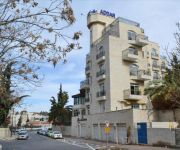
Addar
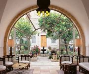
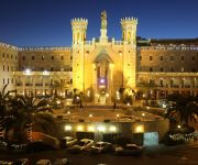
American Colony Hotel
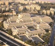
DAN JERUSALEM
Ambassador Jerusalem
Notre Dame Center of Jerusalem
National Hotel Jerusalem
Commodore Hotel
House 57
ibis Styles Jerusalem Sheikh Jarrah
JERUSALEM INN
Videos from this area
These are videos related to the place based on their proximity to this place.
Second Temple Period Quarry Excavated in Jerusalem
Within the framework of an excavation project the Israel Antiquities Authority is conducting prior to the construction of Highway 21 by the Moriah Company, an enormous quarry dating to the...
מערת קבורה מימי בית שני בהר הצופים, ירושלים
Zahi Shaked A tour guide in Israel and his camera zahigo25@walla.com 9726905522 tel סיור עם מורה הדרך ומדריך הטיולים צחי שקד 0546905522 באתר נחשפו...
City of David's Alternate History
Palestinian residents are evicted and exploited to make way for excavations of ancient holy sites. See more videos from The Tiziano Project's program in East Jerusalem on StoriesFrom: http://www.s...
The Old City of Jerusalem - the Muslim Quarter tour Tour Guide: Zahi Shaked
Zahi Shaked A tour guide in Israel and his camera +972 54 6905522 zahigo25@walla.com צחי שקד, מורה דרך ומדריך תיירים. מצלם אותם בכל הזדמנות 0546905522...
Zedekiah's Cave (Solomon's Quarries) at the Old City of Jerusalem (near the Damascus Gate)
Zahi Shaked A tour guide in Israel and his camera zahigo25@walla.com 9726905522 tel סיור עם מורה הדרך ומדריך הטיולים צחי שקד 0546905522.
Jerusalem LRT returns to service after the arab riots
The Palestinians destroyed 2 tram stations, tried to saw the tracks and the catenary poles. For now the service in this area is conducted without signaling and communications.
وصول جثمان الشهيد محمد حسين ابو خضير الى شعفاط
لحظة وصول جثمان شهيد الفجر "محمد ابو خضير" رحمه الله, الذي حرق حيا على يد مستوطنين بعد طعنه عدة طعنات و بتر...
King Solomon's Quarries (Zedekiah Cave) under Jerusalem Old City
http://tiltul.com/ "King Solomon's Quarries" (Zedekiah Cave) under Jerusalem Old City. It is not about Searching, it is about Finding. TilTul http://tiltul.com/ - Automate the Web.
Time-lapse of the city and sun rays from the BYU Jerusalem center.
Cinematography equipment: http://www.videoslider.com Kickstarter: https://www.kickstarter.com/projects/dortch/autobot-timelapse-and-video-slider-tough-and-intel Purchase this clip here: (http://www...
Trip Through The West Bank Checkpoints
Travel with a Jerusalem resident on his daily commute to his West Bank university through the checkpoints. See more videos from The Tiziano Project's program in East Jerusalem on StoriesFrom:...
Videos provided by Youtube are under the copyright of their owners.
Attractions and noteworthy things
Distances are based on the centre of the city/town and sightseeing location. This list contains brief abstracts about monuments, holiday activities, national parcs, museums, organisations and more from the area as well as interesting facts about the region itself. Where available, you'll find the corresponding homepage. Otherwise the related wikipedia article.
Orient House
Orient House is a building located in East Jerusalem that served as the headquarters of the Palestine Liberation Organization (PLO) in the 1980s and 1990s. Built in 1897 by Ismail Musa al-Husseini, it has been owned by the Al-Husayni family since. Originally intended to serve as a family residence, it was at times vacated to host important guests, such as Kaiser Wilhelm II of Germany in 1898, and Emperor Haile Selassie of Ethiopia in 1936.
St. George's Cathedral, Jerusalem
St. George's Cathedral is an Anglican (Episcopal) cathedral in Jerusalem, established in 1899. It is the seat of the Bishop of Jerusalem of the Episcopal Church in Jerusalem and the Middle East. The church was built by the fourth bishop of the diocese--George Francis Popham Blyth. Most of the missionaries present in Palestine at the time were Evangelical Anglicans, but Blyth was from the Anglo-Catholic party of the Church of England.
French Hill
For the community in California, see French Hill, California. French Hill, also Giv'at Shapira is a neighborhood in northern East Jerusalem. It is located on territory occupied during the Six-Day War in 1967, later annexed to Israel under the Jerusalem Law in 1980. The United Nations Security Council declared this law a violation of international law, and states that the Council will not recognize this law, and calls on member states to accept the decision of the council.
American Colony, Jerusalem
The American Colony was a colony established in Jerusalem in 1881 by members of a Christian utopian society led by Anna and Horatio Spafford. Now a hotel in East Jerusalem, it is still known by that name today.
Battle of Ammunition Hill
Ammunition Hill was a military post in the northern part of Jordanian controlled East Jerusalem, and the site of one of the fiercest battles of the Six-Day War.
Hadassah Medical Center
Hadassah Medical Center is a medical organization that operates two university hospitals at Ein Kerem and Mount Scopus in Jerusalem, Israel, as well as schools of medicine, dentistry, nursing, and pharmacology affiliated with the Hebrew University of Jerusalem. Its declared mission is to extend a “hand to all, without regard for race, religion or ethnic origin.
Wadi al-Joz
Wadi al-Joz, also Wadi Joz, (Valley of the Walnuts), is an Arab neighborhood in East Jerusalem, located at the head of the Kidron Valley, north of the Old City. The population of Wadi Joz is 13,000. The Wadi Joz neighborhood is located 750 meters above sea level in the Egoz Valley (Nahal Egoz). The neighborhood was established outside Herod's Gate in the late 19th century when wealthy Arab families built summer houses there.
American Colony Hotel
The American Colony Hotel is a luxury hotel located in a historic building in Jerusalem which previously housed the utopian American-Swedish community known as the American Colony.
Ramat Eshkol
Ramat Eshkol is a neighborhood in north-eastern Jerusalem. It was built on land captured from Jordan in the Six-Day War and was the first neighborhood built in East Jerusalem after the Six-Day War in 1967. The international community considers Israeli settlements in East Jerusalem illegal under international law, but the Israeli government disputes this.
St. George's School, Jerusalem
St. George's School is a boys' school in East Jerusalem run by the Anglican diocese of Jerusalem. St. George's School is located next to St. George's College, just outside the walls of the Old City of Jerusalem. The school was established in 1899. The author of the Thomas the Tank Engine series of books, Rev. W Awdry, taught at the school in 1933-1936.
Arzei HaBira
Arzei Habira is a Haredi neighborhood in Jerusalem, Israel. It is bordered by Ma'alot Dafna to the north, Shmuel HaNavi to the west, Beit Yisrael to the south, and Road 1 and Sheikh Jarrah to the east.
Tombs of the Kings (Jerusalem)
The Tombs of the Kings are a collection of rock cut tombs in East Jerusalem believed to be the burial site of Queen Helene of Adiabene. The tombs are located 820 meters north of Jerusalem's Old City walls in the Sheikh Jarrah neighborhood. The grandeur of the site led to the mistaken belief that the tombs had once been the burial place of the kings of Judah, hence the name Tombs of the Kings; but the tombs are now associated with Queen Helena of Adiabene.
Sheikh Jarrah
Sheikh Jarrah is a predominantly Palestinian neighborhood in East Jerusalem on the road to Mount Scopus. It receives its name from the 13th-century tomb of Sheikh Jarrah, a physician of Saladin's, located within its vicinity. The modern neighborhood was founded in 1865 and gradually became a residential center of Jerusalem's Muslim elite, particularly the al-Husayni family.
Sanhedria
Sanhedria is a Haredi neighborhood in northern Jerusalem, Israel. It lies east of Golda Meir Street and adjacent to Ramat Eshkol, Shmuel HaNavi, Maalot Dafna and the Sanhedria Cemetery. The neighborhood is named after the Tombs of the Sanhedrin, an elaborate underground complex of rock-cut tombs constructed in the 1st century and thought to be the burial place of the members of the Sanhedrin.
Shimon HaTzadik
Shimon HaTzadik is a Jewish neighborhood in East Jerusalem, established around the Tomb of Simeon the Just, after whom it was named. The tomb and surrounding lands (a plot of approximately 18 dunams) was purchased in 1876 by the committee of the Sephardic community and the Ashkenazi Assembly of Israel.
Bab a-Zahara
Bab a-Zahara Arabic: باب الساهرة is an Arab neighborhood in East Jerusalem, north of the Old City. It is bordered by the American Colony to the north, Wadi Joz to the east, Herod's Gate and Damascus Gate on its south, and Mas'udiyyah, Mea Shearim to the west. Herod's Gate, which is called Bab a-Zahara (Gate of Flowers) in Arabic, lend its name to this neighborhood.
Givat HaMivtar
Givat HaMivtar is a Jewish neighborhood in northern Jerusalem established in 1970 between Ramat Eshkol and French Hill. It is located on a hill where an important battle took place in the Six Day War. Archaeological excavations have revealed important ancient Jewish tombs in the region. Givat Hamivtar was one of the first "Build Your Own Home" neighborhoods in Jerusalem.
Ma'alot Dafna
Ma’alot Dafna is a Jewish neighborhood in northern Jerusalem. It borders the neighborhood of Shmuel HaNavi to the west, Ammunition Hill to the east, Ramat Eshkol to the north and Arzei HaBira to the south.
Kiryat Menachem Begin
Kiryat Menachem Begin, named after former Israeli Prime Minister Menachem Begin and also known as Kiryat HaMemshala, is a complex of government buildings in East Jerusalem located between Sheikh Jarrah in the north, adjacent to Mount Scopus in the east and Ammunition Hill in the west. It serves as home to several government offices, along with the main government complex in Givat Ram. It also includes the National Headquarters of the Israel Police.
National Headquarters of the Israel Police
The National Headquarters of the Israel Police (Hamateh HeArtzi) is the headquarters of the Israel Police, located in Kiryat Menachem Begin in Jerusalem.
Nablus Road
Nablus Road is one of the traditional routes into Jerusalem's walled city. Starting at the Damascus Gate, it is the ancient road north.
Assassination of Rehavam Ze'evi
Rehavam Ze'evi, Israel's tourism minister, was assassinated at shortly before 7:00 am on Wednesday, 17 October 2001, at the Hyatt Hotel in Jerusalem by a squad of Palestinians assassins acting on behalf of the PFLP militant organization. Ze'evi was the first Israeli minister to be assassinated in a terrorist attack, and the most senior Israeli person to be killed by militants during the entire Arab-Israeli conflict.
Jerusalem British War Cemetery
Jerusalem British War Cemetery is a British cemetery in Jerusalem (Jerusalem War Cemetery) is a military cemetery for fallen soldiers of the British Empire in the first World War in Israel. The cemetery is located on Mount Scopus.
Nahalat Shimon
Nahalat Shimon is a Jewish religious neighborhood in East Jerusalem. Nahalat Shimon was founded in 1891 by Sephardic and Ashkenazi Jewish Kollels, to house poor Yemenite and Sephardi Jews. The cornerstone of the neighborhood was laid in 1890, near the Tomb of Simeon the Just.
Sanhedria Cemetery
Not to be confused with the Tombs of the Sanhedrin. Sanhedria Cemetery is a 27-dunam Jewish burial ground in the Sanhedria neighborhood of Jerusalem, adjacent to the intersection of Levi Eshkol Boulevard, Shmuel HaNavi Street, and Bar-Ilan Street. Unlike the Mount of Olives and Har HaMenuchot cemeteries that are located on the outer edges of the city, Sanhedria Cemetery is situated in the heart of western Jerusalem, in close proximity to residential housing.


