Safety Score: 4,2 of 5.0 based on data from 9 authorites. Meaning please reconsider your need to travel to Israel.
Travel warnings are updated daily. Source: Travel Warning Israel. Last Update: 2024-04-25 08:17:04
Delve into Sanhedriyya
The district Sanhedriyya of Jerusalem in Jerusalem is a district located in Israel and is a district of the nations capital.
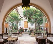
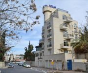
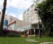
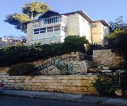
In need of a room? We compiled a list of available hotels close to the map centre further down the page.
Since you are here already, you might want to pay a visit to some of the following locations: Jericho, Ramla, Karney Shomron, Ash Shunah al Janubiyah and Al `Arid. To further explore this place, just scroll down and browse the available info.
Local weather forecast
Todays Local Weather Conditions & Forecast: 32°C / 90 °F
| Morning Temperature | 22°C / 72 °F |
| Evening Temperature | 33°C / 91 °F |
| Night Temperature | 24°C / 75 °F |
| Chance of rainfall | 0% |
| Air Humidity | 12% |
| Air Pressure | 1007 hPa |
| Wind Speed | Moderate breeze with 9 km/h (6 mph) from North-West |
| Cloud Conditions | Overcast clouds, covering 95% of sky |
| General Conditions | Overcast clouds |
Friday, 26th of April 2024
24°C (76 °F)
18°C (64 °F)
Overcast clouds, fresh breeze.
Saturday, 27th of April 2024
22°C (71 °F)
17°C (63 °F)
Overcast clouds, moderate breeze.
Sunday, 28th of April 2024
21°C (69 °F)
17°C (63 °F)
Light rain, gentle breeze, overcast clouds.
Hotels and Places to Stay
American Colony Hotel
Addar
Ambassador Jerusalem
JERUSALEM INN
ibis Styles Jerusalem Sheikh Jarrah
House 57
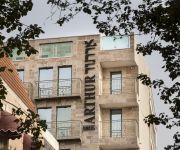
Arthur Hotel - An Atlas Boutique Hotel
Habira
Abraham Hostel
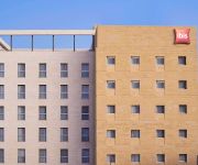
ibis Jerusalem City Center
Videos from this area
These are videos related to the place based on their proximity to this place.
Second Temple Period Quarry Excavated in Jerusalem
Within the framework of an excavation project the Israel Antiquities Authority is conducting prior to the construction of Highway 21 by the Moriah Company, an enormous quarry dating to the...
ירושלים - רמת שלמה. אחד מתוך 17העתקים בעולם של מרכז חסידות חבד (770), ובית הרבי מליובאוויטש.
Zahi Shaked A tour guide in Israel and his camera zahigo25@walla.com 9726905522 tel סיור עם מורה הדרך ומדריך הטיולים צחי שקד 0546905522 My name is Zahi...
Beautiful houses in Jerusalem - Hospital Shaarei Tzedek - the old building (now home to the IBA)
Zahi Shaked A tour guide in Israel and his camera zahigo25@walla.com 9726905522 tel סיור עם מורה הדרך ומדריך הטיולים צחי שקד 0546905522 My name is Zahi...
Jerusalem streets drive
Drive on streets Ezra, Nehemiah and Zephaniah in Jerusalem. January 1, 2010.
Jerusalem old city - Free tour 1/6
1st part of tour with touristguide "Kobi" to the secrets of old city of Jerusalem.
jerusalem center
Jerusalem is situated on the southern spur of a plateau in the Judean Mountains, which include the Mount of Olives (East) and Mount Scopus (North East). The elevation of the Old City is approximate...
Jerusalem old city - Free tour 2/6
2nd part of walkingtour with guide "Kobi" to the secrets of old city of Jerusalem.
Dancing threw sha'ar shchem on yom yerushalyim
Hundred of modern orthodox and orthodox Jews dance threw shar shchem on yom yerushalayim 2013 at the old city.
Videos provided by Youtube are under the copyright of their owners.
Attractions and noteworthy things
Distances are based on the centre of the city/town and sightseeing location. This list contains brief abstracts about monuments, holiday activities, national parcs, museums, organisations and more from the area as well as interesting facts about the region itself. Where available, you'll find the corresponding homepage. Otherwise the related wikipedia article.
Shmuel HaNavi bus bombing
The Shmuel HaNavi bus bombing was the suicide bombing of a crowded public bus (Egged bus 2) in the Shmuel HaNavi quarter in Jerusalem, Israel, on August 19, 2003. Twenty-four people were killed and over 130 wounded. Many of the victims were children, some of them infants. The Islamist militant group Hamas claimed responsibility for the attack.
Belz (Hasidic dynasty)
Belz is a Hasidic dynasty named for the town of Belz in Western Ukraine, near the Polish border. The town has existed since at least the 10th century, with the Jewish community being established during the 14th century. The town became home to Hasidic Judaism in the early 19th century. At the beginning of World War II, Belz had 6,100 inhabitants, of which 3,600 were Jewish.
Kerem Avraham
Kerem Avraham (lit. Avraham's Vineyard) is a neighbourhood near Geula in central Jerusalem, Israel, founded in 1855. It is bounded by Malkhei Yisrael Street, Yechezkel Street, Tzefanya Street, and the Schneller Compound.
Battle of Ammunition Hill
Ammunition Hill was a military post in the northern part of Jordanian controlled East Jerusalem, and the site of one of the fiercest battles of the Six-Day War.
Mea Shearim
Mea Shearim is one of the oldest Jewish neighborhoods in Jerusalem, Israel. It is populated mainly by Haredi Jews and was built by the original settlers of the Yishuv haYashan.
Tiferet Yisrael Synagogue
Tiferet Yisrael Synagogue was one of the most outstanding synagogues in the Old City of Jerusalem in the 19th and 20th centuries. It was destroyed by the Arab Legion during the 1948 Arab-Israeli War and left as ruins by the Israeli government after the recapture of the Old City in Six-Day War. Named after Rabbi Yisroel of Ruzhin, founder of the Ruzhin Hasidic dynasty, it was also known as the Nissan Beck Shul,, after its founder, Rabbi Nissan Beck.
Ramat Eshkol
Ramat Eshkol is a neighborhood in north-eastern Jerusalem. It was built on land captured from Jordan in the Six-Day War and was the first neighborhood built in East Jerusalem after the Six-Day War in 1967. The international community considers Israeli settlements in East Jerusalem illegal under international law, but the Israeli government disputes this.
Belz Great Synagogue
The Belz Great Synagogue is the largest synagogue in Israel. It was built by the Belz Hasidic community with financial help from its supporters and admirers around the world.
Mir yeshiva (Jerusalem)
The Mir yeshiva, known as the Mirrer Yeshiva or The Mir, is an Orthodox Jewish yeshiva in Jerusalem, Israel. With over 7,500 single and married students, it is the largest yeshiva in Israel. Many of the students are from the United States and Canada. It is also believed to be the largest yeshiva in the world. Rabbi Nosson Tzvi Finkel was the rosh yeshiva of the yeshiva in Jerusalem until his death on November 8, 2011. He is succeeded by his son, Rabbi Eliezer Yehuda Finkel.
EYAHT
EYAHT, is a full-time college for advanced Jewish learning for women in Jerusalem, Israel. Geared to unaffiliated, college-educated and professional women aged 22-30 from English-speaking countries, EYAHT introduces women to the basics of Torah Judaism and encourages them to integrate Torah values into their lives. Most of its students are inspired to become baalot teshuva ("returnees to the faith"), marry and establish their own Torah-observant homes. EYAHT has over 2,000 alumnae.
Bukharim quarter
The Bukharim quarter (Skhunat HaBukharim) is a neighborhood in the center of Jerusalem, Israel. Many of the residents today are Haredi Jews. The quarter borders Tel Arza on the west, the Shmuel HaNavi neighborhood on the north, Arzei HaBira on the east and Geula on the south.
Arzei HaBira
Arzei Habira is a Haredi neighborhood in Jerusalem, Israel. It is bordered by Ma'alot Dafna to the north, Shmuel HaNavi to the west, Beit Yisrael to the south, and Road 1 and Sheikh Jarrah to the east.
Mekor Baruch
Mekor Baruch also spelled Makor Baruch, is a neighborhood in Jerusalem, Israel. The neighborhood is bordered by Malkhei Yisrael Street to the north, Sarei Yisrael Street to the west, Jaffa Road to the south, and the Zikhron Moshe neighborhood to the east.
Zikhron Moshe
Zikhron Moshe is a Haredi neighborhood in the center of Jerusalem, Israel. Zikhron Moshe was founded in 1905. It is located between Meah Shearim and Geula. The first inhabitants were secular teachers. It was one of several neighborhoods in Jerusalem named for Sir Moses Montefiore.
Sanhedria Murhevet
Sanhedria HaMurhevet is a Haredi neighborhood in Jerusalem, Israel. Its name translates as "expanded Sanhedria". The neighborhood was founded in 1970 as a northern expansion of Sanhedria. The neighborhood is horseshoe-shaped. As of 2007 it has 784 residences. The neighborhood is closed to automobile traffic on Shabbat and Jewish holidays. Sanhedria Murhevet is home to Yeshivat Tiferet Zvi, Yeshiva Toras Moshe, Yeshiva Chofetz Chaim, the Jerusalem Kollel, and Kollel Meshech Chochma.
Sanhedria
Sanhedria is a Haredi neighborhood in northern Jerusalem, Israel. It lies east of Golda Meir Street and adjacent to Ramat Eshkol, Shmuel HaNavi, Maalot Dafna and the Sanhedria Cemetery. The neighborhood is named after the Tombs of the Sanhedrin, an elaborate underground complex of rock-cut tombs constructed in the 1st century and thought to be the burial place of the members of the Sanhedrin.
Schneller Orphanage
This article is about the Jerusalem orphanage that became known as Camp Schneller; for other uses, see Schneller Schneller Orphanage, also called the Syrian Orphanage, was a German Protestant orphanage that operated in Jerusalem from 1860 to 1940. It was one of the first structures to be built outside the Old City of Jerusalem and paved the way for the expansion of Jerusalem in the 19th century.
Kikar HaShabbat
Kikar HaShabbat, sometimes known in the Haredi community as Kikar Shabbos, is a major intersection joining five streets in Jerusalem, Israel, between the Haredi neighborhoods of Meah Shearim and Geula. These are: Yehezkel Street from the north, Malkhei Yisrael Street from the west, Mea Shearim Street from the east, Straus Street from the southeast, and Yisha'ayahu Street from the southwest.
Beit Yisrael
Beit Yisrael is a predominantly Haredi neighborhood in central Jerusalem, Israel. It is located just north of Mea Shearim. The name Beit Yisrael is taken from the verse in Ezekiel 36:10, in which Ezekiel prophesies to the hills and mountains of Israel, "I shall make numerous on you the people, the entire House of Israel; the cities will be reinhabited and the ruins will be rebuilt.
Ezrat Torah
Ezrat Torah is a Haredi neighborhood in northern Jerusalem. It is bordered by Kiryat Sanz on the west, Golda Meir Blvd. on the north and east, and Tel Arza on the south.
Tel Arza
Tel Arza is a Hareidi neighborhood in northern Jerusalem. It is bordered by Ezrat Torah on the north and west, Golda Meir Blvd. on the East, and Bar Ilan St. and Yirmiyahu St. on the South. Tel Arza was established in 1931, as part of the expansion experienced in the Old Yishuv while recovering from the 1929 Palestine riots. Its name is taken from the Mishna, where it is described as a place where Jews were murdered.
Ma'alot Dafna
Ma’alot Dafna is a Jewish neighborhood in northern Jerusalem. It borders the neighborhood of Shmuel HaNavi to the west, Ammunition Hill to the east, Ramat Eshkol to the north and Arzei HaBira to the south.
Kiryat Sanz, Jerusalem
Kiryat Sanz is a Haredi Jewish neighborhood in Jerusalem, Israel. It is located in the northwestern part of Jerusalem. The neighborhood was established in 1965 by Jewish immigrants from Sanz in Galicia, largely as a center for their followers. The neighborhood is bordered by the neighborhoods Kiryat Belz and Ezrat Torah.
Bar-Ilan Street
Bar-Ilan Street is a section of Route 417 between Yirmiyahu Street and Hativat HarEl Street in northern Jerusalem, Israel. It is a major artery that runs through a heavily Ultra-Orthodox neighborhood. Bar-Ilan Street has become a symbol of the battle between secular Jews and Haredi residents of the neighborhood who want the street closed to vehicular traffic on Shabbat.
Sanhedria Cemetery
Not to be confused with the Tombs of the Sanhedrin. Sanhedria Cemetery is a 27-dunam Jewish burial ground in the Sanhedria neighborhood of Jerusalem, adjacent to the intersection of Levi Eshkol Boulevard, Shmuel HaNavi Street, and Bar-Ilan Street. Unlike the Mount of Olives and Har HaMenuchot cemeteries that are located on the outer edges of the city, Sanhedria Cemetery is situated in the heart of western Jerusalem, in close proximity to residential housing.


