Safety Score: 2,7 of 5.0 based on data from 9 authorites. Meaning we advice caution when travelling to United States.
Travel warnings are updated daily. Source: Travel Warning United States. Last Update: 2024-04-28 08:22:10
Touring Delair
Delair in Camden County (New Jersey) is a town located in United States about 130 mi (or 209 km) north-east of Washington DC, the country's capital place.
Time in Delair is now 05:38 AM (Sunday). The local timezone is named America / New York with an UTC offset of -4 hours. We know of 11 airports nearby Delair, of which 4 are larger airports. The closest airport in United States is Philadelphia International Airport in a distance of 13 mi (or 20 km), South-West. Besides the airports, there are other travel options available (check left side).
There are two Unesco world heritage sites nearby. The closest heritage site in United States is Independence Hall in a distance of 11 mi (or 18 km), East. Also, if you like the game of golf, there are several options within driving distance. We collected 2 points of interest near this location. Need some hints on where to stay? We compiled a list of available hotels close to the map centre further down the page.
Being here already, you might want to pay a visit to some of the following locations: Camden, Philadelphia, Woodbury, Mount Holly and Norristown. To further explore this place, just scroll down and browse the available info.
Local weather forecast
Todays Local Weather Conditions & Forecast: 20°C / 68 °F
| Morning Temperature | 10°C / 50 °F |
| Evening Temperature | 24°C / 76 °F |
| Night Temperature | 19°C / 66 °F |
| Chance of rainfall | 0% |
| Air Humidity | 57% |
| Air Pressure | 1022 hPa |
| Wind Speed | Light breeze with 5 km/h (3 mph) from North-East |
| Cloud Conditions | Overcast clouds, covering 100% of sky |
| General Conditions | Light rain |
Sunday, 28th of April 2024
28°C (82 °F)
23°C (73 °F)
Sky is clear, gentle breeze, clear sky.
Monday, 29th of April 2024
22°C (72 °F)
14°C (56 °F)
Moderate rain, gentle breeze, broken clouds.
Tuesday, 30th of April 2024
13°C (56 °F)
15°C (58 °F)
Light rain, light breeze, overcast clouds.
Hotels and Places to Stay
Residence Inn Cherry Hill Philadelphia
Crowne Plaza PHILADELPHIA-CHERRY HILL
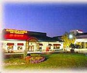
Clarion Hotel & Conference Center
Wm. Mulherin's Sons Hotel
Holiday Inn PHILADELPHIA-CHERRY HILL
Express Inn
Genes Motel
Hallmark Inn
Garden State Inn
Americas Best Value Inn-Cherry Hill/Philadelphia
Videos from this area
These are videos related to the place based on their proximity to this place.
Pennsauken Tanker Fire
A gasoline tanker overturned and burned on the ramp from Rt. 130N to Rt. 90E in Pennsauken, NJ, Feb. 23,2015. In addition to the Pennsauken FD, the Camden County Foam Task Force/Hazmat team.
Railfanning Pennsauken, NJ: CSX, NS, and NJT Action 6/11/11
HD 1080p: On an overcast Saturday, Eastern Railfan Productions joined forces with GulfWindProductions to railfan the town of Pennsauken, NJ. Our main purpose was to catch NS 39G, which we...
Pennsauken Football Scrimmage vs Paul VI and Bergen Catholic.mp4
Pennsauken High School football scrimmage vs. Paul VI and Bergen Catholic High Schools on 8/27/11.
Red Car Diaries ROAD TRIP 2009 02 20 DC to NJ
Bil Drives from DC to southern New Jersey to visit his sister and listen to Carsie Blanton and Alexandra Day perform at Barrington Coffee House. Fun drive and cute video with a Ferrari.
Jarochos Equipo Veracruz Campeones 2012 Liga Imperial Azteca
Felicitaciones a todos los jugadores, porra, integrantes y familiares del equipo Veracruz campeones de la liga imperial azteca. Ganando la final en serie de penales en Pennsauken NJ. 10/142012.
2004 BMW X5 Used Cars Palmyra NJ
http://www.starcarsonline.com This 2004 BMW X5 is available from Star Cars. For details, call us at 856-829-5900.
Gallardo LP 560 4 Features Like No Other - Lamborghini Palmyra, NJ
Lamborghini Gallardo LP 560-4 Showing Off To The World.
Videos provided by Youtube are under the copyright of their owners.
Attractions and noteworthy things
Distances are based on the centre of the city/town and sightseeing location. This list contains brief abstracts about monuments, holiday activities, national parcs, museums, organisations and more from the area as well as interesting facts about the region itself. Where available, you'll find the corresponding homepage. Otherwise the related wikipedia article.
Palmyra, New Jersey
Palmyra is a borough in Burlington County, New Jersey, United States. As of the 2010 United States Census, the borough's population was 7,398, reflecting an increase of 307 (+4.3%) from the 7,091 counted in the 2000 Census, which had in turn increased by 35 (+0.5%) from the 7,056 counted in the 1990 Census. Palmyra was originally incorporated as a township by an Act of the New Jersey Legislature on April 19, 1894, from portions of Cinnaminson Township and Riverton.
Pennsauken Township, New Jersey
Pennsauken Township is a township in Camden County, New Jersey, United States, and a suburb of Philadelphia. As of the 2010 United States Census, the township's population was 35,885, reflecting an increase of 148 (+0.4%) from the 35,737 counted in the 2000 Census, which had in turn increased by 999 (+2.9%) from the 34,738 counted in the 1990 Census. \t Pennsauken is home to a large industrial park that includes a Pepsi bottling plant and J & J Snack Foods.
River Line (New Jersey Transit)
The River Line (styled River LINE by NJ Transit) is a diesel light rail system in New Jersey, United States, that connects the cities of Camden and Trenton, New Jersey's capital. It is operated for New Jersey Transit by the Southern New Jersey Rail Group (SNJRG), which originally included Bechtel Group and Bombardier. Now that the project is in its operational phase, Bombardier is the only member of SNJRG.
Delair Bridge
The Delair Bridge is a lift bridge carrying the New Jersey Transit Atlantic City Line and a former Conrail line, now a shared asset between Norfolk Southern Railway and CSX Transportation. It crosses the Delaware River between Philadelphia, Pennsylvania, and Pennsauken Township, New Jersey, just south of the Betsy Ross Bridge. The bridge's southern track is currently reserved for freight traffic, and the northern track is currently reserved for the Atlantic City Line.
Pennsauken – Route 73 (River Line station)
Pennsauken/Route 73 is a station on the River Line light rail system, located on River Road in Pennsauken, New Jersey, United States. The station opened on March 15, 2004. Southbound service from the station is available to Camden, New Jersey. Northbound service is available to the Trenton Rail Station with connections to New Jersey Transit trains to New York City, SEPTA trains to Philadelphia, Pennsylvania, and Amtrak trains.
Pennsauken Public Schools
The Pennsauken Public Schools are a comprehensive community public school district serving students in prekindergarten through twelfth grade from Pennsauken Township, in Camden County, New Jersey, United States. Students from Merchantville attend the district's high school as part of a sending/receiving relationship. As of the 2007-08 school year, the district's 12 schools had an enrollment of 5,568 students and 343.7 classroom teachers (on an FTE basis), for a student–teacher ratio of 16.2.
Pennsauken Creek
Pennsauken Creek is a 3.8-mile-long tributary of the Delaware River in Burlington and Camden counties, New Jersey in the United States. Pennsauken Creek drains 33 square miles of southwestern Burlington County and northern Camden County and joins the Delaware River near Palmyra. The North Branch of the Pennsauken is in Burlington County, while the South Branch forms the boundary between Burlington and Camden counties.
Pennsauken High School
Pennsauken High School is a four-year comprehensive regional public high school that serves Pennsauken Township, Camden County, New Jersey, United States, as part of the Pennsauken Public Schools. Students from Merchantville attend the school as part of a sending/receiving relationship. As of the 2010-11 school year, the school had an enrollment of 1,570 students and 112.6 classroom teachers (on an FTE basis), for a student–teacher ratio of 13.94:1.


