Safety Score: 2,7 of 5.0 based on data from 9 authorites. Meaning we advice caution when travelling to United States.
Travel warnings are updated daily. Source: Travel Warning United States. Last Update: 2024-05-16 08:19:50
Discover Swanson Corners
Swanson Corners in Hampshire County (Massachusetts) is a place in United States about 321 mi (or 517 km) north-east of Washington DC, the country's capital city.
Current time in Swanson Corners is now 05:11 AM (Thursday). The local timezone is named America / New York with an UTC offset of -4 hours. We know of 12 airports near Swanson Corners, of which 5 are larger airports. The closest airport in United States is Westover ARB/Metropolitan Airport in a distance of 10 mi (or 16 km), East. Besides the airports, there are other travel options available (check left side).
There is one Unesco world heritage site nearby. It's Statue of Liberty in a distance of 122 mi (or 197 km), South-West. Also, if you like playing golf, there are a few options in driving distance. If you need a hotel, we compiled a list of available hotels close to the map centre further down the page.
While being here, you might want to pay a visit to some of the following locations: Hartford, Newfane, Keene, Worcester and Hudson. To further explore this place, just scroll down and browse the available info.
Local weather forecast
Todays Local Weather Conditions & Forecast: 13°C / 56 °F
| Morning Temperature | 13°C / 56 °F |
| Evening Temperature | 13°C / 56 °F |
| Night Temperature | 11°C / 51 °F |
| Chance of rainfall | 25% |
| Air Humidity | 98% |
| Air Pressure | 1012 hPa |
| Wind Speed | Gentle Breeze with 6 km/h (4 mph) from South-West |
| Cloud Conditions | Overcast clouds, covering 100% of sky |
| General Conditions | Moderate rain |
Thursday, 16th of May 2024
21°C (70 °F)
13°C (55 °F)
Broken clouds, light breeze.
Friday, 17th of May 2024
19°C (66 °F)
11°C (52 °F)
Overcast clouds, gentle breeze.
Saturday, 18th of May 2024
17°C (62 °F)
12°C (53 °F)
Light rain, light breeze, overcast clouds.
Hotels and Places to Stay
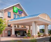
Holiday Inn Express & Suites WESTFIELD
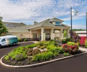
Homewood Suites by Hilton Holyoke-Springfield-North
Fairfield Inn & Suites Springfield Holyoke
HOLYOKE HOTEL AND CONFERENCE CENTER
Elm Motel
Quality Inn Westfield - Springfield
Videos from this area
These are videos related to the place based on their proximity to this place.
Southampton home damaged in fire
No one was injured in a fire late Monday morning that damaged a home in Southampton.
Inside the Rhode Island building - The Big E fair, West Slr
Here's a quick tour inside the Rhode Island building - one of six state buildings you can tour during the Big E fair which takes place at the end of Sept to the beginning of October each year....
WHIP CITY SPEEDWAY : Modified Lites Feature August 9, 2008
http://www.whipcityphotos.net & http://www.greenlaps.com Modified Lites Feature at WHIP CITY SPEEDWAY on August 9, 2008.
Whip City Speedway : 750cc 5/24/08
Brought to you by http://www.whipcityphotos.net 750cc Feature Whip City Speedway 5/24/08.
Whip City Speedway : Quad 4 Feature Race June 21, 2008
Brought To You By http://www.whipcityphotos.net Quad 4 Feature Race on June 21, 2008 at Whip City Speedway.
WHIP CITY SPEEDWAY : 4 Cylinder Feature July 26, 2008
4 Cylinder Feature At WHIP CITY SPEEDWAY on July 26, 2008.
WHIP CITY SPEEDWAY : Quad 4 Feature August 23, 2008
Brought To You By http://www.whipcityphotos.net http://www.greenlaps.com Quad 4 Feature at WHIP CITY SPEEDWAY on August 23, 2008 With a Special appearance of one of the nation's top midget...
Whip City Speedway : Modified Lites Feature Race 9/5/10
Modified Lites Feature Race at Whip City Speedway on 9/5/10.
WHIP CITY SPEEDWAY : 600cc Feature August 2, 2008
Brought To You By http://www.whipcityphotos.net http://www.greenlaps.com 600cc Feature at WHIP CITY SPEEDWAY on August 2, 2008.
Whip City Speedway : Quad 4 _ 5/24/08
Brought to you by http://www.whipcityphotos.net Quad 4 feature race at Whip City Speedway.
Videos provided by Youtube are under the copyright of their owners.
Attractions and noteworthy things
Distances are based on the centre of the city/town and sightseeing location. This list contains brief abstracts about monuments, holiday activities, national parcs, museums, organisations and more from the area as well as interesting facts about the region itself. Where available, you'll find the corresponding homepage. Otherwise the related wikipedia article.
Barnes Municipal Airport
See: Barnes Air National Guard Base for United States Air Force use of the airport Barnes Regional Airport, also known as Westfield-Barnes Airport, is a tower-controlled joint civil-military public airport located three miles (5 km) north of the central business district of Westfield, a city in Hampden County, Massachusetts, United States. This airport is owned by City of Westfield.
WHYN (AM)
WHYN (AM 560) is a news/talk station in the Pioneer Valley area of Massachusetts, owned by Clear Channel Communications. It originally started at 1400 kHz (licensed to Northampton, Massachusetts) but moved to 560 in the 1950s. The Call Letters WHYN stand for Holyoke, Northampton. It was a Top 40 station "Big 56" and was idolized by many teens growing up in the Springfield area. Over the years, the station was known as Whyn (pronounced WIN) radio.
Barnes Air National Guard Base
See: Barnes Municipal Airport for civil airport information Barnes Air National Guard Base has hosted the Massachusetts Air National Guard 104th Fighter Wing (in various designations) since 1946.


