Safety Score: 2,7 of 5.0 based on data from 9 authorites. Meaning we advice caution when travelling to United States.
Travel warnings are updated daily. Source: Travel Warning United States. Last Update: 2024-05-05 08:24:42
Explore Little River
Little River in Hampden County (Massachusetts) is a city in United States about 317 mi (or 510 km) north-east of Washington DC, the country's capital.
Local time in Little River is now 06:35 AM (Sunday). The local timezone is named America / New York with an UTC offset of -4 hours. We know of 12 airports in the vicinity of Little River, of which 5 are larger airports. The closest airport in United States is Bradley International Airport in a distance of 11 mi (or 18 km), South. Besides the airports, there are other travel options available (check left side).
There is one Unesco world heritage site nearby. It's Statue of Liberty in a distance of 117 mi (or 188 km), South-West. Also, if you like golfing, there are multiple options in driving distance. If you need a place to sleep, we compiled a list of available hotels close to the map centre further down the page.
Depending on your travel schedule, you might want to pay a visit to some of the following locations: Hartford, Newfane, Worcester, Keene and Hudson. To further explore this place, just scroll down and browse the available info.
Local weather forecast
Todays Local Weather Conditions & Forecast: 9°C / 48 °F
| Morning Temperature | 8°C / 46 °F |
| Evening Temperature | 9°C / 49 °F |
| Night Temperature | 9°C / 49 °F |
| Chance of rainfall | 13% |
| Air Humidity | 95% |
| Air Pressure | 1026 hPa |
| Wind Speed | Light breeze with 4 km/h (3 mph) from North |
| Cloud Conditions | Overcast clouds, covering 100% of sky |
| General Conditions | Moderate rain |
Sunday, 5th of May 2024
18°C (64 °F)
16°C (60 °F)
Light rain, light breeze, overcast clouds.
Monday, 6th of May 2024
22°C (72 °F)
13°C (56 °F)
Sky is clear, light breeze, clear sky.
Tuesday, 7th of May 2024
13°C (56 °F)
15°C (60 °F)
Moderate rain, light breeze, overcast clouds.
Hotels and Places to Stay
Holiday Inn Express & Suites WESTFIELD
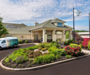
Homewood Suites by Hilton Holyoke-Springfield-North
HOLYOKE HOTEL AND CONFERENCE CENTER
Fairfield Inn & Suites Springfield Holyoke
Elm Motel
Quality Inn Westfield - Springfield
Videos from this area
These are videos related to the place based on their proximity to this place.
Westfield MA Center Construction Timelapse 2011-2012
This timelapse movie was created from images captured by the WWLP web camera atop the Tavern Restaurant in the center of Westfield, Massachusetts overlooking the construction on Park Square....
The Spring Market is Here in Westfield, MA
Winter getting you down? Not me! I decided to take this sunny day to get spring started in Westfield, MA! Full story here: http://westernmahomes.net/the-spring-real-estate-market-is-already-in-b...
Westfield River Brewing in Westfield, MA
I took a tour and tasting at Westfield River Brewing on Mainline Drive in Westfield, MA 01085, home of Black Squirrel Ale. http://www.westernmahomes.net.
Westfield deals with tornado damage
It may have not suffered the worst damage, but parts of Westfield were hit pretty hard by Wednesday's tornado.
Sell My House Fast Westfield MA - We Buy Westfield MA Houses Fast for Cash
We buy Westfield MA Houses Fast and we are able to pay cash for them. We close on your house anywhere from 5-15 days from the date you contact us. We are a group of local investors who look...
1996 GMC Sierra C/K 3500 Used Cars Westfield MA
http://www.westfieldautomall.com This 1996 GMC Sierra C/K 3500 is available from Westfield Auto Mall. For details, call us at 413-562-1111.
High water worries in Westfield
Many residents of Westfield had to be evacuated Sunday over concerns about the Westfield River flooding.
Videos provided by Youtube are under the copyright of their owners.
Attractions and noteworthy things
Distances are based on the centre of the city/town and sightseeing location. This list contains brief abstracts about monuments, holiday activities, national parcs, museums, organisations and more from the area as well as interesting facts about the region itself. Where available, you'll find the corresponding homepage. Otherwise the related wikipedia article.
Westfield, Massachusetts
Westfield is a city in Hampden County, in the Pioneer Valley of western Massachusetts, United States. Westfield was first settled in 1660. It is part of the Springfield, Massachusetts Metropolitan Statistical Area. The population was 41,094 at the 2010 census.
WWLP
WWLP is the NBC-affiliated television station for the Pioneer Valley of Western Massachusetts that is licensed to Springfield. It broadcasts a high definition digital signal on VHF channel 11 from a transmitter on Provin Mountain in the Feeding Hills section of Agawam. Owned by LIN TV Corporation, WWLP has studios at Broadcast Center in the Sandy Hill section of Chicopee next to the I-391/MA 116 interchange.
WAQY
WAQY (102.1 FM) is a Springfield, Massachusetts area classic rock radio station. Since the late 1980s, the station has been known as "Rock 102".
Hampshire and Hampden Canal
The Hampshire and Hampden Canal was the Massachusetts segment of an 86-mile canal that once connected New Haven, Connecticut to the Connecticut River north of Northampton, Massachusetts. Its Connecticut segment was called the Farmington Canal. The canal dates to 1821 when New Haven businessmen began to raise capital and investigate a possible canal route from their harbor to central Massachusetts, and on to Barnet, Vermont and Canada beyond.
Saint Mary High School (Westfield, Massachusetts)
Saint Mary High School is a private, Roman Catholic high school in Westfield, Massachusetts. It is located in the Roman Catholic Diocese of Springfield in Massachusetts.
Provin Mountain
Provin Mountain is a very narrow traprock mountain ridge located in the Connecticut River Valley of Massachusetts. It is part of the Metacomet Ridge which extends from Long Island Sound near New Haven, Connecticut, north through the Connecticut River Valley of Massachusetts to the Vermont border. Provin Mountain is known for its scenic cliffs, unique microclimate ecosystems, and rare plant communities. It is traversed by the 110-mile Metacomet-Monadnock Trail.
Great River Bridge (Westfield)
The Great River Bridge in Westfield, Massachusetts is a camelback truss bridge over the Westfield River.
Holy Trinity Parish, Westfield
Holy Trinity Parish - designated for Polish immigrants in Westfield, Massachusetts, United States. Founded 1903. It is one of the Polish-American Roman Catholic parishes in New England in the Diocese of Springfield in Massachusetts.


