Safety Score: 2,7 of 5.0 based on data from 9 authorites. Meaning we advice caution when travelling to United States.
Travel warnings are updated daily. Source: Travel Warning United States. Last Update: 2024-05-04 08:22:41
Delve into Hosmer Corner
Hosmer Corner in Hampden County (Massachusetts) is located in United States about 315 mi (or 507 km) north-east of Washington DC, the country's capital town.
Current time in Hosmer Corner is now 10:31 PM (Saturday). The local timezone is named America / New York with an UTC offset of -4 hours. We know of 10 airports close to Hosmer Corner, of which 3 are larger airports. The closest airport in United States is Bradley International Airport in a distance of 9 mi (or 14 km), South. Besides the airports, there are other travel options available (check left side).
There is one Unesco world heritage site nearby. It's Statue of Liberty in a distance of 114 mi (or 184 km), South-West. Also, if you like playing golf, there are some options within driving distance. If you need a hotel, we compiled a list of available hotels close to the map centre further down the page.
While being here, you might want to pay a visit to some of the following locations: Hartford, Newfane, Worcester, Keene and Hudson. To further explore this place, just scroll down and browse the available info.
Local weather forecast
Todays Local Weather Conditions & Forecast: 9°C / 48 °F
| Morning Temperature | 8°C / 46 °F |
| Evening Temperature | 9°C / 49 °F |
| Night Temperature | 9°C / 49 °F |
| Chance of rainfall | 13% |
| Air Humidity | 95% |
| Air Pressure | 1026 hPa |
| Wind Speed | Light breeze with 4 km/h (3 mph) from North |
| Cloud Conditions | Overcast clouds, covering 100% of sky |
| General Conditions | Moderate rain |
Sunday, 5th of May 2024
18°C (64 °F)
16°C (60 °F)
Light rain, light breeze, overcast clouds.
Monday, 6th of May 2024
22°C (72 °F)
13°C (56 °F)
Sky is clear, light breeze, clear sky.
Tuesday, 7th of May 2024
13°C (56 °F)
15°C (60 °F)
Moderate rain, light breeze, overcast clouds.
Hotels and Places to Stay
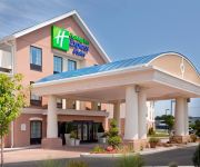
Holiday Inn Express & Suites WESTFIELD
Elm Motel
Granby Motel
Quality Inn Westfield - Springfield
Videos from this area
These are videos related to the place based on their proximity to this place.
Westfield River Brewing in Westfield, MA
I took a tour and tasting at Westfield River Brewing on Mainline Drive in Westfield, MA 01085, home of Black Squirrel Ale. http://www.westernmahomes.net.
Westfield deals with tornado damage
It may have not suffered the worst damage, but parts of Westfield were hit pretty hard by Wednesday's tornado.
GoPro HD: Jessy Nelson Full Moto 2 - 2012 Lucas Oil Pro Motocross Championship Southwick
Shot 100% on the HD HERO2® camera from http://GoPro.com. Take a ride with Jessy Nelson during the entire second moto at the 9th round of the 2012 Lucas Oil Pro Motocross Championship.
Home Improvement Contractor in Southwick MA
http://jerichobuildersma.com - local home improvement contractor in southwick ma home improvements in southwick ma home improvement contractor in southwick ma home improvement professionals ...
Southwick 9-08-13 NESC 40B
My first race in over a year. Thought I was great shape but I was totally fatigued by the 3rd lap.
Practice day before races at Southwick MX with ACR
I would have video for the races if i didnt leave my gopro on overnight and im on my Honda CRF80F.
2013 Rugged Maniac, Southwick, Run-Through with Obstacle Shortcuts
Click "Show More" to see the shortcuts for all the obstacles. The Hulk Hands are Back! I did the race again this year (Sunday, 11:30am heat). The course was more challenging than last year...
Bounce House Rentals Southwick MA 01077 Party Tent Rentals Agawam MA 01001
www.partypatrolrental.com Bounce House Rentals in Southwick MA. Tent Rentals in Agawam MA. We have a great selection of bounce house rentals, waterslide rentals, tent rentals, obstacle course...
Videos provided by Youtube are under the copyright of their owners.
Attractions and noteworthy things
Distances are based on the centre of the city/town and sightseeing location. This list contains brief abstracts about monuments, holiday activities, national parcs, museums, organisations and more from the area as well as interesting facts about the region itself. Where available, you'll find the corresponding homepage. Otherwise the related wikipedia article.
WWLP
WWLP is the NBC-affiliated television station for the Pioneer Valley of Western Massachusetts that is licensed to Springfield. It broadcasts a high definition digital signal on VHF channel 11 from a transmitter on Provin Mountain in the Feeding Hills section of Agawam. Owned by LIN TV Corporation, WWLP has studios at Broadcast Center in the Sandy Hill section of Chicopee next to the I-391/MA 116 interchange.
WAQY
WAQY (102.1 FM) is a Springfield, Massachusetts area classic rock radio station. Since the late 1980s, the station has been known as "Rock 102".
Hampshire and Hampden Canal
The Hampshire and Hampden Canal was the Massachusetts segment of an 86-mile canal that once connected New Haven, Connecticut to the Connecticut River north of Northampton, Massachusetts. Its Connecticut segment was called the Farmington Canal. The canal dates to 1821 when New Haven businessmen began to raise capital and investigate a possible canal route from their harbor to central Massachusetts, and on to Barnet, Vermont and Canada beyond.
Provin Mountain
Provin Mountain is a very narrow traprock mountain ridge located in the Connecticut River Valley of Massachusetts. It is part of the Metacomet Ridge which extends from Long Island Sound near New Haven, Connecticut, north through the Connecticut River Valley of Massachusetts to the Vermont border. Provin Mountain is known for its scenic cliffs, unique microclimate ecosystems, and rare plant communities. It is traversed by the 110-mile Metacomet-Monadnock Trail.


