Safety Score: 2,7 of 5.0 based on data from 9 authorites. Meaning we advice caution when travelling to United States.
Travel warnings are updated daily. Source: Travel Warning United States. Last Update: 2024-05-16 08:19:50
Delve into West Whately
West Whately in Hampshire County (Massachusetts) is a town located in United States about 326 mi (or 525 km) north-east of Washington DC, the country's capital town.
Time in West Whately is now 05:41 AM (Thursday). The local timezone is named America / New York with an UTC offset of -4 hours. We know of 12 airports closer to West Whately, of which 5 are larger airports. The closest airport in United States is Westover ARB/Metropolitan Airport in a distance of 9 mi (or 15 km), South-East. Besides the airports, there are other travel options available (check left side).
There is one Unesco world heritage site nearby. It's Statue of Liberty in a distance of 128 mi (or 205 km), South-West. Also, if you like the game of golf, there are some options within driving distance. In need of a room? We compiled a list of available hotels close to the map centre further down the page.
Since you are here already, you might want to pay a visit to some of the following locations: Hartford, Newfane, Keene, Worcester and Troy. To further explore this place, just scroll down and browse the available info.
Local weather forecast
Todays Local Weather Conditions & Forecast: 13°C / 56 °F
| Morning Temperature | 14°C / 56 °F |
| Evening Temperature | 14°C / 56 °F |
| Night Temperature | 11°C / 51 °F |
| Chance of rainfall | 24% |
| Air Humidity | 98% |
| Air Pressure | 1012 hPa |
| Wind Speed | Gentle Breeze with 6 km/h (4 mph) from South-West |
| Cloud Conditions | Overcast clouds, covering 100% of sky |
| General Conditions | Moderate rain |
Thursday, 16th of May 2024
21°C (71 °F)
13°C (56 °F)
Broken clouds, light breeze.
Friday, 17th of May 2024
20°C (67 °F)
11°C (53 °F)
Overcast clouds, gentle breeze.
Saturday, 18th of May 2024
17°C (63 °F)
12°C (53 °F)
Light rain, light breeze, overcast clouds.
Hotels and Places to Stay
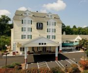
D HOTEL AND SUITES-HOLYOKE
Fairfield Inn & Suites Springfield Northampton/Amherst
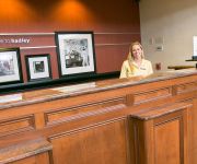
Hampton Inn Hadley-Amherst Area
AUTUMN INN
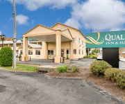
Quality Inn & Suites Northampton- Amherst
AMERICAS BEST VALUE INN
Clarion Hotel & Conference Center
HOTEL NORTHAMPTON
Super 8 Holyoke/Northampton Area
Videos from this area
These are videos related to the place based on their proximity to this place.
Valley Gives 2013, Easthampton Community Center, Easthampton, MA
On 12/12/13, go to http://www.valleygivesday.org and donate to the Easthampton Community Center. On December 12, 2013, during a single day of giving, please support the Easthampton Community.
DJI Phantom Vision2+ sunset over Easthampton MA 5/26/14
Took the Phantom up for a flight to catch some of the sunset over Easthampton Ma today. I love the rock steady gimbal and video quality is pretty good in low light.
Manhan Bridge Construction - Easthampton Ma - MassDOT / Northern Construction 8/1/13
08/1/13 The MassDOT is working on replacing the Easthampton Manhan River Bridge. They are using the Accelerated Bridge Technique and today 8 Deck Bulb Tee Beams were installed. The process.
Easthampton Chiropractic - Short | Easthampton, MA
http://chiropracticeasthampton.com/ - Give us a call today at (413) 527-8880. Dr. Andosca and the staff at Easthampton Chiropractic, are passionate about providing their patients with the best...
Easthampton - Pedestrian Bridge Installation 5-1-13 Manhan Bridge - MassDOT - Northern Construction
Easthampton - Pedestrian Bridge Installation 5-1-13 Manhan Bridge Pedestrian Bridge Installation 5-1-13 Manhan Bridge - Greater Easthampton Chamber of Commerce On Wednesday 5-1-13 the ...
Beagle Field Trial - Easthampton Beagle Club, MA
This Small Pack Option on Hare Beagle Field Trial shows the 13" female class running on March 19, 2011 photographed by Sarah Harrington of Better Beagling Magazine.
Park Hill Orchard - Easthampton Ma. 01027
A fly over at Park Hill Orchard in Easthampton MA with a DJI Phantom Vision 2 Plus - http://parkhillorchard.com/
Easthampton Spirit Committee 2014 Fireworks (01027)
A short piece of the 25 minute fireworks display in Easthampton MA. on June 28,2014.
Easthampton microburst aftermath 2014
This is what it looks like now driving down Mountain Road into Easthampton, MA.
Greater Easthampton Chamber of Commerce Holiday Stroll 2012
The 2012 Holiday Stroll in Easthampton is always a great time and a long tradition. This years was another great event for the community. People of all ages from the community get together...
Videos provided by Youtube are under the copyright of their owners.
Attractions and noteworthy things
Distances are based on the centre of the city/town and sightseeing location. This list contains brief abstracts about monuments, holiday activities, national parcs, museums, organisations and more from the area as well as interesting facts about the region itself. Where available, you'll find the corresponding homepage. Otherwise the related wikipedia article.
Williston Northampton School
The Williston Northampton School, or "Williston," is a private co-educational preparatory school for boarding and day students in seventh grade through postgraduate year located in Easthampton, Massachusetts. The 125-acre campus offers a range of extra-curricular activities in the arts and athletics. Located in the Pioneer Valley, the school is within 15 miles of Amherst, Smith, Mount Holyoke, and Hampshire colleges as well as the University of Massachusetts Amherst.
Flywheel Arts Collective
The Flywheel Arts Collective is a collectively run, DIY culture non-profit performance space, in Easthampton, Massachusetts. Flywheel hosts cheap and free shows as well as community events and workshops. Flywheel is governed by consensus and is run by volunteers. Its programming schedule is determined by members of the Flywheel community, which is open for anyone to join, get trained in their operations, or to schedule an event.
WGBY-TV
WGBY-TV is a PBS station licensed to the city of Springfield, Massachusetts. It is a division of the WGBH Educational Foundation, based in Boston, Massachusetts, but has its own independent web presence, logo, and local programming. Its transmitter is located on the peak of Mt. Tom in Holyoke, Massachusetts and provides programming to much of western Massachusetts, northern Connecticut, and southern Vermont. Its digital signal is assigned to UHF TV channel 22.
WFXQ-CD
WFXQ-CD is a Class A television station for the Pioneer Valley of Western Massachusetts that is licensed to Springfield. It broadcasts a digital signal on UHF channel 28 from a transmitter at the top of the old Mount Tom Ski Area in Holyoke. Owned by the LIN TV Corporation, WFXQ is sister to NBC affiliate WWLP who it serves as a full-time repeater of, and the two share studios at Broadcast Center in the Sandy Hill section of Chicopee next to the I-391/MA 116 interchange.
WGGB-DT2
WGGB-DT2 is the primary Fox and secondary MyNetworkTV-affiliated television station for Western Massachusetts' Pioneer Valley. The station is a second digital subchannel of ABC affiliate WGGB-TV owned by Gormally Broadcasting. Over-the-air, it broadcasts a 720p high definition digital signal on UHF channel 40.2 from a transmitter on Mount Tom in Holyoke.
WRNX
WRNX is an American radio station licensed to serve the community of Amherst, Massachusetts. The station is owned by Clear Channel Communications and the broadcast license is held by CC Licenses, LLC. The station was assigned the WRNX call letters by the Federal Communications Commission on September 21, 1990.
Notre Dame-Immaculate Conception School
Notre Dame-Immaculate Conception School was a private, Roman Catholic elementary school in Easthampton, Massachusetts, located in the Roman Catholic Diocese of Springfield in Massachusetts.
Sacred Heart of Jesus Parish, Easthampton
Sacred Heart of Jesus Parish - designated for Polish immigrants in Easthampton, Massachusetts, United States. It was founded in 1909. It is one of the Polish-American Roman Catholic parishes in New England in the Diocese of Springfield in Massachusetts. It close in June 2010.


