Safety Score: 3,0 of 5.0 based on data from 9 authorites. Meaning we advice caution when travelling to United Kingdom.
Travel warnings are updated daily. Source: Travel Warning United Kingdom. Last Update: 2024-04-28 08:22:10
Discover Pont Pen - y - benglog
Pont Pen - y - benglog in Gwynedd (Wales) is a town in United Kingdom about 199 mi (or 320 km) north-west of London, the country's capital city.
Current time in Pont Pen - y - benglog is now 11:07 AM (Sunday). The local timezone is named Europe / London with an UTC offset of one hour. We know of 12 airports near Pont Pen - y - benglog, of which 5 are larger airports. The closest airport in United Kingdom is Anglesey Airport in a distance of 23 mi (or 37 km), West. Besides the airports, there are other travel options available (check left side).
There are several Unesco world heritage sites nearby. The closest heritage site in United Kingdom is Castles and Town Walls of King Edward in Gwynedd in a distance of 12 mi (or 20 km), East. Also, if you like playing golf, there are a few options in driving distance. Looking for a place to stay? we compiled a list of available hotels close to the map centre further down the page.
When in this area, you might want to pay a visit to some of the following locations: Bethesda, Llanberis, Aber, Maentwrog and Llangoed. To further explore this place, just scroll down and browse the available info.
Local weather forecast
Todays Local Weather Conditions & Forecast: 7°C / 45 °F
| Morning Temperature | 5°C / 41 °F |
| Evening Temperature | 7°C / 45 °F |
| Night Temperature | 7°C / 45 °F |
| Chance of rainfall | 0% |
| Air Humidity | 69% |
| Air Pressure | 1005 hPa |
| Wind Speed | Moderate breeze with 11 km/h (7 mph) from North-East |
| Cloud Conditions | Overcast clouds, covering 100% of sky |
| General Conditions | Light rain |
Monday, 29th of April 2024
9°C (49 °F)
8°C (47 °F)
Moderate rain, moderate breeze, overcast clouds.
Tuesday, 30th of April 2024
10°C (49 °F)
8°C (46 °F)
Moderate rain, moderate breeze, overcast clouds.
Wednesday, 1st of May 2024
13°C (55 °F)
8°C (46 °F)
Light rain, light breeze, overcast clouds.
Hotels and Places to Stay
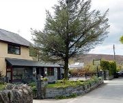
Gors yr Eira Country Guest House
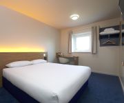
TRAVELODGE BANGOR
Videos from this area
These are videos related to the place based on their proximity to this place.
Zipworld
A great day out at Zipworld Bethesda, North Wales on Longest zip line in the northern hemisphere. Zipworld Velocity travelling at speeds of up to 100mph this is the nearest thing to flying...
ZIP World. longest zip line Europe
As the Wales Official tour Guides we meet each year to familiarise our selves with different attractions and tourist sites . This year as well as looking at various attractions some one thought...
Zip World Velocity Big Zipper, Little Zipper, Onboard Video and the full experience
The full experience video of our day at Zip World Velocity. First there was a briefing and kitting up, then a walk to the Little Zipper to test your nerve. Then a journey in a converted mine...
Sacral Lumbar Release
Dru Yoga's flowing style combines strength with power, effectiveness with ease. The Sacral Lumbar release realigns the lower spine, bringing you fresh energy and vitality. You can also use...
Ogwen Kayaking Pt 1
Raw un-edited footage of a December day 2013 kayaking the Afon Ogwen. The 3 part footage is from the B4409 road bridge (below the gun barrel) to the old A55 road bridge.
Zip World Velocity
2nd October 2014 - Visit to Zip World Velocity, the Northern Hemisphere's longest zip line at the now disused part of the Penrhyn Quarry, Snowdonia, North Wales. Click on the video settings...
Videos provided by Youtube are under the copyright of their owners.
Attractions and noteworthy things
Distances are based on the centre of the city/town and sightseeing location. This list contains brief abstracts about monuments, holiday activities, national parcs, museums, organisations and more from the area as well as interesting facts about the region itself. Where available, you'll find the corresponding homepage. Otherwise the related wikipedia article.
Glyder Fawr
Glyder Fawr is a mountain in Snowdonia, Wales, the highest in the Glyderau at just over 1,000m. It is the fifth highest mountain in Wales. The summit lies on the ridge between Glyder Fach and Y Garn, and has views to the north, across the Ogwen Valley, of Pen yr Ole Wen and the Carneddau, and views south to the Snowdon Horseshoe. The summit plateau is very rocky, making progress slow.
Glyder Fach
Glyder Fach is a mountain in Snowdonia, north-west Wales, and is the second highest of the Glyderau and the sixth highest in Wales. Routes to the summit lead from Tryfan and Bristly Ridge to the north, via Glyder Fawr from Pen-y-Pass to the south, and along the Glyder ridge to the east, towards Capel Curig. It is a popular spot for climbers. According to Sir Ifor Williams, the word "Glyder" derives from the Welsh word "Gludair", meaning a heap of stones.
Ogwen Cottage
Ogwen Cottage Outdoor Pursuits Centre is part of Birmingham City Council's Outdoor Learning Service. It provides outdoor education and has links to the climbing community.
Pen yr Ole Wen
Pen yr Ole Wen is the seventh highest mountain in Snowdonia and in Wales. It is the most southerly of the Carneddau range. The mountain lies to the north of Idwal Cottage youth hostel on the A5 road, from where it has a pyramidal appearance. It may be climbed from the hostel by a path that leads directly up the south west "corner", climbing 675 m in about 1.5 km (i.e. an average gradient of nearly 1 in 2).
Llyn Ogwen
Llyn Ogwen is a ribbon lake in north-west Wales. It lies alongside the A5 road between two mountain ranges of Snowdonia, the Carneddau and the Glyderau. Somewhat unusually, the county boundary at this point is drawn so that the lake itself lies in the county of Gwynedd, but all the surrounding land (excluding the outflow) lies in Conwy County Borough.
Cwm Idwal
Cwm Idwal is a hanging valley in the Glyderau range of mountains in northern Snowdonia, the national park in the mountainous region of North Wales. Its main interest is to hill walkers and rock climbers, but it is also of interest to geologists and naturalists, given its combination of altitude (relatively high in UK terms), aspect (north-facing) and terrain (mountainous and rocky). In a 2005 poll conducted by Radio Times, Cwm Idwal was ranked the 7th greatest natural wonder in Britain.
Llyn Idwal
Llyn Idwal is a small lake (approximately 800 m by 300 m) that lies within Cwm Idwal in the Glyderau mountains of Snowdonia. It is named after Prince Idwal Foel a grandson of Rhodri Mawr, one of the ancient Kings of Wales, legend stating that the unfortunate offspring was murdered by being drowned in the lake. In fact Idwal Foel died in battle against the Saxons in 942 and the legend is that he was cremated beside the lake as was the burial custom for Celtic nobility.
Castell y Gwynt
Castell y Gwynt is a top of Glyder Fach in Snowdonia, north-west Wales. It has the merit of being the only 3000 ft Welsh summit classed as only a Nuttall, hence it is not included in the Welsh 3000s. It has a prominence of 15.7 m (51.5 ft), and was only included on the Nuttall's list after re-surveying in 2007. The top is more famous as a feature than a summit. "Castell y Gwynt" and the "Cantilever Stone" were used in Walt Disney's The Dragonslayer.


