Safety Score: 3,0 of 5.0 based on data from 9 authorites. Meaning we advice caution when travelling to United Kingdom.
Travel warnings are updated daily. Source: Travel Warning United Kingdom. Last Update: 2024-04-29 08:03:39
Discover Penmaenmawr
Penmaenmawr in Conwy (Wales) with it's 2,535 citizens is a city in United Kingdom about 201 mi (or 324 km) north-west of London, the country's capital city.
Local time in Penmaenmawr is now 10:03 AM (Monday). The local timezone is named Europe / London with an UTC offset of one hour. We know of 11 airports in the vicinity of Penmaenmawr, of which 5 are larger airports. The closest airport in United Kingdom is Anglesey Airport in a distance of 25 mi (or 40 km), West. Besides the airports, there are other travel options available (check left side).
There are several Unesco world heritage sites nearby. The closest heritage site in United Kingdom is Castles and Town Walls of King Edward in Gwynedd in a distance of 12 mi (or 20 km), South-East. Also, if you like golfing, there is an option about 14 mi (or 23 km). away. Looking for a place to stay? we compiled a list of available hotels close to the map centre further down the page.
When in this area, you might want to pay a visit to some of the following locations: Aber, Conwy, Llandudno, Bethesda and Llangoed. To further explore this place, just scroll down and browse the available info.
Local weather forecast
Todays Local Weather Conditions & Forecast: 10°C / 49 °F
| Morning Temperature | 9°C / 48 °F |
| Evening Temperature | 10°C / 50 °F |
| Night Temperature | 9°C / 48 °F |
| Chance of rainfall | 9% |
| Air Humidity | 84% |
| Air Pressure | 1007 hPa |
| Wind Speed | Moderate breeze with 13 km/h (8 mph) from North |
| Cloud Conditions | Overcast clouds, covering 96% of sky |
| General Conditions | Moderate rain |
Tuesday, 30th of April 2024
13°C (56 °F)
9°C (49 °F)
Light rain, fresh breeze, overcast clouds.
Wednesday, 1st of May 2024
13°C (56 °F)
10°C (50 °F)
Light rain, gentle breeze, overcast clouds.
Thursday, 2nd of May 2024
10°C (51 °F)
9°C (48 °F)
Moderate rain, gentle breeze, overcast clouds.
Hotels and Places to Stay
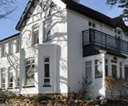
Sychnant Pass Country House
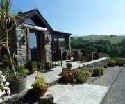
Rhiwiau Isaf
Merrion
Videos from this area
These are videos related to the place based on their proximity to this place.
Dusk over Conway Morfa, North Wales
A time lapse video sequence showing the transition from day to night as seen from the top of Conway mountain. The view overlooks Conway Morfa, the Conwy estuary and the Great Orme at Llandudno.
Video of an Electric Glider Flying Over a Flat Conway Beach
This is a flight over the beach at Conway North Wales in a Nan Alex XXL e electric radio controlled glider with a Bloggie HD camera attached to the wing.
Gwylanedd Penthouse Llanfairfechan
Holiday apartment in Llanfairfechan. Sea views. See ww. northwalesholiday. co m.
emerging (baby swans at llanfairfechan)
day old cygnets climbing out of the pond with varying degrees of success.
Llanfairfechan Fireworks 2013
Recorded on the promenade at Llanfairfechan on the 8th November 2013. My mobile phone was caused the buzzing sound during the recording, not sure why that happened only noticed it just now.
Videos provided by Youtube are under the copyright of their owners.
Attractions and noteworthy things
Distances are based on the centre of the city/town and sightseeing location. This list contains brief abstracts about monuments, holiday activities, national parcs, museums, organisations and more from the area as well as interesting facts about the region itself. Where available, you'll find the corresponding homepage. Otherwise the related wikipedia article.
Penmaenmawr
PenmaenmawrConwy Penmaenmawr is a town in the parish of Dwygyfylchi, in Conwy County Borough, Wales. It lies on the North Wales coast between Conwy and Llanfairfechan and was an important quarrying town, though this industry is no longer a major employer. The population (including Dwygyfylchi) was 3857 in 2001. The town was bypassed by the A55 Expressway in the 1980s, losing its old Edwardian period promenade in the process, which was largely replaced by a modern one.
St Winifred's School
St Winifred's School was a school for girls based in Llanfairfechan, Conwy county borough, North-West Wales.
Penmaenmawr & Welsh Granite Co
The Penmaenmawr & Welsh Granite Co. owned and operated a major granite quarry on the north Wales coast located between Conwy and Llanfairfechan. Granite axe-heads and other implements from Neolithic quarries at Penmaenmawr have been found throughout Britain. Penmaenmawr & Welsh Granite Co. Locale WalesDates of operation 1830s–1960sTrack gauge 36Headquarters Penmaenmawr In the 1830s commercial granite quarries were opened on Penmaenmawr to meet the growing demand for granite setts.
Bwlch-y-Ddeufaen
Bwlch-y-Ddeufaen is a mountain pass in Conwy county borough, north Wales, traversable only on foot or horseback, following the former Roman road from Caerhun (Canovium) to Caernarfon (Segontium). The route may be followed by road to Rowen or to Llanbedr-y-Cennin and from either, the way, through a mountain gate, is a clearly marked green path to Abergwyngregyn. The route lies between the peaks of Tal y Fan and Drum, in the Carneddau range in north Snowdonia.
Tal y Fan
Tal y Fan is an outlying peak of the Carneddau mountains in North Wales. It is one of the four Marilyns that make up the Carneddau, the others being Carnedd Llywelyn, Pen Llithrig y Wrach and Creigiau Gleision. It is 610 m high, and lies mid-way between the Conwy valley to the east and Penmaenmawr on the coast to the north-west. It is the most northerly 2000 ft summit in Wales. Bwlch y Ddeufaen separates Tal y Fan from the main Carneddau ridge, the closest summit on which is Carnedd y Ddelw.


