Safety Score: 3,0 of 5.0 based on data from 9 authorites. Meaning we advice caution when travelling to United Kingdom.
Travel warnings are updated daily. Source: Travel Warning United Kingdom. Last Update: 2024-04-28 08:22:10
Explore Mendlesham
Mendlesham in Suffolk (England) with it's 884 inhabitants is located in United Kingdom about 73 mi (or 117 km) north-east of London, the country's capital.
Local time in Mendlesham is now 04:40 AM (Monday). The local timezone is named Europe / London with an UTC offset of one hour. We know of 11 airports in the wider vicinity of Mendlesham, of which 5 are larger airports. The closest airport in United Kingdom is RAF Honington in a distance of 15 mi (or 23 km), North-West. Besides the airports, there are other travel options available (check left side).
There are several Unesco world heritage sites nearby. The closest heritage site in United Kingdom is Royal Botanic Gardens, Kew in a distance of 63 mi (or 101 km), South-West. Also, if you like golfing, there are multiple options in driving distance. If you need a place to sleep, we compiled a list of available hotels close to the map centre further down the page.
Depending on your travel schedule, you might want to pay a visit to some of the following locations: Ipswich, Snetterton, Shropham, Norwich and Hellington. To further explore this place, just scroll down and browse the available info.
Local weather forecast
Todays Local Weather Conditions & Forecast: 13°C / 56 °F
| Morning Temperature | 4°C / 39 °F |
| Evening Temperature | 13°C / 55 °F |
| Night Temperature | 7°C / 44 °F |
| Chance of rainfall | 0% |
| Air Humidity | 62% |
| Air Pressure | 1016 hPa |
| Wind Speed | Moderate breeze with 13 km/h (8 mph) from North |
| Cloud Conditions | Broken clouds, covering 71% of sky |
| General Conditions | Broken clouds |
Tuesday, 30th of April 2024
12°C (54 °F)
9°C (48 °F)
Light rain, moderate breeze, overcast clouds.
Wednesday, 1st of May 2024
15°C (59 °F)
11°C (53 °F)
Light rain, gentle breeze, overcast clouds.
Thursday, 2nd of May 2024
10°C (51 °F)
10°C (51 °F)
Moderate rain, gentle breeze, overcast clouds.
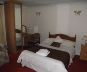
Hotels and Places to Stay
Bull Auberge
Best Western Cedars Hotel
Videos from this area
These are videos related to the place based on their proximity to this place.
Mud Buggying at Stonham
Tim went for a trip in his kite buggy behind my truck at Stonham in the mud.
Mike Bacon
EADT Senior Sports Writer Mike Bacon, coming down to earth on the second tee at Stonham Barns, after a wonderful long putt for a 2 on the first.
Debenham YFC 4x4 Offroad
Debenham YFC go 4x4 offroading in Suffolk, but our track needs a good reworking. We all managed to get stuck, but had fun.
Offroading At The Mid-Suffolk Show
Offroading at the Mid-Suffolk Show. We ran the course quite dry for the morning, then flooded it in the afternoon. An excellent day out!
Dorset Police
Dorset Police DUE TO THE RECENT UNAUTHORIZED TAMPERING AND REMOVAL OF OUR SITE, WHICH WE HAVE NOW REGAINED CONTROL. OUR WEB SITE IS FUNDED ON BEHALF OF THE ...
Aberinkula @Latitude 2008 3rd Part end of gig.
Aberinkula @ latitude 2008 3rd part and the very end of gig. Taken from a motorola mobile, so dont complain about quality. Excellent gig!
Paul Leary flies the Malibu
13 October 2012. Senior Tow coach Paul Leary flies the Moyes Malibu at Mendlesham aerodrome of Suffolk Coastal Floaters HGC.
Videos provided by Youtube are under the copyright of their owners.
Attractions and noteworthy things
Distances are based on the centre of the city/town and sightseeing location. This list contains brief abstracts about monuments, holiday activities, national parcs, museums, organisations and more from the area as well as interesting facts about the region itself. Where available, you'll find the corresponding homepage. Otherwise the related wikipedia article.
Mid-Suffolk Light Railway
The Mid-Suffolk Light Railway (aka The Middy) is a heritage railway in Suffolk, which in its heyday it was a branch line which ran for just 19 miles from Haughley to Laxfield, Suffolk. The line became part of the London and North Eastern Railway in 1924 and the last trains ran on 26 July 1952. The Railway is now both a heritage railway and preservation museum run by a small but dedicated band of volunteers.
Mendlesham transmitting station
The Mendlesham transmitting station is a broadcasting and telecommunications facility, situated close to the village of Mendlesham, near the town of Stowmarket, in Suffolk, United Kingdom. It is owned and operated by Arqiva. It has a 305.4 metres high guyed steel lattice mast. Constructed in 1959, it came into service on 27 October of that year.
Mendlesham railway station
Mendlesham railway station was a station on the Mid-Suffolk Light Railway.
Wetheringsett-cum-Brockford
Wetheringsett-cum-Brockford is a civil parish in the Mid Suffolk district of Suffolk in eastern England. The parish contains the village of Wetheringsett, together with the hamlets of Blacksmith's Green, Broad Green, Brockford Street, Suffolk (located on the A140), Brockford Green, Knaves Green, Page's Green, Park Green, Pitman's Corner, Wetherup Street and White Horse Corner. In 2005 its population was 670.
Brockford and Wetheringsett railway station
Brockford and Wetheringsett railway station was a station on the Mid-Suffolk Light Railway.


