Safety Score: 3,0 of 5.0 based on data from 9 authorites. Meaning we advice caution when travelling to United Kingdom.
Travel warnings are updated daily. Source: Travel Warning United Kingdom. Last Update: 2024-04-28 08:22:10
Delve into Batley
Batley in Kirklees (England) with it's 50,807 habitants is a town located in United Kingdom about 164 mi (or 264 km) north-west of London, the country's capital town.
Time in Batley is now 05:37 AM (Monday). The local timezone is named Europe / London with an UTC offset of one hour. We know of 9 airports closer to Batley, of which 5 are larger airports. The closest airport in United Kingdom is Leeds Bradford Airport in a distance of 11 mi (or 18 km), North. Besides the airports, there are other travel options available (check left side).
There are several Unesco world heritage sites nearby. The closest heritage site in United Kingdom is Liverpool – Maritime Mercantile City in a distance of 33 mi (or 53 km), South-East. Also, if you like the game of golf, there are some options within driving distance. In need of a room? We compiled a list of available hotels close to the map centre further down the page.
Since you are here already, you might want to pay a visit to some of the following locations: Morley, Gildersome, Drighlington, Mirfield and Crigglestone. To further explore this place, just scroll down and browse the available info.
Local weather forecast
Todays Local Weather Conditions & Forecast: 13°C / 55 °F
| Morning Temperature | 7°C / 45 °F |
| Evening Temperature | 11°C / 52 °F |
| Night Temperature | 10°C / 50 °F |
| Chance of rainfall | 0% |
| Air Humidity | 66% |
| Air Pressure | 1011 hPa |
| Wind Speed | Moderate breeze with 11 km/h (7 mph) from North |
| Cloud Conditions | Broken clouds, covering 77% of sky |
| General Conditions | Light rain |
Tuesday, 30th of April 2024
16°C (60 °F)
9°C (49 °F)
Light rain, moderate breeze, broken clouds.
Wednesday, 1st of May 2024
17°C (62 °F)
12°C (53 °F)
Light rain, gentle breeze, broken clouds.
Thursday, 2nd of May 2024
12°C (54 °F)
11°C (51 °F)
Overcast clouds, gentle breeze.
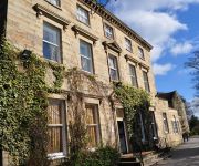
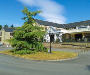
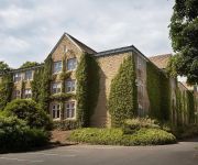
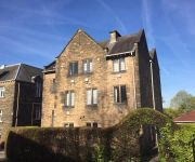
Hotels and Places to Stay
VILLAGE LEEDS SOUTH
Healds Hall West Yorkshire
Gomersal Park Hotel and Leisure Club
Holiday Inn LEEDS - BRADFORD
The Mirfield Monastery
JCT.40 Holiday Inn LEEDS - WAKEFIELD M1
Ramada Wakefield M1 Jct 40
Heath Cottage
TRAVELODGE LEEDS MORLEY
Gomersal Lodge Hotel
Videos from this area
These are videos related to the place based on their proximity to this place.
Visita al Car Boot Sale di Dewsbury (Yorkshire, UK), il 13 Aprile 2014
Visita al car boot sale di Dewsbury, un paese vicino a Leeds. Il mercato dell'usato di Dewsbury si tiene ogni domenica ed è uno dei più grandi mercati dell'usato della zona. Fra i visitatori...
FLYING VISIT TO DEWSBURY MODEL AERO CLUB - FEBRUARY 2015
A quick look at Dewsbury Model Aero Club (UK) on a very cold Sunday afternoon in February 2015.
A QUICK VISIT TO DEWSBURY MODEL AERO CLUB (UK) IN JUNE 2014
http://www.dewsburymac.org.uk I have been a member of this club from time to time over the years. Dewsbury Model Aero Club.
DJI PHANTOM 2 DRONE - FLYING AT DEWSBURY MODEL AERO CLUB
DJI Phantom 2 with ZENMUSE H3-3D Gimbal and a GoPro black Edition camera. This is a test flight at my local model flying club.
A TRIP ON MY 00 GAUGE MODEL RAILWAY - USING A MICRO ONBOARD CAMERA ON THE TRAIN
This is the 00 gauge model railway in my office. I clipped on a "Veho Muvi" camera onto the train itself & this is what I saw.
S.M. Hasan Askari Miya @ Mohaddis-e-Azam Mission, Dewsbury (Part 3/5)
(Part 3 of 5) Fazil-e-Baghdad Sheikh Maulana Mohammed Hasan Askari Miya's speech @ Mohaddis-e-Azam Mission Dewsbury which took place on 6th April 2014.
Dewsbury Rams v Keighley Cougars 6th May 2012 Rugby League
Highlights from Cougars clash with Rams at Tetley Stadium 6th May 2012.
S.M. Hasan Askari Miya @ Mohaddis-e-Azam Mission, Dewsbury (Part 2/5)
(Part 2 of 5) Fazil-e-Baghdad Sheikh Maulana Mohammed Hasan Askari Miya's speech @ Mohaddis-e-Azam Mission Dewsbury which took place on 6th April 2014.
DEWSBURY ON SEA CARNIVAL 2010
Dewsbury On Sea 2010 - an annual event where Dewsbury (which is nowhere near the sea) creates beaches in its main streets where children can build sand castles. This video was produced...
Videos provided by Youtube are under the copyright of their owners.
Attractions and noteworthy things
Distances are based on the centre of the city/town and sightseeing location. This list contains brief abstracts about monuments, holiday activities, national parcs, museums, organisations and more from the area as well as interesting facts about the region itself. Where available, you'll find the corresponding homepage. Otherwise the related wikipedia article.
Batley and Spen (UK Parliament constituency)
Batley and Spen /bætli ənd spɛn/ /bæʔli ənd spɛn/ is a constituency represented in the House of Commons of the UK Parliament since 1997 by Mike Wood of the Labour Party.
West Yorkshire Urban Area
The West Yorkshire Urban Area is a term used by the Office for National Statistics (ONS) to refer to a conurbation in West Yorkshire, England, based around the cities of Leeds, Bradford and Wakefield, and the large town of Huddersfield. However, it excludes towns such as Castleford, Halifax, Pontefract and Wetherby which though part of the county of West Yorkshire are considered independently.
Upper Batley
Upper Batley is an area of Batley in West Yorkshire, England. It was popular with the millowners of Batley in the 19th century as a place to build their family homes. There are many fine stone built villas in the area. Batley Hall, a two-storey oak-and-stone building, was originally built in 1370 by William Copley, although the present building dates from 1857. Its gatehouses are now ordinary homes, and the Old Hall is now a residential home.
Mount Pleasant, Batley
Mount Pleasant is a rugby league stadium in Batley, West Yorkshire, England. It is the home of Batley Bulldogs. Renowned for its famous slope, Mount Pleasant is situated at the top of the hill that overlooks the town of Batley. The end of the ground at the top of the hill is surrounded by three grandstands. Behind the rugby posts is a relatively new terraced stand, which houses the players changing rooms and also executive boxes.
Batley Variety Club
The Batley Variety Club was a variety club in Batley, West Yorkshire, England. It was financed and co-founded by the late Yorkshire showman and businessman Peter Fleming in partnership with James Corrigan. It had a capacity of around 1600 people, and when it opened offered cabaret with an inclusive dinner for 6s6d. At the peak of its success, the club was said to have had 300,000 members. It closed circa 1978 and reopened as the Crumpet night club.
Batley bus station
Batley bus station serves the town of Batley, West Yorkshire, England. The bus station is owned and maintained by Metro (West Yorkshire PTE). The bus station is situated in Batley Town Centre and can be accessed from Bradford Road and St. James's Street. It was re-built by Metro in April 2005 replacing the previously owned Arriva Yorkshire site. There are six stands and a real-time information board at the bus station. Arriva Yorkshire is the main operator.
Dewsbury bus station
Dewsbury bus station serves the town of Dewsbury, West Yorkshire, England. The bus station is managed and owned by Metro (West Yorkshire PTE). The bus station is situated in Dewsbury Town Centre next to Aldams Road and can be accessed there and from South Street. The bus station was rebuilt in 1994 with a main passenger concourse and 19 bus stands.
Dewsbury Town Hall
Dewsbury Town Hall is Victorian Town Hall stands in front of the old marketplace in the centre of Dewsbury, West Yorkshire, England. This grade II listed building is full of original stained glass windows, wood panelling, columns and ornate ceilings. The Town Hall contains a 700 seat concert hall, function and meeting rooms, and the Old Court Room. Dewsbury Town Hall presents concerts, events, dinner dances, award evenings and is frequently used by TV and film crews.
Foxsons Mill, Staincliffe
Foxsons Mill, Staincliffe was a doubling mill in Dewsbury, West Yorkshire. It was Lancashire Cotton Corporation sole mill in West Yorkshire. A doubling mill, it doubled yarns of count's 4's to 40's. built in It was taken over by the Lancashire Cotton Corporation in the 1930s and passed to Courtaulds in 1964. The mill was demolished in 1973, and the land is now housing.
Mount Pleasant (cricket ground)
Mount Pleasant was a cricket ground in Batley, Yorkshire. The first recorded match on the ground was in 1869, when Batley played an Burnley. The ground hosted a single first-class match in 1883 when the T Emmett's XI played RG Barlow's XI. The ground, adjacent to the stadium of Batley Bulldogs RLFC, is the home of Batley Cricket Club. They are members of the Central Yorkshire Cricket League.


