Safety Score: 3,0 of 5.0 based on data from 9 authorites. Meaning we advice caution when travelling to United Kingdom.
Travel warnings are updated daily. Source: Travel Warning United Kingdom. Last Update: 2024-05-08 08:04:21
Discover Fareham
Fareham in Hampshire (England) with it's 57,390 citizens is a city in United Kingdom about 64 mi (or 104 km) south-west of London, the country's capital city.
Local time in Fareham is now 01:58 AM (Thursday). The local timezone is named Europe / London with an UTC offset of one hour. We know of 10 airports in the vicinity of Fareham, of which 5 are larger airports. The closest airport in United Kingdom is Southampton Airport in a distance of 10 mi (or 17 km), North-West. Besides the airports, there are other travel options available (check left side).
There are several Unesco world heritage sites nearby. The closest heritage site in United Kingdom is Dorset and East Devon Coast in a distance of 13 mi (or 20 km), South-East. Also, if you like golfing, there are a few options in driving distance. We discovered 3 points of interest in the vicinity of this place. Looking for a place to stay? we compiled a list of available hotels close to the map centre further down the page.
When in this area, you might want to pay a visit to some of the following locations: Portsmouth, Cowes, Gurnard, Northwood and Newchurch. To further explore this place, just scroll down and browse the available info.
Local weather forecast
Todays Local Weather Conditions & Forecast: 15°C / 59 °F
| Morning Temperature | 12°C / 53 °F |
| Evening Temperature | 15°C / 58 °F |
| Night Temperature | 12°C / 54 °F |
| Chance of rainfall | 0% |
| Air Humidity | 80% |
| Air Pressure | 1027 hPa |
| Wind Speed | Light breeze with 5 km/h (3 mph) from North-West |
| Cloud Conditions | Broken clouds, covering 52% of sky |
| General Conditions | Broken clouds |
Friday, 10th of May 2024
16°C (60 °F)
13°C (55 °F)
Overcast clouds, gentle breeze.
Saturday, 11th of May 2024
17°C (62 °F)
13°C (56 °F)
Overcast clouds, gentle breeze.
Sunday, 12th of May 2024
17°C (62 °F)
14°C (57 °F)
Broken clouds, gentle breeze.
Hotels and Places to Stay
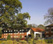
Meon Valley Marriott Hotel & Country Club
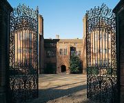
New Place
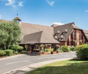
Solent Hotel & Spa
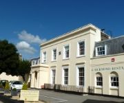
Lysses House
B+B Wickham
Holiday Inn FAREHAM - SOLENT
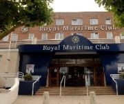
Royal Maritime Club
Duke of Buckingham
Holiday Inn PORTSMOUTH
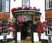
The Bugle Hotel
Videos from this area
These are videos related to the place based on their proximity to this place.
ped wheelies and drifting
gibbo and joshy in lee on solent doing some wheelies on there aeroxs, gibbo wheelies shame the shidder is fucked)
(HD) Fareham to Gosport on the Bus Rapid Transit (BRT) - First day Sunday 22nd April 2012
A trip down the Fareham to Gosport Bus Corridor, which uses the old railway track, on the first day of operation - Sunday 22nd April 2012. This is Bus Rapid Transit (BRT) Phase 1 and is run...
(HD) Fareham to Gosport on the Bus Rapid Transit (BRT) - First day Sunday 22nd April 2012
A trip down the Fareham to Gosport Bus Corridor, which uses the old railway track, on the first day of operation - Sunday 22nd April 2012. This is Bus Rapid Transit (BRT) Phase 1 and is run...
60163 Tornado passing through Fareham 21.06.2009
In which new A1 Pacific Tornado on an excursion passes though Fareham tunnel and then through the station.
Sky Cam - Bath Lane Recreation Ground, Fareham Creek - DJI Phantom 2 Vision Plus
Aerial Views of Fareham Creek and Cams Hill Golf Course, filmed from Bath Lane Recreation Ground. I filmed this using the DJI Phantom 2 Vision+.
Mechanical waving mannequin at Car-wash
mannequin man doing his mechanical waving car wash dummy in Fareham Road, Gosport PO13 0AT.
Sky Cam - Fareham Town Centre - DJI Phantom 2 Vision Plus
Aerial Views of Fareham Town Centre, filmed from Park Lane Recreation Ground. I filmed this using the DJI Phantom 2 Vision+. Despite what the video says, this was filmed on 6th July (not 6th...
Following a Lamborghini Murcielago through Fareham
While driving through Fareham we came across this beautiful car and thought we would follow it.
Videos provided by Youtube are under the copyright of their owners.
Attractions and noteworthy things
Distances are based on the centre of the city/town and sightseeing location. This list contains brief abstracts about monuments, holiday activities, national parcs, museums, organisations and more from the area as well as interesting facts about the region itself. Where available, you'll find the corresponding homepage. Otherwise the related wikipedia article.
Borough of Fareham
The Borough of Fareham is a local government district and borough in Hampshire, England. Its council is based in Fareham. Other places within the Borough include Portchester, Stubbington, Hill Head, Titchfield, Warsash, Locks Heath, Sarisbury and half of Whiteley. The Borough covers much of the semi-urban area between the cities of Southampton and Portsmouth, and is part of the South Hampshire conurbation, with many residents commuting to the two cities for employment.
Fort Fareham
Fort Fareham is one of the Palmerston Forts, in Fareham, England. After the Gosport Advanced Line of Fort Brockhurst, Fort Elson, Fort Rowner, Fort Grange and Fort Gomer had been approved by the Royal Commission on the Defence of the United Kingdom a decision was made to build an outer line of three more forts two miles in advance of the Gosport Advanced Line. Of these three projected forts only Fort Fareham was built due to the need to cut costs.
Fareham railway station
Fareham railway station is a railway station on the West Coastway Line situated aboutBad rounding here{{#invoke:Math|precision_format| 1*1,000/1,609.344 | 1--1 }} miles (1 km) from the town of Fareham in Hampshire, England.
Neville Lovett Community School
Neville Lovett Community School is a mid-sized comprehensive (ages 11 - 16) mixed-sex school of 800 pupils, located in Fareham, Hampshire. It was the first school in Hampshire designated as a Specialist Maths and Computing College in September 2003. The school is named after the first Bishop of Portsmouth, Neville Lovett. Neville Lovett Community School now has plans to become the Fareham Academy (ages 11-18) in September 2013
Fareham Town F.C
Fareham Town F.C. is a football club based in Fareham, Hampshire, England. The club is affiliated to the Hampshire Football Association, and is a FA Charter Standard club. They play in the Wessex League Premier Division, whilst their reserves are in the Wyvern League.
Westbury Manor Museum
Westbury Manor Museum is the main town centre museum located at 84 West Street, Fareham, Hampshire, England. It features a variety of exhibits on local history, such as the use of Fareham red bricks in the construction of the Royal Albert Hall. It also has a small cafe. The museum is housed in an 18th Century Grade II listed building with formal Victorian style gardens to the rear, formerly used as the offices of Fareham Urban District from 1934 to 1976.
HMS Collingwood (establishment)
For ships of the same name see HMS Collingwood. HMS Collingwood is a stone frigate (shore establishment) of the Royal Navy. It is the lead establishment of the Maritime Warfare School (MWS) and the largest naval training organisation in Western Europe.
Fareham Shopping Centre
Fareham Shopping Centre is at the heart of the centre of the medium sized Hampshire town of Fareham. Built in two phases between 1975 and 1981, the centre contains many well known retailers and is quite large for a town of its size. The shopping centre is part of a wider scheme of buildings in the town centre that were constructed around the same time.
Fareham bus station
Fareham bus station serves the town of Fareham, Hampshire, England. The bus station is situated just off West Street in the town centre. National Express Coaches also go from here all over the country. The main bus operators at the bus station are First Hampshire & Dorset and Stagecoach in Hampshire. Bus services go from Fareham as far afield as Southampton, Gosport, Southsea, Havant, Wickham and Winchester.
Cams Hall
Cams Hall at Fareham, Hampshire, United Kingdom, is a Palladian mansion set in parkland overlooking Portsmouth Harbour. The land at Cams Hall was mentioned in the Domesday Book of 1086 and a manor house was recorded here as far back as the 13th century. The current building, designed by the architect Jacob Leroux, was constructed of Portland stone and yellow bricks around 1770. Later adaptations to the house have been attributed to the famous Georgian architects the Adam Brothers.
Heart Solent
Heart Solent is an Independent Local Radio station broadcasting to southern and western parts of Hampshire, West Sussex, east Dorset and the Isle of Wight. The station began broadcasting on 30 July 2010 as a result of a merger between Heart Hampshire (formerly Ocean Sound) and Heart Dorset & New Forest (formerly 2CR).
Funtley Deviation
The Funtley Deviation was a 2 mile (3.2 kilometres) long stretch of additional track built in 1906 to supplement a precarious tunnel north of Fareham. It was closed in 1974 and is now a nature walk with a small car park at the Highland Road end.


