Safety Score: 3,0 of 5.0 based on data from 9 authorites. Meaning we advice caution when travelling to United Kingdom.
Travel warnings are updated daily. Source: Travel Warning United Kingdom. Last Update: 2024-05-07 07:59:51
Delve into Gwithian
Gwithian in Cornwall (England) is located in United Kingdom about 246 mi (or 396 km) west of London, the country's capital town.
Current time in Gwithian is now 06:47 PM (Tuesday). The local timezone is named Europe / London with an UTC offset of one hour. We know of 9 airports close to Gwithian, of which two are larger airports. The closest airport in United Kingdom is Land's End Airport in a distance of 15 mi (or 24 km), South-West. Besides the airports, there are other travel options available (check left side).
There is one Unesco world heritage site nearby. It's Cornwall and West Devon Mining Landscape in a distance of 35 mi (or 56 km), East. Also, if you like playing golf, there is an option about 14 mi (or 22 km). away. If you need a hotel, we compiled a list of available hotels close to the map centre further down the page.
While being here, you might want to pay a visit to some of the following locations: Germoe, Redruth, Wendron, Penzance and St. Day. To further explore this place, just scroll down and browse the available info.
Local weather forecast
Todays Local Weather Conditions & Forecast: 15°C / 59 °F
| Morning Temperature | 12°C / 53 °F |
| Evening Temperature | 14°C / 57 °F |
| Night Temperature | 11°C / 51 °F |
| Chance of rainfall | 0% |
| Air Humidity | 83% |
| Air Pressure | 1024 hPa |
| Wind Speed | Moderate breeze with 9 km/h (6 mph) from South |
| Cloud Conditions | Broken clouds, covering 67% of sky |
| General Conditions | Broken clouds |
Wednesday, 8th of May 2024
16°C (60 °F)
12°C (53 °F)
Overcast clouds, light breeze.
Thursday, 9th of May 2024
15°C (59 °F)
12°C (53 °F)
Overcast clouds, gentle breeze.
Friday, 10th of May 2024
16°C (61 °F)
12°C (53 °F)
Overcast clouds, gentle breeze.
Hotels and Places to Stay
Bostrase
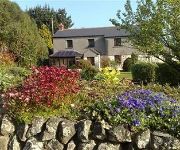
The Old Farmhouse
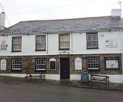
Star Inn
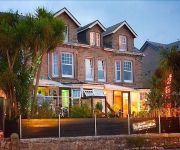
The Atlantic
Carbis Bay
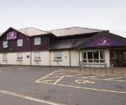
TRAVELODGE HAYLE
Hayle
WHITE HART HAYLE
Camborne
Videos from this area
These are videos related to the place based on their proximity to this place.
Beachside Holiday Park, Hayle, Cornwall
http://www.beachside.co.uk Beachside Holiday Park is set amidst sand dunes right beside the beach in St Ives Bay, Cornwall. Beachside has holiday accommodation and pitches that are ideal for...
Cornwall Bed & Breakfast -Cornish B&B St Ives Bay Hayle
B&B Hotel from £32 pppn in stunning location with magnificient sea views - 5 guest bedrooms - all with sea views and en-suite, including the Family Room which has double bed and bunk beds....
Hayle beach (Cornwall) after sunset Freedom
Short video of the beach at Hayle after the sun had gone down.
video hayle beach
Video of Hayle beach taken from the dunes at sandy Acres and looking across to Carbis bay and St Ives.
The Romance of Darby and Joan
The Trelawny Singers singing The Romance of Darby and Joan written by the Cornish Bard and poet John Barber at St Elwyn's Church, Hayle on Sunday 28th July 2013.
Self Catering Holidays in St Ives Bay, Cornwall
The Penellen (Sleeps 12/14 + Cot) is in a commanding position overlooking St Ives Bay and is a large family coastal residence that offers spacious accommodation with direct access to the coast...
Self Catering Properties in Cornwall
Chymoresk is situated in St. Ives Bay enjoying superb views from St. Ives across to Godrevy Lighthouse. It has the most glorious 3 mile stretch of golden sands backed by sand dunes, cliffs...
Videos provided by Youtube are under the copyright of their owners.
Attractions and noteworthy things
Distances are based on the centre of the city/town and sightseeing location. This list contains brief abstracts about monuments, holiday activities, national parcs, museums, organisations and more from the area as well as interesting facts about the region itself. Where available, you'll find the corresponding homepage. Otherwise the related wikipedia article.
Godrevy
Godrevy (Cornish: Godrevi, meaning small farms) is an area on the eastern side of St Ives Bay, west Cornwall, England, United Kingdom. Facing the Atlantic Ocean it is popular with both the surfing community and walkers. It is part owned by the National Trust, and offshore on Godrevy Island is a lighthouse maintained by Trinity House which is said to be the inspiration for Virginia Woolf's novel To the Lighthouse.
Gwinear–Gwithian
Gwinear–Gwithian (Cornish: Sen Gwynnyer–Sen Goedhyan) is a coastal civil parish in west Cornwall, England, United Kingdom. It includes the villages of Connor Downs, Gwinear, Gwithian, Reawla and Rosewarne. The parish is situated approximately two miles (3 km) east of Hayle two miles (3 km) west of Camborne. For the purposes of local government Gwinear–Gwithian has a parish council and elects councillors every four years. The principal local authority is Cornwall Council.
Phillack
Phillack is a village (and formerly a parish) in west Cornwall, England, United Kingdom. It is about one mile (1.6 km) northeast of Hayle and half-a-mile (0.8 km) inland from St Ives Bay on Cornwall's Atlantic ocean coast. The village is separated from the sea by a range of high sand dunes known as The Towans. Phillack has been in the civil parish of Hayle since 1935; before that it was a separate parish in its own right.
Connor Downs
Connor Downs is a village in west Cornwall, England, United Kingdom, in the civil parish of Gwinear-Gwithian. It is situated approximately two miles (3 km) east of Hayle and about two miles south-southeast of Gwithian churchtown. The name "Connor" was originally the name of Connerton, the medieval manor of the parish of Gwithian. The village straddles the old course of the A30 road but has now been bypassed and the new road passes to the north.
Angarrack viaduct
Angarrack railway viaduct is situated at Angarrack in west Cornwall, United Kingdom. The eleven-arch granite-built viaduct carries the Cornish Main Line railway across the steep-sided valley of the Angarrack River, a tributary of the River Hayle, between the present day stations of Camborne and Hayle. The village extends up the valley and under the viaduct. The original viaduct at Angarrack was designed by Isambard Kingdom Brunel for the West Cornwall Railway and was "...
Gwinear, Cornwall
Gwinear is a village in west Cornwall, United Kingdom. It is about two miles (3 km) east of Hayle and overlooks the Angarrack valley. Gwinear village sits on a hill with impressive views from the northern end of the village down the Angarrack valley. There is a local pub, the Royal Standard, and a community hall. Gwinear is the church town of Gwinear-Gwithian civil parish.
Loggans Moor
Loggans Moor is a nature reserve and Site of Special Scientific Interest, noted for its biological characteristics, in west Cornwall, England, UK. It is located 1 mile north-east of the town of Hayle, off the A30 road. The 11-hectare nature reserve is owned by Cornwall Wildlife Trust.
St Gothian Sands
St Gothian Sands is a Local Nature Reserve near Gwithian, Cornwall. It was declared a nature reserve in the summer of 2005 by the mayor of Hayle


