Safety Score: 3,0 of 5.0 based on data from 9 authorites. Meaning we advice caution when travelling to United Kingdom.
Travel warnings are updated daily. Source: Travel Warning United Kingdom. Last Update: 2024-05-01 08:01:32
Discover Saint Hilary
Saint Hilary in Cornwall (England) is a town in United Kingdom about 250 mi (or 403 km) south-west of London, the country's capital city.
Current time in Saint Hilary is now 05:22 AM (Thursday). The local timezone is named Europe / London with an UTC offset of one hour. We know of 9 airports near Saint Hilary, of which two are larger airports. The closest airport in United Kingdom is Land's End Airport in a distance of 11 mi (or 18 km), West. Besides the airports, there are other travel options available (check left side).
There is one Unesco world heritage site nearby. It's Cornwall and West Devon Mining Landscape in a distance of 35 mi (or 57 km), East. Also, if you like playing golf, there is an option about 18 mi (or 29 km). away. Looking for a place to stay? we compiled a list of available hotels close to the map centre further down the page.
When in this area, you might want to pay a visit to some of the following locations: Germoe, Penzance, Wendron, St. Buryan and Redruth. To further explore this place, just scroll down and browse the available info.
Local weather forecast
Todays Local Weather Conditions & Forecast: 11°C / 52 °F
| Morning Temperature | 9°C / 48 °F |
| Evening Temperature | 11°C / 51 °F |
| Night Temperature | 10°C / 49 °F |
| Chance of rainfall | 0% |
| Air Humidity | 81% |
| Air Pressure | 1007 hPa |
| Wind Speed | Gentle Breeze with 9 km/h (5 mph) from East |
| Cloud Conditions | Overcast clouds, covering 100% of sky |
| General Conditions | Light rain |
Friday, 3rd of May 2024
12°C (54 °F)
9°C (48 °F)
Overcast clouds, gentle breeze.
Saturday, 4th of May 2024
13°C (56 °F)
10°C (50 °F)
Scattered clouds, light breeze.
Sunday, 5th of May 2024
12°C (54 °F)
12°C (54 °F)
Light rain, moderate breeze, overcast clouds.
Hotels and Places to Stay
Bostrase
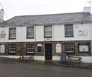
Star Inn
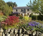
The Old Farmhouse
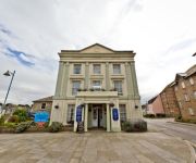
The Atlantic
Carbis Bay
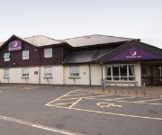
TRAVELODGE HAYLE
WHITE HART HAYLE
Hayle
Videos from this area
These are videos related to the place based on their proximity to this place.
A Guide To Marazion - see description for updated video link...
Updated video now available at http://youtu.be/MpK4mbOhC-s Welcome to Penzance & Marazion in Cornwall http://www.whealrodney.co.uk Wheal Rodney is perfectly located for your holiday. The...
A guide to Marazion, near Penzance in west Cornwall
Welcome to Marazion, home of the iconic St Michael's Mount. Wheal Rodney has produced this video guide to the ancient town of Marazion. Wheal Rodney Holiday Park is the perfect location for...
Wheal Rodney Holiday Park - see description for updated video link...
Updated video now at http://youtu.be/80myFmB-qwA http://www.whealrodney.co.uk 01736710605 Wheal Rodney is just 3.5 miles from Penzance and offers a beautifully secluded campsite as well as...
Pasty Cup kitesurf racing British Championships - promo 2013
promo video for the Pasty Cup 25th - 26th May @ Marazion. Come for a ride on board with North kiteboarding UK team rider, Lee Pasty Harvey and experience the thrill of kitesurf racing before...
Bristol VR - 1056 - OTA 290G
Going through Marazion on the Penzance Running Day, 20th April 2014. I was also conducting on this vehicle on the day.
Go Kayak Sails: Kayak Sailing at St Michaels Mount, West Cornwall.
Edward and I sailing Go Kayak Sails in Mounts Bay P.Z. Cornwall in May 2012. Sailing from Perranuthnoe across the bay downwind then around the outside of St Michael's Mount and across the wind,...
セントマイケルズマウント St Michael's Mount --Visiting inside the castle
陸との通路が潮の満干により、水没する島、セントマイケルマウント。城内散策。St.Michael's Mount is a tidal island. Looking around inside the castle. Tide and...
plot 1 and 2 Highfield Rosudgeon
STUNNING, INDIVIDUALLY DESIGNED BRAND NEW PROPERTY WITH SEA AND RURAL VIEWS. One of a pair of individually designed, brand new, 5 bedroom detached homes set on a generous ...
Videos provided by Youtube are under the copyright of their owners.
Attractions and noteworthy things
Distances are based on the centre of the city/town and sightseeing location. This list contains brief abstracts about monuments, holiday activities, national parcs, museums, organisations and more from the area as well as interesting facts about the region itself. Where available, you'll find the corresponding homepage. Otherwise the related wikipedia article.
Goldsithney
Goldsithney (Cornish: Golsydhni, meaning fair of St Sithney) is a village in west Cornwall, England, United Kingdom. It is on the A394 road at grid reference SW546306, about four miles (6 km) east of Penzance and one mile (1.6 km) east of Marazion. It is in the civil parish of Perranuthnoe. The centre of Goldsithney is a conservation area and has two pubs (the Trevelyan Arms and the Crown Inn), a shop, a gallery and a post office. The village holds a Charter fair in August each year.
Praa Sands
Praa Sands (Cornish: Poll an Wragh) - properly pronounced pray; prah or prar is incorrect - is a coastal village in Cornwall, United Kingdom. It is in the parish of Breage and lies off the main road between Helston and Penzance. Formerly serving the local mining industry, it is now mostly a tourist-oriented area.
Rosudgeon
Rosudgeon is a village in Cornwall, UK mainly situated on the A394 Penzance to Helston Road. For the purposes of local government Rosudgeon falls within the Perranuthnoe civil parish area.
Cornwall and West Devon Mining Landscape
The Cornwall and West Devon Mining Landscape is a World Heritage Site which includes select mining landscapes across Cornwall and West Devon in the south west of the United Kingdom. The site was added to the World Heritage List during the 30th Session of the UNESCO World Heritage Committee in Vilnius, July 2006.
St Hilary Church, Cornwall
The Church of St Hilary is an Early English–style church in the village of St Hilary, Cornwall, United Kingdom. It features a 13th-century tower; following a fire in 1853, the remainder of the church was rebuilt two years later by William White. The church is dedicated to Saint Hilary of Poitiers and is a Grade I listed building. The architecture is described in Pevsner's Buildings of England: Cornwall.
Kenneggy
Kenneggy comprises two separate hamlets, Higher Kenneggy to the west and Lower Kennegy to the east, in Cornwall, England, UK. They are situated in the west of the civil parish of Breage, 5 miles east of the town of Penzance. To the south is the beach of Kenneggy Sands and to the north the hamlet of Kenneggy Downs.
Kenneggy Downs
Kenneggy Downs is a hamlet in Cornwall, England, UK. It is situated in the west of the civil parish of Breage, 5 miles east of the town of Penzance. The hamlet contains a public house. Kenneggy Downs is north of the twin hamlets of Kenneggy.
Penberthy Croft Mine
Penberthy Croft Mine, is a disused mine and Site of Special Scientific Interest (SSSI) in Cornwall, England, UK. It is located to the north of the civil parish of St Hilary, 5 miles east of the town of Penzance. The mine was designated a SSSI in 1993, is listed as of national importance in the Geological Conservation Review and is the world type locality for connellite and bayldonite.


