Safety Score: 3,0 of 5.0 based on data from 9 authorites. Meaning we advice caution when travelling to Italy.
Travel warnings are updated daily. Source: Travel Warning Italy. Last Update: 2024-05-12 08:29:37
Touring Vecchietto
The district Vecchietto of Bibola in Provincia di Massa-Carrara (Tuscany) with it's 90 residents Vecchietto is a subburb located in Italy about 203 mi north-west of Rome, the country's capital place.
Need some hints on where to stay? We compiled a list of available hotels close to the map centre further down the page.
Being here already, you might want to pay a visit to some of the following locations: Aulla, Montale, Podenzana, Fosdinovo and Santo Stefano di Magra. To further explore this place, just scroll down and browse the available info.
Local weather forecast
Todays Local Weather Conditions & Forecast: 23°C / 73 °F
| Morning Temperature | 16°C / 61 °F |
| Evening Temperature | 21°C / 70 °F |
| Night Temperature | 16°C / 61 °F |
| Chance of rainfall | 0% |
| Air Humidity | 50% |
| Air Pressure | 1016 hPa |
| Wind Speed | Light breeze with 5 km/h (3 mph) from South-West |
| Cloud Conditions | Scattered clouds, covering 29% of sky |
| General Conditions | Scattered clouds |
Monday, 13th of May 2024
20°C (69 °F)
16°C (61 °F)
Broken clouds, light breeze.
Tuesday, 14th of May 2024
21°C (70 °F)
16°C (62 °F)
Light rain, light breeze, broken clouds.
Wednesday, 15th of May 2024
17°C (63 °F)
16°C (60 °F)
Moderate rain, gentle breeze, overcast clouds.
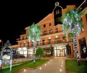
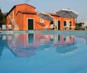
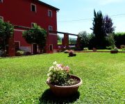
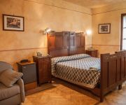
Hotels and Places to Stay
Demy Hotel
La Trigola
Hotel Hermitage
Albergo la Castellana
Santa Caterina Park Hotel
Casali Romei
Albergo Ristorante Ama La Luna
La Pietra
Elicrim
Lunezia Resort Casa Vacanze
Videos from this area
These are videos related to the place based on their proximity to this place.
Motocavalcata Aulla Lunigiana 2014 in 15 minuti
Sintesi dei quasi 100 chilometri della motocavalcata della Lunigiana Aulla 2014. Bella, tecnica, fangosa, viscida bastarda, con radici, pietre e rivoli di melma. Scenari e percorsi fantastici,...
VIA FRANCIGENA - Da Aulla a Sarzana - di Sergio Colombini
La tappa di oggi inizia da Aulla, percorreremo la Via Francigena montana. Si parte dal centro della città, in poco tempo siamo alla chiesa di San Caprasio. Visitiamo la chiesa e gli scavi...
I libici (del Mali) - Aulla, Lunigiana - luglio 2011 - febbraio 2013
Fosphoro, smart photojpurnalism and video/photocommunication e l'Associazione "Teriya" di Aulla presentano "I libici" (del Mali) - di Vincenzo Cammarata e Melania Sebastiani con la collaboraz...
Piacenza to Aulla, Via Francigena | FrancigenaWays.com
This section of the Camino to Rome, the Via Francigena, starts in the friendly city of Piacenza in Emilia-Romagna, Italy, and finishes in Aulla. This is a beautiful section of the Via Francigena...
Sarzana S.StefanoMagra Aulla 2010 -n.8
Ripartiamo, SCMT permettendo..., da Sarzana. Lo scalo di S. Stefano Magra sfila con le sue rimesse ed il 'bendidio' dei rotabili della treno Storici Liguria, Ad Aulla, Lunigiana, le 668 e 663...
Medioevo in Piazza Aulla 2014
Per due sere Aulla attraversa gli oceani del tempo per immergersi nel Medioevo........
Compagnia della Spada Aulla - Trailer 2012-
Video trailer della Compagna della Spada di Aulla, gruppo storico che esegue spettacolari combattimenti con la spada a due mani medievale. Il filmato, realizzato dalla Loppiedo Filma, riporta...
www.ferrovia-lucca-aulla.com - locomotiva a vapore FS Gr. 740.278
Ferrovia Lucca Aulla, partenza treno speciale dalla stazione di Aulla Lunigiana - dicembre 2008. Locomotiva a vapore FS Gr. 740-278 con carrozze "Corbellini" 3 Cl.
Dunyakan | Mama Africa 2012 | Aulla
https://www.facebook.com/Dunyakan?fref=ts Sebastiano Morgavi: Kora / Percussioni Dario Castiello: Basso / Percussioni Luca Savorani: Chitarra Lancei Dioubate: Percussioni Stefano Fabbri: Batteria.
Aulla moto 28-04-12
Tour giornaliero in moto da Parma ad Aulla per farsi una scorpacciata di panigacci.
Videos provided by Youtube are under the copyright of their owners.
Attractions and noteworthy things
Distances are based on the centre of the city/town and sightseeing location. This list contains brief abstracts about monuments, holiday activities, national parcs, museums, organisations and more from the area as well as interesting facts about the region itself. Where available, you'll find the corresponding homepage. Otherwise the related wikipedia article.
Tyrrhenian Sea
The Tyrrhenian Sea is part of the Mediterranean Sea off the western coast of Italy.
Tellaro
Tellaro is a village on the east coast of the Gulf of La Spezia in Liguria, northern Italy. It is a frazione of the comune (municipality) of Lerici.
Luna (Etruria)
Luna (mod. Luni) was an ancient city of Etruria, Italy, 4~ miles southeast of modern Sarzana. It was the frontier town of Etruria, on the left bank of the river Macra, the boundary in imperial times between Etruria and Liguria. When the Romans first appeared in these parts, however, the Ligurians were in possession of the territory as far as Pisa.
Province of La Spezia
The Province of La Spezia is a province in the Liguria region of Italy. Its capital is the city of La Spezia. It has an area of 881 km², and a total population of 223,606 inhabitants (2010). There are 32 communes in the province (source: Italian institute of statistics Istat In the province of La Spezia are the famous Cinque Terre, Portovenere and the Islands, a UNESCO World Heritage Site http://whc. unesco. org/en/list/826.
Comando Raggruppamento Subacquei e Incursori Teseo Tesei
See Decima Flottiglia MAS for Italian frogmen during and before WWII. COMSUBIN (Comando Raggruppamento Subacquei e Incursori Teseo Tesei) is the elite combat frogman force and one of the Italian special forces. Italy was the first nation to use frogmen and human torpedoes. The Italian Naval Assault Divisions are considered to be the precursors to modern Naval Special Forces.
Stadio Alberto Picco
Stadio Alberto Picco is the main football stadium in La Spezia, Italy. Since 1919 it is the home ground of Spezia Calcio 1906. The stadium holds 10,336.
Stadio degli Oliveti
Stadio degli Oliveti is a multi-use stadium in Massa, Italy. It is currently used mostly for football matches and is the home ground of U.S. Massese 1919. The stadium holds 8,900 and was opened in 1975.
Magra
The Magra is a 62 kilometres long river of Northern Italy, which runs through Pontremoli, Villafranca in Lunigiana and Aulla in the province of Massa-Carrara; Santo Stefano di Magra, Vezzano Ligure, Arcola, Sarzana and Ameglia in the province of La Spezia. In Roman times it was known as the Macra and marked the eastern boundary of the territory of Liguria. The river’s drainage basin occupies around 1,686 km².
Tino (island)
Tino is an Italian island situated in the Ligurian Sea, at the westernmost end of the Gulf of La Spezia. It is part of an archipelago of three closely spaced islands jutting out south from the mainland at Portovenere. The largest of the three, Palmaria, lies to the north and the tiny Tinetto to the south. In 1997, the archipelago, together with Portovenere and the Cinque Terre, was designated by UNESCO as a World Heritage Site.
Luni, Italy
Luni is a frazione of the comune (municipality) of Ortonovo, province of La Spezia, in the easternmost end of the Liguria region of northern Italy. It gives its name to Lunigiana, a region spanning eastern Liguria and northern Tuscany.
USS Williamsburg (AGC-369)
USS Williamsburg was a US Navy gunboat, a former private yacht, that served as a presidential yacht from 1945 to 1953.
Vara (river)
The Vara is a river of the Province of La Spezia in Liguria, north-west Italy, which runs through Varese Ligure, Brugnato, Borghetto di Vara and Castiglione di Vara. At 58 km it is the longest river in Liguria. The main source of the river is on Monte Zatta; for much of its course it flows in a southeasterly direction, parallel to the Riviera di levante, in the valley which takes its name: the Val di Vara.
Palmaria (island)
Palmaria is an Italian island situated in the Ligurian Sea, at the westernmost end of the Gulf of La Spezia. Measuring 1.6 km², it is the largest island of an archipelago of three closely spaced islands jutting out south from the mainland at Portovenere. The other islands, Tino, and the tiny Tinetto lie further south. In 1997, the archipelago, together with Portovenere and the Cinque Terre, was designated by UNESCO as a World Heritage Site.
Orto Botanico di Montemarcello
The Orto Botanico di Montemarcello is a nature preserve and botanical garden located within the Parco Naturale Regionale di Montemarcello-Magra, near Ameglia, Province of La Spezia, Liguria, Italy. The garden stands atop Mount Murlo (365 m) within the Caprione promontory, hills dividing the gulf of La Spezia from the Magra river plain.
German submarine U-455
German submarine U-455 was a Type VIIC U-boat built for the Nazi German Kriegsmarine for service during World War II. She was laid down on 3 September 1940, launched on 21 June 1941 and commissioned on 21 August 1941 with Kapitänleutnant Hans-Henrich Giessler in command of a crew of 51. Her service began with the 5th U-boat Flotilla, a training outfit. She was transferred to the 7th flotilla for operations at the beginning of 1942 and again to the 29th flotilla in March 1944.
Orto Botanico dei Frignoli
The Orto Botanico dei Frignoli (7 hectares) is a botanical garden located at 900 metres elevation on SS63 del Passo del Cerreto, Fivizzano, Province of Massa-Carrara, Italy. It is open daily in the warmer months; an admission fee is charged. The garden was originally established in 1932 as a nursery of the Corpo Forestale dello Stato (State Forestry Corps). In 1990 it became a provincial botanical garden with help from Comunità Montana and the Museo di Storia Naturale della Lunigiana.
Tinetto
Tinetto is an Italian island situated in the Ligurian Sea. It is part of an archipelago of three closely spaced islands jutting out south from the mainland at Portovenere. In 1997, the archipelago, together with Portovenere and the Cinque Terre, was designated by UNESCO as a World Heritage Site.
Carrara Cathedral
The Carrara Cathedral is a Roman Catholic church in Carrara, northern Italy. Nearly all the exterior is covered by local Carrara marble.
Monte Sagro
Monte Sagro is a mountain in the Alpi Apuane, in Tuscany, central Italy, overlooking the city of Carrara. It is located in the northern part of the range, and, being mostly composed of marble of renowned quality, is home to several quarries. The name (meaning "holy") identifies it as a sacred place for the ancient Liguri tribe, together with the Monte Bego at the modern boundary between France and Italy.
Sarzana Cathedral
Sarzana Cathedral (Italian: Concattedrale di Santa Maria Assunta di Sarzana) in Sarzana, Liguria, Italy, is a co-cathedral of the Diocese of La Spezia-Sarzana-Brugnato. It is dedicated to the Assumption of the Virgin Mary. The building is a mixture of the Romanesque and Gothic styles, reflecting the length of the period of its construction, from the early 13th to the late 15th century.
La Spezia Centrale railway station
La Spezia Centrale railway station is the main station of La Spezia, situated in the Piazza Medaglie d’Oro in the city centre.
San Venerio Lighthouse
San Venerio Lighthouse (Italian: Faro di San Venerio) is a lighthouse on the island of Tino, in the comune of Porto Venere in the Province of La Spezia, Liguria, Italy. Its construction began in 1839, and completed in 1840. It illuminates and guides the sailors in that part of Ligurian Sea.
Codiponte
Codiponte is a village in the municipality of Casola in Lunigiana, Tuscany, Italy. It is located in the Province of Massa and Carrara and is about 20 minutes drive from the larger town of Aulla. The population is about 200. Codiponte lies in the shadow of the Alpi Apuane and in the valley of the River Aullela. It is 255 meters above sea level and has a continental climate with hot summers and cold winters including snowfalls during winter.
Scola Tower
The Scola Tower - or tower of St. John the Baptist - is a former military building located just beyond the northeastern tip (called tip Scola) of Palmaria (island) in Portovenere, in the Gulf of Poets in the province of La Spezia, Italy. It is part of, along with the Fort Cavour and Umberto I and the Batteria Semaforo, the defensive positions of Palmaria.
Church of St. Peter (Portovenere)
The Church of St. Peter, is a religious building site in square Lazzaro Spallanzani in Portovenere, Italy, in the Gulf of Poets in the province of La Spezia.


