Safety Score: 3,0 of 5.0 based on data from 9 authorites. Meaning we advice caution when travelling to Italy.
Travel warnings are updated daily. Source: Travel Warning Italy. Last Update: 2024-05-01 08:01:32
Touring Rapegna
Rapegna in Provincia di Macerata (The Marches) with it's 37 residents is a town located in Italy about 75 mi (or 121 km) north-east of Rome, the country's capital place.
Time in Rapegna is now 07:52 AM (Thursday). The local timezone is named Europe / Rome with an UTC offset of 2 hours. We know of 12 airports nearby Rapegna, of which 5 are larger airports. The closest airport in Italy is Rieti Airport in a distance of 34 mi (or 55 km), South-West. Besides the airports, there are other travel options available (check left side).
There are several Unesco world heritage sites nearby. The closest heritage site in Italy is Assisi, the Basilica of San Francesco and Other Franciscan Sites in a distance of 30 mi (or 48 km), North-West. Need some hints on where to stay? We compiled a list of available hotels close to the map centre further down the page.
Being here already, you might want to pay a visit to some of the following locations: Castelsantangelo sul Nera, Fluminata, Visso, Norcia and Preci. To further explore this place, just scroll down and browse the available info.
Local weather forecast
Todays Local Weather Conditions & Forecast: 13°C / 56 °F
| Morning Temperature | 11°C / 52 °F |
| Evening Temperature | 10°C / 49 °F |
| Night Temperature | 6°C / 43 °F |
| Chance of rainfall | 12% |
| Air Humidity | 76% |
| Air Pressure | 1009 hPa |
| Wind Speed | Moderate breeze with 9 km/h (6 mph) from North-East |
| Cloud Conditions | Overcast clouds, covering 100% of sky |
| General Conditions | Moderate rain |
Friday, 3rd of May 2024
13°C (55 °F)
8°C (46 °F)
Light rain, light breeze, broken clouds.
Saturday, 4th of May 2024
15°C (60 °F)
9°C (48 °F)
Scattered clouds, gentle breeze.
Sunday, 5th of May 2024
18°C (65 °F)
11°C (52 °F)
Few clouds, gentle breeze.
Hotels and Places to Stay
Palazzo Seneca
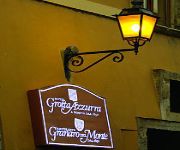
Hotel Grotta Azzurra
Videos from this area
These are videos related to the place based on their proximity to this place.
Piantamaggio 2003- Ancarano di Norcia - 30 aprile 2003
Antica tradizione che si svolge in alcuni centri dei comuni di Norcia e Preci, dove si rinnova in segno di fertilità, l'innalzamento nella piazza del paese di un albero in mezzo a suoni e...
Corso di orienteering del Nettunia AirSoft a Norcia - parte 1
Il Nettunia AirSoft impegnato in un corso di orienteering alla scuola di sopravvivanza che ha sede a Norcia. Una tre giorni molto piacevole ed istruttiva! www.nettunia-airsoft.it.
Esibizione Tamburini San Benedetto 2013
Esibizione Tamburini San Benedetto 2013 - Esibizione tamburini in Piazza Martiri a Gualdo Tadino il venerdì dei Giochi de le Porte.
Filmato con drone dji phantom2 vision plus
un breve filmato con foto girato con drone dji phantom 2 vision plus su laghetto riserva di pesca in località Gualdo. La qualità può essere discutibile ma è il mio primo.... al prossimo...
Neve e piste da sci di monte prata a due passi da Castelluccio di Norcia
Video realizzato con Parrot Bebop Drone + Go Pro Hero 3 da ABC OnLine http://www.abc-online.it Per informazioni sulla località e sul mondo sportivo nella zona http://www.nandosport.it.
Monti Sibillini com neve - novembro 2007
Monti Sibillini, região de Marche na Itália, com neve em novembro de 2007.
Italy in a Day - Time Lapse Castelluccio di Norcia
Castelluccio di Norcia (PG) immerso in un mare di nebbia. Ho girato questi video il 26 ottobre 2013 per Italy in a Day di Gabriele Salvatores. Tre video sono oggi nel film presentato alla Mostra...
La fiorita di Castelluccio di Norcia
La fiorita di Castelluccio di Norcia, uno spettacolo unico in Valnerina.
Un anno a Castelluccio di Norcia
"Il luogo più simile al #Tibet che esista in Europa", così Fosco Maraini, il grande etnografo ed esploratore italiano, definì l'Altopiano di #Castelluccio negli anni '30, ed oggi possiamo...
Videos provided by Youtube are under the copyright of their owners.
Attractions and noteworthy things
Distances are based on the centre of the city/town and sightseeing location. This list contains brief abstracts about monuments, holiday activities, national parcs, museums, organisations and more from the area as well as interesting facts about the region itself. Where available, you'll find the corresponding homepage. Otherwise the related wikipedia article.
Parco Nazionale dei Monti Sibillini
The Parco Nazionale dei Monti Sibillini is an Italian national park located across the regions of Marche and Umbria, encompassing the provinces of Macerata, Fermo, Ascoli Piceno and Perugia. It was established in 1993, and now contains more than 70,000 hectares.
Macchie (Castelsantangelo sul Nera)
Macchie is in the Italian region of the Marche. It is a Frazione of Castelsantangelo sul Nera. For ISTAT in 2001 there were 16 people in Macchie. The village is placed at 1078 metres in the center of Monti Sibillini National Park.
Monte Cornaccione
Monte Cornaccione, or simply Cornaccione, is a mountain in the Marche, Province of Macerata, in the Monti Sibillini National Park, 1769 above mean sea level.
Punta di Valloprare
Punta di Valloprare is a mountain in the Marche, Province of Macerata, in the Monti Sibillini National Park, at 1776 above mean sea level.
Monte Cardosa
Monte Cardosa is a mountain of Marche, Italy.
Monte Lieto
Monte Lieto is a mountain of Marche, Italy.
Monte Pian Falcone
Monte Pian Falcone is a mountain of Marche, Italy.
Spina di Gualdo
Spina di Gualdo is a mountain of Marche, Italy.


