Safety Score: 3,0 of 5.0 based on data from 9 authorites. Meaning we advice caution when travelling to Germany.
Travel warnings are updated daily. Source: Travel Warning Germany. Last Update: 2024-04-29 08:03:39
Delve into Steesow
Steesow in Mecklenburg-Vorpommern with it's 202 habitants is a town located in Germany about 89 mi (or 144 km) north-west of Berlin, the country's capital town.
Time in Steesow is now 03:08 AM (Tuesday). The local timezone is named Europe / Berlin with an UTC offset of 2 hours. We know of 13 airports closer to Steesow, of which 5 are larger airports. The closest airport in Germany is Schwerin Parchim Airport in a distance of 21 mi (or 34 km), North-East. Besides the airports, there are other travel options available (check left side).
There are several Unesco world heritage sites nearby. The closest heritage site in Germany is Hanseatic City of Lübeck in a distance of 60 mi (or 97 km), North-West. In need of a room? We compiled a list of available hotels close to the map centre further down the page.
Since you are here already, you might want to pay a visit to some of the following locations: Lanz, Cumlosen, Karstaedt, Gorleben and Prezelle. To further explore this place, just scroll down and browse the available info.
Local weather forecast
Todays Local Weather Conditions & Forecast: 22°C / 71 °F
| Morning Temperature | 10°C / 51 °F |
| Evening Temperature | 22°C / 72 °F |
| Night Temperature | 16°C / 61 °F |
| Chance of rainfall | 0% |
| Air Humidity | 60% |
| Air Pressure | 1018 hPa |
| Wind Speed | Gentle Breeze with 6 km/h (4 mph) from North-West |
| Cloud Conditions | Broken clouds, covering 52% of sky |
| General Conditions | Broken clouds |
Wednesday, 1st of May 2024
21°C (70 °F)
16°C (61 °F)
Broken clouds, moderate breeze.
Thursday, 2nd of May 2024
22°C (71 °F)
16°C (61 °F)
Light rain, moderate breeze, scattered clouds.
Friday, 3rd of May 2024
19°C (65 °F)
12°C (53 °F)
Light rain, gentle breeze, overcast clouds.
Hotels and Places to Stay
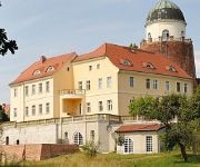
Burghotel Lenzen
Videos from this area
These are videos related to the place based on their proximity to this place.
Imagefilm Freiwillige Feuerwehr Grabow 2013
Auf www.Feuerwehr-Grabow.org erhalten Sie Informationen über Einsätze, Technik, Personal, Termine und vieles mehr der Freiwilligen Feuerwehr Grabow/Meckl. Der Film gibt einen kleinen Eindruck.
Hermann Schepler - Kunstmaler -
Der Maler und Grafiker Hermann Schepler ist 1911 in Mecklenburg geboren, hat nach seinem Abitur in Dresden eine Ausbildung zum Wissenschaftlich Medizinischen Zeichner abgeschlossen und ...
Melone vs. Superböller video eins
Extremes Sprengkomando. Böller klasse III zerstört Melone. siehe dazu video 2 - der krater!!!
Melone vs. Superböller video zwei der krater
Extremes Sprengkomando. Böller klasse III zerstört Melone.
Turmsprengung Gartow 1 (Höhbeck) 2009
Am 20.8.2009 gegen 12.00h war ich vor Ort, um das für Funker immer schmerzliche Ende einer funktechnischen Einrichtung festzuhalten. Es war zudem der heisseste Tag des Jahres. Wir hören das...
Sprengung des Sendeturms Höhbeck 1 am 20.8.2009
Der 1963 errichtete, 327 Meter hohe Sendeturm "Höhbeck 1", der bis 1990 zur Realisierung von Richtfunkverbindungen nach West-Berlin und bis 2008 zur Verbreitung von Fernsehprogrammen diente, ...
http://www.kutscher-ulli-wendland-express.de/youtube1.html
Nach einem Ausritt etwas Abkühlung für die Pferde und Spaß für Reiter/Reiterinnen ..
http://www.kutscher-ulli-wendland-express.de/youtube.html
Ausritt durch den schönen Gräfl. Gartower Forst.
Videos provided by Youtube are under the copyright of their owners.
Attractions and noteworthy things
Distances are based on the centre of the city/town and sightseeing location. This list contains brief abstracts about monuments, holiday activities, national parcs, museums, organisations and more from the area as well as interesting facts about the region itself. Where available, you'll find the corresponding homepage. Otherwise the related wikipedia article.
Nausdorf Canal
The Nausdorf Canal lies in the municipality Lenzen, in the northwest of the German state of Brandenburg. It links two lakes - the Rambower See and the Rudower See - and runs through the Rambower Moor. It takes its name from the village Nausdorf, located midway along the canal. The canal is about 5 km long and a maximum of 3 m wide. Its depth is about 1 m; its bed is covered with a thick layer of mud. The watercourse is not navigable.


