Safety Score: 3,0 of 5.0 based on data from 9 authorites. Meaning we advice caution when travelling to Germany.
Travel warnings are updated daily. Source: Travel Warning Germany. Last Update: 2024-04-28 08:22:10
Touring Kapern
Kapern in Lower Saxony is a town located in Germany about 86 mi (or 138 km) north-west of Berlin, the country's capital place.
Time in Kapern is now 02:44 AM (Monday). The local timezone is named Europe / Berlin with an UTC offset of 2 hours. We know of 12 airports nearby Kapern, of which 5 are larger airports. The closest airport in Germany is Schwerin Parchim Airport in a distance of 30 mi (or 48 km), North. Besides the airports, there are other travel options available (check left side).
There are several Unesco world heritage sites nearby. The closest heritage site in Germany is Hanseatic City of Lübeck in a distance of 68 mi (or 110 km), North-West. Need some hints on where to stay? We compiled a list of available hotels close to the map centre further down the page.
Being here already, you might want to pay a visit to some of the following locations: Lanz, Cumlosen, Prezelle, Gorleben and Trebel. To further explore this place, just scroll down and browse the available info.
Local weather forecast
Todays Local Weather Conditions & Forecast: 17°C / 63 °F
| Morning Temperature | 10°C / 49 °F |
| Evening Temperature | 16°C / 62 °F |
| Night Temperature | 11°C / 53 °F |
| Chance of rainfall | 0% |
| Air Humidity | 57% |
| Air Pressure | 1023 hPa |
| Wind Speed | Gentle Breeze with 6 km/h (4 mph) from East |
| Cloud Conditions | Overcast clouds, covering 90% of sky |
| General Conditions | Overcast clouds |
Tuesday, 30th of April 2024
21°C (70 °F)
15°C (60 °F)
Broken clouds, gentle breeze.
Wednesday, 1st of May 2024
21°C (70 °F)
16°C (60 °F)
Scattered clouds, moderate breeze.
Thursday, 2nd of May 2024
23°C (73 °F)
15°C (59 °F)
Overcast clouds, moderate breeze.
Hotels and Places to Stay
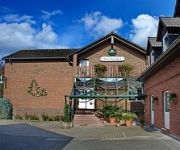
Seeblick Garni
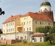
Burghotel Lenzen
Videos from this area
These are videos related to the place based on their proximity to this place.
H1Z1 - Download Alpha NonSteam (Multiplayer Included)
H1Z1 Download Alpha: http://androidbests.com/games/h1z1-download With past few 2 or 3 weeks coders unveiled H1Z1 download in addition to greater the length of the earth gas significant locations.
Turmsprengung Gartow 1 (Höhbeck) 2009
Am 20.8.2009 gegen 12.00h war ich vor Ort, um das für Funker immer schmerzliche Ende einer funktechnischen Einrichtung festzuhalten. Es war zudem der heisseste Tag des Jahres. Wir hören das...
Gartow am See i juli 1987
I juli 1987 kjørte vi til Gartow am See der vi leide ei campinghytte. Som naboer fikk vi blant annet Turid Liverød og hennes sønn Are som vi kjente fra Sandefjord.
Micro Magic 2011 in Gartow
Eindrück und Siegerehrung des 2. Wendländer Micro Magic Cup am 10.04.2011 in Gartow. www.mm-sailing.de.
Sprengung des Sendeturms Höhbeck 1 am 20.8.2009
Der 1963 errichtete, 327 Meter hohe Sendeturm "Höhbeck 1", der bis 1990 zur Realisierung von Richtfunkverbindungen nach West-Berlin und bis 2008 zur Verbreitung von Fernsehprogrammen diente, ...
http://www.kutscher-ulli-wendland-express.de/youtube1.html
Nach einem Ausritt etwas Abkühlung für die Pferde und Spaß für Reiter/Reiterinnen ..
http://www.kutscher-ulli-wendland-express.de/youtube.html
Ausritt durch den schönen Gräfl. Gartower Forst.
Real 3D: BT Lenzen - Elbtal - Höhbeck
Beobachtungsturm BT 9 bei Lenzen - Fähre - Aussichtsturm auf dem Höhbeck (Schwedenschanze) - und zurück Created with MAGIX Video Pro X4.
Videos provided by Youtube are under the copyright of their owners.
Attractions and noteworthy things
Distances are based on the centre of the city/town and sightseeing location. This list contains brief abstracts about monuments, holiday activities, national parcs, museums, organisations and more from the area as well as interesting facts about the region itself. Where available, you'll find the corresponding homepage. Otherwise the related wikipedia article.
Aland (river)
The Aland is a river in the German states of Lower Saxony and Saxony-Anhalt, left tributary of the Elbe. It is the continuation of the river Biese, which is the continuation of the river Milde. The Aland is 27 km long, whereas the total Milde-Biese-Aland system is 97 km long. The Aland flows into the Elbe in Schnackenburg.


