Safety Score: 3,0 of 5.0 based on data from 9 authorites. Meaning we advice caution when travelling to Germany.
Travel warnings are updated daily. Source: Travel Warning Germany. Last Update: 2024-05-17 08:07:57
Discover Einsiedel
The district Einsiedel of Hölle in Upper Franconia (Bavaria) is a subburb in Germany about 166 mi south-west of Berlin, the country's capital city.
If you need a hotel, we compiled a list of available hotels close to the map centre further down the page.
While being here, you might want to pay a visit to some of the following locations: Issigau, Blankenstein, Blankenberg, Harra and Pottiga. To further explore this place, just scroll down and browse the available info.
Local weather forecast
Todays Local Weather Conditions & Forecast: 12°C / 53 °F
| Morning Temperature | 13°C / 55 °F |
| Evening Temperature | 10°C / 49 °F |
| Night Temperature | 9°C / 48 °F |
| Chance of rainfall | 0% |
| Air Humidity | 71% |
| Air Pressure | 1006 hPa |
| Wind Speed | Moderate breeze with 12 km/h (7 mph) from North-West |
| Cloud Conditions | Broken clouds, covering 80% of sky |
| General Conditions | Light rain |
Saturday, 18th of May 2024
10°C (50 °F)
9°C (49 °F)
Light rain, gentle breeze, overcast clouds.
Sunday, 19th of May 2024
17°C (62 °F)
9°C (49 °F)
Light rain, gentle breeze, overcast clouds.
Monday, 20th of May 2024
20°C (67 °F)
13°C (55 °F)
Light rain, light breeze, scattered clouds.
Hotels and Places to Stay
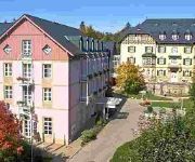
relexa
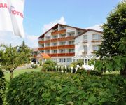
Meister Bär Frankenwald
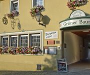
Grüner Baum
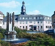
Goldene Krone
Rüdiger
Pension Wölfel Nichtraucherpension
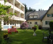
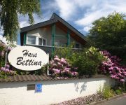
Bettina Gästehaus
Mordlau Landhotel-Café
Prinzregent Luitpold Gästehaus
Haus Birken
Videos from this area
These are videos related to the place based on their proximity to this place.
Wandern Franken: Frankenweg, Etappe 1_Blankenstein-Schwarzenbach a.W.
Die erste Etappe des Frankenweges als Tagestour mit Rückfahrt zum Startpunkt.Es geht durch das herrliche Selbitz- Tal, über Höhen und Auen in sehr unterschiedlicher Landschaft. Tour- Beschreibun...
Saalebrücke in Harra
Die Saalebrücke in Harra, 1932 erbaut - 1945 gesprengt um den Besatzern den Vormarsch zu erschweren. In den 50er Jahren wieder aufgebaut.
Sormitztal Express
Ausfahrt des Sormitztal-Express aus dem Bahnhof Blankenstein im Oktober 2011. Es handelt sich um eine Dampflock der Baureihe 41. Und hier ist der Name Dampflock Programm...! Und die ...
Six Finger Jack Ende von Nr 7 Kino Blankenberg IMG 4673
Six Finger Jack - Ende von Nr 7 - Kino Blankenberg am 24.05.2014.
www.reifenshop-direkt.de - Sommer- und Winterreifen zu Dauertiefpreisen direkt vom Reifenprofi
Das Video zeigt, warum Sie sich für den neuen REIFENSHOP entscheiden sollten. Egal ob Onlinekauf oder Montage vor Ort. Wir sind Ihr professioneller Ansprechpartner rund um das Thema Sommer-.
Einsatzfahrt MTW-Z + MzKw THW Naila
Der Mannschaftstransportwagen Zugtrupp - vergleichbar mit einem Einsatzleitwagen ELW 1 - und der Mehrzweckkraftwagen (MzKw) des THW Ortsverbandes Naila auf Einsatzfahrt von der Unterkunft...
gloomy atmosphere after severe weather - düstere Stimmung nach einem Unwetter
Am 8. Mai 2009 tobte ein Unwetter über Naila, ich habe versucht, ein paar der Blitze aufzunehmen. Leider hatte ich dabei kein Glück, die düstere Stimmung kommt aber trotzdem ganz gut rüber!
Ausnahmezustand in Naila
Dr. Mohr "harlem-shakt" mit vollem Körpereinsatz für Ihren Auftrag. Für unsere Produkte zeigen wir vollen Körpereinsatz.
VW Fox Michael Schmidt AMC Naila Eispokal Oberfranken 2010
VW Fox Michael Schmidt AMC Naila Eispokal Oberfranken 2010.
dilego.de Mein Internetkaufhaus
Willkommen bei dilego.de. Ihrem Internetkaufhaus! Endlich ist es soweit. Erstmalig können Sie viele Artikel aus dem dilego.de Onlineshop in unserem stationären Ladengeschäft in Naila direkt...
Videos provided by Youtube are under the copyright of their owners.
Attractions and noteworthy things
Distances are based on the centre of the city/town and sightseeing location. This list contains brief abstracts about monuments, holiday activities, national parcs, museums, organisations and more from the area as well as interesting facts about the region itself. Where available, you'll find the corresponding homepage. Otherwise the related wikipedia article.
Hof (district)
Hof is a district in Bavaria, Germany. It is bounded by (from the south and clockwise) the districts of Wunsiedel, Bayreuth, Kulmbach and Kronach, the states of Thuringia and Saxony, and the Czech Republic. The city of Hof is an enclave within the district, as well a being the district's administrative seat.
Franconian Forest
The Franconian Forest is a mid-altitude mountain range in Northern Bavaria, Germany. It is located in the district of Upper Franconia (Oberfranken) and forms the geological connection between the Fichtelgebirge and the Thuringian Forest.
Hof-Plauen Airport
Hof-Plauen Airport is an airport serving Hof, a city in the German state of Bavaria. The airport is located 3.2 nautical miles southwest of Hof.
Saale-Rennsteig
Saale-Rennsteig is a Verwaltungsgemeinschaft ("collective municipality") in the district Saale-Orla-Kreis, in Thuringia, Germany. The seat of the Verwaltungsgemeinschaft is in Blankenstein. The Verwaltungsgemeinschaft Saale-Rennsteig consists of the following municipalities: Birkenhügel Blankenberg Blankenstein Harra Neundorf bei Lobenstein Pottiga
Triptis–Marxgrün railway
|} The Triptis–Marxgrün railway is a branch line in Germany that runs through the states of Thuringia and Bavaria, and which was originally built and operated by the Prussian state railways. It ran from Triptis via Ziegenrück, Bad Lobenstein and Blankenstein to Marxgrün. The only section still in service today is the stretch of line between Ebersdorf-Friesau and Blankenstein.
Selbitz (river)
The Selbitz is a left-bank tributary of the river Saale in the eastern Franconian Forest and is a watercourse of tertiary importance. Its source lies about 650 metres above sea level from a pond northwest of the Helmbrechts quarter of Wüstenselbitz, flows around Helmbrechts at first in an easterly direction and then towards the north.
Döbraberg
Döbraberg is a mountain of Bavaria, Germany.
Joditz
Joditz is a village in Upper Franconia, in the municipality of Köditz and the district of Hof. Joditz lies in the valley of the Saale, ten kilometers north-west of the town of Hof. The village has 345 inhabitants (as of January 2010) and contains a parish church. The area of the parish includes the hamlets Joditz, Lamitz, Saalenstein, Scharten, Stöckaten and Siebenhitz. At the centre of the village is St John's Evangelical Lutheran Church.
Steinerne Rose
The Steinerne Rose is a rare natural monument. It is a diabase rock formation, that originated on the sea bed from outflowing lava in the middle Devonian, i.e. about 400 million years ago. The lava formed pillow-like bodies which have an internal structure of concentric layers. Over thousands, if not millions, of years these layers have been weathered out, giving the bodies the appearance of rosebuds in bloom.
Zottelbach
Zottelbach is a river of Bavaria, Germany.


