Safety Score: 3,0 of 5.0 based on data from 9 authorites. Meaning we advice caution when travelling to Germany.
Travel warnings are updated daily. Source: Travel Warning Germany. Last Update: 2024-05-03 08:06:06
Delve into Mauthausen
The district Mauthausen of Pidingerau in Upper Bavaria (Bavaria) is a subburb in Germany about 330 mi south of Berlin, the country's capital town.
If you need a hotel, we compiled a list of available hotels close to the map centre further down the page.
While being here, you might want to pay a visit to some of the following locations: Piding, Bad Reichenhall, Bayerisch Gmain, Anger and Ainring. To further explore this place, just scroll down and browse the available info.
Local weather forecast
Todays Local Weather Conditions & Forecast: 13°C / 56 °F
| Morning Temperature | 7°C / 45 °F |
| Evening Temperature | 14°C / 57 °F |
| Night Temperature | 9°C / 48 °F |
| Chance of rainfall | 0% |
| Air Humidity | 65% |
| Air Pressure | 1015 hPa |
| Wind Speed | Light breeze with 5 km/h (3 mph) from South |
| Cloud Conditions | Overcast clouds, covering 98% of sky |
| General Conditions | Overcast clouds |
Sunday, 5th of May 2024
17°C (62 °F)
11°C (52 °F)
Light rain, light breeze, broken clouds.
Monday, 6th of May 2024
19°C (66 °F)
12°C (53 °F)
Light rain, light breeze, overcast clouds.
Tuesday, 7th of May 2024
9°C (48 °F)
8°C (47 °F)
Light rain, calm, overcast clouds.
Hotels and Places to Stay
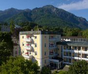
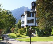
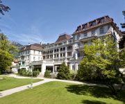
Sonnenbichl
Galerie Hotel Bad Reichenhall
Prinz Landhotel
Amber Hotel Bavaria
Luisenbad Parkhotel
Bayern Vital
Wyndham Grand Axelmannstein
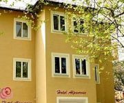
Alpenrose
Bergfried & Schönblick
Rupertus
Videos from this area
These are videos related to the place based on their proximity to this place.
Basecamp Festival in Bad Reichenhall - 1. Platz - King of the mountain (Ziggdawg & andy )
1. Platz beim Newcomer Film & Foto aus der Region des Basecamp Festival in Bad Reichenhall vom 27.01 - 30.01.2010.
Winterbilder Ferienwohnungen Gästehaus Scheil Bad Reichenhall
Winter in der Umgebung von Gästehaus Scheil in Bad Reichenhall.
Panorama Ferienwohnungen Gästehaus Scheil Bad Reichenhall / Bayern
Aussicht auf Garten und Berge von Gästehaus Scheil Ferienwohnungen in Bad Reichenhall.
Race 07 GTR Evolution 2 Drive Training Corvette C05 Nordschleife
Download Links: Packages1: http://www.4shared.com/rar/GRTxK1_H/p... Packages2: http://www.4shared.com/rar/lWHLCwZV/p... Packages3: http://www.4shared.com/rar/ruoRTVee/p... Packages4: ...
nach 12 888km wieder nach Deutschland
nach einer Reise durch die Türkei, Syrien und Jordanien gehts bei Salzburg wieder nach Deutschland rein.
Gästehaus Scheil Ferienwohnungen Bad Reichenhall / Bayern
im Garten von Gästehaus Scheil in Bad Reichenhall.
2012-09-14-Tour Bayern / Österreich Teil 1
Storyboard 00:00 -- Start von Großgmain Richtung Hallein auf der L237 die kleine Waldstrasse nach Glanegg 07:52 -- Irgendwo von Jt. Johann im Pongau auf der 311 Richtung Zell am See 09:03...
Weihnachtsschüzen Grossgmain Böllerschützen Bayerisch Gmain
Dreikönigsschiessen beim Reiterbauern in Grossgmain!
Videos provided by Youtube are under the copyright of their owners.
Attractions and noteworthy things
Distances are based on the centre of the city/town and sightseeing location. This list contains brief abstracts about monuments, holiday activities, national parcs, museums, organisations and more from the area as well as interesting facts about the region itself. Where available, you'll find the corresponding homepage. Otherwise the related wikipedia article.
Berchtesgadener Land
Berchtesgadener Land is a district in Bavaria, Germany. It is bounded by the district of Traunstein and by the state of Austria.
Untersberg
The Untersberg is a mountain massif of the Berchtesgaden Alps that straddles the border between Berchtesgaden, Germany and Salzburg, Austria. The mountain is popular with tourists due to its proximity to the city of Salzburg: less than 16 km (10 mi) to the north and within easy reach by bus, for example Salzburg city bus 21 to Glanegg, which runs every 15 minutes on weekdays. Trails lead to the top, but most people use the cable car that lifts passengers over 1300m to the Geiereck peak.
Bad Reichenhall Ice Rink roof collapse
At approximately 15:00 UTC on Monday 2 January 2006, in the town of Bad Reichenhall, Bavaria, Germany, near the Austrian border, the roof of a 1970s-built ice rink collapsed, possibly under the weight of heavy snowfall, trapping 50 people underneath the rubble. Fifteen people were killed, with the last body being recovered early on 5 January. Eight children are known to have died. Thirty-two people were injured.
Predigtstuhl Cable Car
The Predigtstuhl Cable Car has been in operation since 1928 and is the oldest large-cabin cable car in world.
Salzburg Airport
Salzburg Airport or Salzburg Airport W. A. Mozart is the second largest airport in Austria. The airport, named after Salzburg-born composer, Wolfgang Amadeus Mozart, is located 1.7 NM west-southwest from the centre of Salzburg and 2 km from the Austrian-German border. It serves as a gateway to Austria's numerous and vast ski areas, including the Ski Amadé region, the largest network of linked ski resorts in Europe.
Schloss Klessheim
Schloss Klessheim is a Baroque palace situated 4 km west of Salzburg in the Austrian commune of Wals-Siezenheim. A former summer residence of the Archbishops of Salzburg, it is now the only year-round Casino.
Freilassing Locomotive World
The Freilassing Locomotive World (Lokwelt Freilassing) is a railway museum in the Berchtesgadener Land, which is operated with the cooperation of the town of Freilassing and the Deutsches Museum. The museum is located on the site of the former Freilassing locomotive shed which belongs to the Deutsche Bahn AG and houses part of the Deutsches Museum's railway collection. The second part of the collection is in the transport centre of the Deutsches Museum on the Theresienhöhe in Munich.
Höglwörther See
Höglwörther See is a lake in Bavaria, Germany. At an elevation of 540 m, its surface area is 13.5 ha.
Burgruine Plainburg
The Plainburg is a ruined castle in the state of Salzburg, Austria.
Dötzenkopf
Dötzenkopf is a mountain of Bavaria, Germany.
Dreisesselberg (Lattengebirge)
Dreisesselberg (Lattengebirge) is a mountain of Bavaria, Germany.
Fuderheuberg
Fuderheuberg is a mountain of Bavaria, Germany.
Högl
Högl is a Bavarian mountain.
Johannishögl
Johannishögl is a mountain of Bavaria, Germany.
Zwiesel (mountain)
Zwiesel is the name of two mountains of Bavaria, Germany, one in the Chiemgau Alps (at 1,782 m) and one near Wackersberg, in the Bad Tölz-Wolfratshausen district (at 1,348 m).
Predigtstuhl (Lattengebirge)
Predigtstuhl (Lattengebirge) is a mountain of Bavaria, Germany.
Spechtenköpfe
Spechtenköpfe is a mountain of Bavaria, Germany.
Hangar-7
Hangar-7 in Salzburg, Austria owned by Red Bull founder Dietrich Mateschitz is not a hangar in a traditional sense but rather a multifunctional building with a collection of historical airplanes, helicopters and Formula One racing cars. It houses a restaurant, two bars, a lounge and aircraft, and is open to the public. It includes the Michelin starred restaurant Ikarus.
Red Bull Arena (Salzburg)
The Red Bull Arena, known during and before the Euro 2008 football championship as the EM Stadion Wals-Siezenheim, is a football stadium in Wals-Siezenheim, a municipality in the suburb of Salzburg, Austria. It was officially opened in March 2003 and is the home ground of Red Bull Salzburg. Previously, the club played at Stadion Lehen.
Röthelbach (Saalach)
Röthelbach is a river of Bavaria, Germany.
Schwarzbach (Saalach)
Schwarzbach is a river of Bavaria, Germany.
Stoißer Ache
Stoißer Ache is a river of Bavaria, Germany.
Wappach
Wappach is a river of Bavaria, Germany.
Die Bachschmiede
Die Bachschmiede is the cultural center of the Austrian community Wals-Siezenheim. It was openend in 2008.
Freilassing station
Freilassing station is located in the Upper Bavarian district of Berchtesgaden. It is the last German station on the railway line from Munich to Salzburg, a border station to Austria and the only station in the town of Freilassing. The station is the junction between the Rosenheim–Salzburg, Salzburg–Berchtesgaden and Salzburg–Mühldorf lines and is used daily by about 160 trains operated by Deutsche Bahn, the Austrian Federal Railways, the Berchtesgadener Land Bahn and WESTbahn.


