Safety Score: 3,0 of 5.0 based on data from 9 authorites. Meaning we advice caution when travelling to France.
Travel warnings are updated daily. Source: Travel Warning France. Last Update: 2024-04-27 08:23:39
Explore Chalard
Chalard in Dordogne (Nouvelle-Aquitaine) is located in France about 250 mi (or 403 km) south of Paris, the country's capital.
Local time in Chalard is now 12:34 AM (Sunday). The local timezone is named Europe / Paris with an UTC offset of 2 hours. We know of 11 airports in the wider vicinity of Chalard, of which 4 are larger airports. The closest airport in France is Périgueux-Bassillac Airport in a distance of 17 mi (or 27 km), South-West. Besides the airports, there are other travel options available (check left side).
There are several Unesco world heritage sites nearby. The closest heritage site in France is Prehistoric Sites and Decorated Caves of the Vézère Valley in a distance of 19 mi (or 30 km), South. If you need a place to sleep, we compiled a list of available hotels close to the map centre further down the page.
Depending on your travel schedule, you might want to pay a visit to some of the following locations: Glandon, Boulazac, Perigueux, Sarlat-la-Caneda and Brive-la-Gaillarde. To further explore this place, just scroll down and browse the available info.
Local weather forecast
Todays Local Weather Conditions & Forecast: 18°C / 64 °F
| Morning Temperature | 10°C / 51 °F |
| Evening Temperature | 14°C / 58 °F |
| Night Temperature | 10°C / 50 °F |
| Chance of rainfall | 20% |
| Air Humidity | 77% |
| Air Pressure | 1000 hPa |
| Wind Speed | Moderate breeze with 12 km/h (8 mph) from North-West |
| Cloud Conditions | Overcast clouds, covering 100% of sky |
| General Conditions | Heavy intensity rain |
Sunday, 28th of April 2024
15°C (60 °F)
10°C (49 °F)
Light rain, gentle breeze, scattered clouds.
Monday, 29th of April 2024
16°C (61 °F)
11°C (51 °F)
Light rain, light breeze, broken clouds.
Tuesday, 30th of April 2024
14°C (57 °F)
11°C (52 °F)
Light rain, light breeze, overcast clouds.
Hotels and Places to Stay
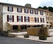
Hostellerie du Fin Chapon Logis
Videos from this area
These are videos related to the place based on their proximity to this place.
Musée de la Médecine de Hautefort
Salle des pauvres du Musée de la médecine de Hautefort (Dordogne-24)
Hautefort : Château de Hautefort : Vue de la terrasse
Le panoramearth est pris du bord sud de la grande terrasse (une cour intérieure) du château de Hautefort. Ce pano est un réplicatif du pano http://youtu.be/tD3LkCvlQLs (mal géocodé). Voir...
Badefols d'Ans : Deux châteaux : un à droite, un à gauche
Le panoramearth est pris de la D62, entre Hautefort et Badefols d'Ans. A cet endroit privilégié, au lieu-dit « Boslavie », on peut voir deux châteaux de part et d'autre de la route. A...
Vol en montgolfière dans le Périgord avec Airshow
Décollage au pied du Château de Hautefort http://www.oosky.fr/vols-en-montgolfiere-chateau-hautefort-dordogne-perigord.
Nobody For Me - Line Dance Phil - RnD 2009
Country RnD - Chorégraphie débutant sur la musique de Carl Perkins - Daddy Sang Bass 32 comptes / 2 murs - 1 TAG (8 comptes)
Météo Dordogne sur France 2
Dans "C'est au programme" du vendredi 24 octobre 2014, mon amie, météorologue et chasseuse d'orages, Rébecca Père Igor, était à l'honneur. Sa page Facebook ...
Videos provided by Youtube are under the copyright of their owners.
Attractions and noteworthy things
Distances are based on the centre of the city/town and sightseeing location. This list contains brief abstracts about monuments, holiday activities, national parcs, museums, organisations and more from the area as well as interesting facts about the region itself. Where available, you'll find the corresponding homepage. Otherwise the related wikipedia article.
Canton of Excideuil
The Canton of Excideuil is a canton of the Dordogne département, in France. The lowest point is in Saint-Pantaly-d'Excideuil at 120 m, the highest point is in Saint-Mesmin at 415 m, the average elevation is 375 m. The least populated commune is Saint-Raphaël with 93 inhabitants and the most populated commune is Excideuil with 1,318.
Haute Loue
Haute Loue is a river in the Dordogne department of France. It is a tributary of the Loue, which is a tributary of the Isle. The source of the river is in the commune of Angoisse. It empties into the Loue southwest of Lanouaille.
Dalon
The Dalon is a river in the Limousin and the Aquitaine regions of France. It is a left tributary of the Auvézère river. The river begins in the commune of Segonzac in Corrèze. The river empties into the Auvézère at the left bank southwest of Génis in Dordogne.


