Safety Score: 2,8 of 5.0 based on data from 9 authorites. Meaning we advice caution when travelling to Canada.
Travel warnings are updated daily. Source: Travel Warning Canada. Last Update: 2024-04-26 08:02:42
Delve into Burnhamthorpe
The district Burnhamthorpe of Etobicoke in Ontario is a district located in Canada about 228 mi south-west of Ottawa, the country's capital town.
In need of a room? We compiled a list of available hotels close to the map centre further down the page.
Since you are here already, you might want to pay a visit to some of the following locations: Toronto, Milton, Lockport, Buffalo and Woodstock. To further explore this place, just scroll down and browse the available info.
Local weather forecast
Todays Local Weather Conditions & Forecast: 10°C / 50 °F
| Morning Temperature | 4°C / 39 °F |
| Evening Temperature | 10°C / 50 °F |
| Night Temperature | 8°C / 46 °F |
| Chance of rainfall | 0% |
| Air Humidity | 33% |
| Air Pressure | 1030 hPa |
| Wind Speed | Moderate breeze with 9 km/h (6 mph) from West |
| Cloud Conditions | Few clouds, covering 15% of sky |
| General Conditions | Few clouds |
Saturday, 27th of April 2024
8°C (47 °F)
11°C (51 °F)
Moderate rain, gentle breeze, overcast clouds.
Sunday, 28th of April 2024
19°C (66 °F)
13°C (56 °F)
Light rain, gentle breeze, overcast clouds.
Monday, 29th of April 2024
9°C (48 °F)
9°C (48 °F)
Light rain, moderate breeze, overcast clouds.
Hotels and Places to Stay
DoubleTree by Hilton Hotel Toronto Airport West
Downtown SQ1 Mississauga Executive Suites
WhiteHall Suites - Mississauga
Courtyard Mississauga-Airport Corporate Centre West
Park Suites Mississauga - Skymark
Best Western Plus Toronto Airport Hotel
BEST WESTERN PREMIER TORONTO
Maplewood Furnished Suites
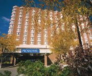
Novotel Toronto Mississauga Centre
Absolute Furnished Suites - by Mirage
Videos from this area
These are videos related to the place based on their proximity to this place.
Centennial Park Etobicoke - Ralph Evans - RE/MAX Professionals Inc
Ralph Evans describes the activities that go on in Etobicoke's Centennial Park. From skiing in the winter time, to golf, mini-putt pulf, go-karting, soccer, baseball, cricket, track and field...
TDESSA XC Grade 8 Girls City Finals 21 Oct 2010
Norseman's Grade 8 girls compete in the Cross Country City Finals at Centennial Park. Carter takes 17th place and the Norseman team places third overall..
Fleetwood Park/Etobicoke Creek Flooding
Some footage of the Toronto flood of 2013. This was taken near Etobicoke Creek and Fleetwood park. Warning: Contains foul language.
Landscaping Equipment TorontoLandscaping Equipment Toronto,Visit Hitch City (888) 401-1694
http://www.hitchcity.com/Landscape Equipment Toronto, Call us at (888) 401-1694, 5170 Dixie Road, Mississauga, ON L4W 1E3 We are the professionals for Landscape Equipment in the GTA. Call...
420 Mill Rd, #107 Etobicoke ON M9C1Z1
http://homesite.obeo.com/viewer/default.aspx?tourid=925354?refURL=youtube Contact: Bill Orr Sutton Group Summit Realty Inc. Brokerage 905-897-9555 billorr2008@gmail.com ...
A Fearless Night Playthrough 1 - Applewood Heights S.S.
Applewood Heights Secondary School Grade 12 Drama Play.
D-Side: 6 - Applewood Heights S.S 2012
Cameraman Notes: Sorry for the shakiness and the back and forth, being in the middle of the stage even with a widescreen camera still has its downfall, so ma...
D-Side: 7 - Applewood Heights S.S 2012
Cameraman Notes: Sorry for the shakiness and the back and forth, being in the middle of the stage even with a widescreen camera still has its downfall, so major parts may have been missed.
What If: Day 1 pt.1 - Applewood H.S.S. 2013
What if we had a world perpendicularly parallel to the world we have now but anything is possible with imagin...with the What If zone that is brought to you....
What If: Day 1 pt.2 - Applewood H.S.S. 2013
What if we had a world perpendicularly parallel to the world we have now but anything is possible with imagin...with the What If zone that is brought to you....
Videos provided by Youtube are under the copyright of their owners.
Attractions and noteworthy things
Distances are based on the centre of the city/town and sightseeing location. This list contains brief abstracts about monuments, holiday activities, national parcs, museums, organisations and more from the area as well as interesting facts about the region itself. Where available, you'll find the corresponding homepage. Otherwise the related wikipedia article.
Canadian Standards Association
The Canadian Standards Association (CSA), is a not-for-profit standards organization which develops standards in 57 areas. CSA publishes standards in print and electronic form and provides training and advisory services. CSA is composed of representatives from industry, government, and consumer groups. CSA began as the Canadian Engineering Standards Association(CESA) in 1919, federally chartered to create standards.
Dixie GO Station
Dixie GO Station is a GO Transit railway station on the Milton line in the Greater Toronto Area, Ontario, Canada. It is located at 2445 Dixie Road in Mississauga, just south of Dundas Street East. Like most GO stations, Dixie offers parking facilities for commuters, and allows for wheelchair-accessible train services through a raised mini-platform giving access to the 5th carriage from the locomotive; it is one of the only three stations on the Milton Line that offer the mini-platform.
Mississauga South
Mississauga South is a federal electoral district in Ontario, Canada, that has been represented in the Canadian House of Commons since 1979. It includes the neighbourhoods of Cawthra, Sheridan Heights, Park Royal, Clarkson, Rattray Park Estates, Lorne Park, Lorne Park Estates, Port Credit, Applewood Acres, Lakeview and Orchard Heights. It has a population of 113,003 and an area of 61 km.
Mississauga East—Cooksville
Mississauga East—Cooksville is a federal electoral district in Ontario, Canada, that has been represented in the Canadian House of Commons since 2004.
Centennial Park Stadium
The Centennial Park Stadium is a 2,200 seat capacity stadium in Etobicoke, Ontario, that is primarily used for soccer, track and field, football and occasionally for kabbadi. It is located within Centennial Park (Toronto). The park is also used for the ropssaa football finals It hosts the Relay For Life in Toronto West event each June, a fundraiser for the Canadian Cancer Society. It is located just south of Lester B.
Air France Flight 358
Air France Flight 358, a flight from Paris, France, to Toronto, Ontario, Canada, using an Airbus A340 airliner, departed Paris without incident at 11:53 UTC 2 August 2005, later touching down on runway 24L at Toronto Pearson International Airport at 20:01 UTC . The aircraft failed to stop on the runway, plunged into nearby Etobicoke Creek, and came to rest, bursting into flames, approximately 300 metres past the end of the runway.
Air Canada Flight 189
Air Canada Flight 189 was an Air Canada flight from Ottawa to Vancouver via Toronto and Winnipeg. On June 26, 1978 it crashed on takeoff in Toronto killing two passengers. During takeoff at 8:15 a.m. one of the DC-9-32's tires burst and partially disintegrated, firing chunks of rubber into the landing gear mechanism. This set off an "unsafe gear" warning, prompting the pilot to abort the takeoff.
Sherway Gardens
Sherway Gardens is a shopping complex which was originally built in 1971. The mall's original structure covered 850,000 square feet and contained 127 stores. Sherway Gardens was subsequently expanded to 972,540 square feet with 215 stores, becoming the eighth largest mall in the Greater Toronto Area. It is a terminus for several Toronto Transit Commission and MiWay bus routes.
Etobicoke Civic Centre
The Etobicoke Civic Centre in the Eatonville neighbourhood of Toronto, once housed the municipal government of the former City of Etobicoke. The building was built in 1958 to replace the single storey brick Township of Etobicoke Municipal Hall at 4096 Dundas Street (now Fox and a Fiddle). A cenotaph was raised on the site to commemorate the contribution of Etobians during the world wars.
Applewood Heights Secondary School
Applewood Heights Secondary School (AHSS) is a public secondary school in Mississauga, Ontario, Canada and is part of the Peel District School Board. The school serves around thirteen hundred students with over a hundred teachers and school staff. Applewood is one of only 3 high schools in Mississauga that offers a French immersion program. The school commenced operations in 1966.
Glenforest Secondary School
Glenforest Secondary School is a public secondary school located in Mississauga, Ontario, Canada. It is also known as GFSS, the short-form. Established in 1969, Glenforest Secondary School is in Peel Regional Municipality, Ontario. It is operated by the Peel District School Board and is also a member of the Glenforest family. Located at 3575 Fieldgate Drive, Glenforest offers education to many students in the area, Enhanced and IB students all over Peel.
Allan A. Martin Senior Public School
Allan A. Martin Senior Public School is a middle school located at 1390 Ogden Avenue in Mississauga, Ontario, Canada. It is the only middle school providing the International Business and Technology Program (IBT) program in the Peel District School Board.
Tomken Road Middle School
Tomken Road Middle School is located at 3200 Tomken Road, Mississauga, Ontario. The school was constructed and open for use in 1968. The school contains two extracurricular learning programs, the French Immersion program and a Sci-Tech program for science and technology. The school also offers many diverse extra-curricular activities. A students is able to attain Tomken T points by participating for a required amount of hours.
Islamic Society of North America Elementary School
Islamic Society of North America Elementary School is an Islamic elementary school in Mississauga, Ontario, Canada. The school is part of the Islamic Society of North America umbrella organization. ISNA Elementary School was founded in 1983, and moved to its current location in 1985; it is one of the oldest Islamic schools in the Greater Toronto Area.
Philip Pocock Catholic Secondary School
Philip Pocock Catholic Secondary School is a Catholic high school in Mississauga, Ontario, Canada. It is operated by the Dufferin-Peel Catholic District School Board and has approximately 1,373 students. The school includes an Extended French Program as well as an Advanced Placement Program for Mathematics. The school building is similar to that of St. Joseph Secondary School in Mississauga which is modeled after Philip Pocock. The school's athletes are called the "Pocock Pirates."
Thomas L. Kennedy Secondary School
Thomas Laird Kennedy Secondary School is a school located in Mississauga, Ontario which was erected in honour of Premier of Ontario Thomas Laird Kennedy. Kennedy had been a longtime resident of Streetsville (now part of Mississauga), where he was Master of the River Park Masonic Lodge. Thomas L. Kennedy Secondary School first opened its doors to approximately four hundred and fifty students in September 1953.
Dixie Outlet Mall
Dixie Outlet Mall, also referred to as Dixie Value Mall, is a shopping mall in Mississauga, Canada, located on the south side of the Queen Elizabeth Way highway. It is Canada's largest enclosed outlet mall. This outlet mall is known for its brand name outlets, including Guess, Mexx, Jacob, Tommy Hilfiger, Winners, Levis, Danier and much more. Dixie Outlet Mall is owned by Ivanhoe Cambridge, a Canadian firm.
Gordon Graydon Memorial Secondary School
Gordon Graydon Memorial Secondary School, "Gordon Graydon", "GGMSS", or simply "Graydon" for short, is a Canadian high school serving Grades 9 to 12, located at 1490 Ogden Avenue in Mississauga, Ontario, Canada. Gordon Graydon is best known for housing the IBT Program. The school opened in 1957, and celebrated its 50th anniversary on May 26, 2007. It was named after Gordon Graydon, a Canadian politician who died in 1953. The school's slogan is "Palma Per Ardua": Success through Hard Work.
Silverthorn Collegiate Institute
Silverthorn Collegiate Institute (SCI) is a high school located in the west end of Toronto. It is under the sanction of the Toronto District School Board. The name comes from the "The Silverthorn Woods" or "Silverthorn's Bush" that border it on the south and the west . This was the northern limit of an old property known locally as "The Silverthorn Mill Farm".
Dixie, Mississauga
Dixie is a neighbourhood in the city of Mississauga, Ontario, Canada. The community lies in the southeastern part of the city and is one of the older neighbourhoods in the city. The name of the neighbourhood dates back to the Village of Dixie at the corner of Cawthra Road and Dundas Street West in the south part of the city. In 1865, the village was named in honour of Dr.
John Cabot Catholic Secondary School
John Cabot Catholic Secondary School is located in Mississauga, Ontario, Canada. It is a Catholic high school in the Dufferin-Peel Catholic District School Board. The school mascot is the Colt.
Baitul Hamd, Mississauga
The Baitul Hamd (House of The Praise) is a mosque in Mississauga, Ontario west of Toronto run by the Ahmadiyya Muslim Community (AMJ) in Canada. It was purchased in 1999 from Trinity Club House. much of the exterior of the building has remained the same. The interior has been transformed into a place of worship.
Michael Power/St. Joseph High School
Michael Power•St. Joseph High School (locally referred as Michael Power, MPSJ, MPSJHS or Power) is a Toronto Catholic District School Board secondary school in the Etobicoke district of the city of Toronto, Canada. The school is an amalgamation of two independent schools, Michael Power High School (an all male school started by the Basilian Fathers) and St. Joseph Islington High School (an all female school led by the Sisters of St. Joseph).
Mississauga—Brampton South (provincial electoral district)
Mississauga—Brampton South is a provincial electoral district in Ontario, Canada, that has been represented in the Legislative Assembly of Ontario since the 2007 provincial election.
Cloverdale Mall
Cloverdale Mall is a community shopping centre located in the Etobicoke area of Toronto, Canada, at 250 The East Mall. It opened in 1956 as an open air shopping plaza on what was part of the Eatonville farm, and is now one of the oldest enclosed shopping centres in Toronto's west end.


