Safety Score: 2,7 of 5.0 based on data from 9 authorites. Meaning we advice caution when travelling to United States.
Travel warnings are updated daily. Source: Travel Warning United States. Last Update: 2024-04-30 08:30:35
Touring Columbia Heights
Columbia Heights in Arlington County (Virginia) is a town located in United States a little south-west of Washington DC, the country's capital place.
Time in Columbia Heights is now 04:51 AM (Tuesday). The local timezone is named America / New York with an UTC offset of -4 hours. We know of 8 airports nearby Columbia Heights, of which 4 are larger airports. The closest airport in United States is Ronald Reagan Washington National Airport in a distance of 5 mi (or 7 km), East. Besides the airports, there are other travel options available (check left side).
There is one Unesco world heritage site nearby. It's Monticello and the University of Virginia in Charlottesville in a distance of 60 mi (or 97 km), South. Also, if you like the game of golf, there are several options within driving distance. We collected 10 points of interest near this location. Need some hints on where to stay? We compiled a list of available hotels close to the map centre further down the page.
Being here already, you might want to pay a visit to some of the following locations: Arlington, Falls Church, Alexandria, Washington DC and Fairfax. To further explore this place, just scroll down and browse the available info.
Local weather forecast
Todays Local Weather Conditions & Forecast: 29°C / 84 °F
| Morning Temperature | 17°C / 62 °F |
| Evening Temperature | 26°C / 79 °F |
| Night Temperature | 20°C / 68 °F |
| Chance of rainfall | 0% |
| Air Humidity | 29% |
| Air Pressure | 1012 hPa |
| Wind Speed | Moderate breeze with 9 km/h (6 mph) from North-East |
| Cloud Conditions | Scattered clouds, covering 49% of sky |
| General Conditions | Light rain |
Tuesday, 30th of April 2024
24°C (76 °F)
19°C (65 °F)
Broken clouds, gentle breeze.
Wednesday, 1st of May 2024
26°C (79 °F)
17°C (63 °F)
Scattered clouds, light breeze.
Thursday, 2nd of May 2024
27°C (81 °F)
18°C (64 °F)
Overcast clouds, gentle breeze.
Hotels and Places to Stay
The Westin Arlington Gateway
Madison at Ballston by Exec Apartments
Madison at Ballston by BOQ Lodging
Hilton Alexandria Mark Center
Hilton Arlington
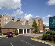
Homewood Suites by Hilton Alexandria-Pentagon South VA
Hampton Inn Alexandria-Pentagon South VA
Oakwood Falls Church
Hilton Garden Inn Arlington Shirlington
Courtyard Alexandria Pentagon South
Videos from this area
These are videos related to the place based on their proximity to this place.
Walkabout: Arlington Forest
A WalkArlington Walkabout through the Arlington Forest neighborhood of Arlington, Virginia. This Walkabout features Lubber Run Park and Amphitheater, a slice of Glencarlyn Park, and a ...
Sky Crane Ops at Bailey's Crossroads
A Sky Crane Helicopter doing some work on the high rises near where I live in Bailey's Crossroads.
Skyline Square Condominium Falls Church Fairfax County Baileys Crossroads 22041 unit 912N
Skyline Square Condominium Falls Church Fairfax County Baileys Crossroads 22041 unit 912N Kirill Gorbounov, MRE, MBA, REALTOR®, Associate BROKER, DPP, CDPE, SFR, BPOR, e-PRO, RSPS, ...
Skyline Square Condominium Baileys Crossroads Falls Church VA 22041 Unit T10s
www.YourSkylineConnection.com Kirill Gorbounov, MRE, MBA, REALTOR®, Associate BROKER, DPP, CDPE, SFR, BPOR, e-PRO, RSPS, QSC, CNE, MRP. Cell / text: (571) 276-0986; Elena ...
1400 sq ft Condominium in Fairfax County Falls Church Bailey's Crossroads Skyline Square #1710S
www.YourSkylineConnection.com.
Baileys Crossroads Skyline Square Condominium Falls Church 22041 #2204S
Baileys Crossroads Skyline Square Condominium Falls Church 22041 #2204S New Appliances, Repainted, Excellent Condition. Washer/Dryer inside the unit. You will love how close this condo is to...
Skyline Square Condominium Falls Church VA 22041 Fairfax County Baileys Crossroads #1111S
www.YourSkylineConnection.com ------------------------------- Kirill Gorbounov, MRE, MBA, REALTOR®, Associate BROKER, DPP, CDPE, SFR, BPOR, e-PRO, RSPS, QSC, CNE, MRP. Cell / text: (571) ...
Penthouse Condominium in Fairfax County Falls Church Baileys Crossroads Skyline Square #2613N
www.YourSkylineConnection.com.
George Mason Drive Skyline Plaza Baileys Crossroads Fairfax County Falls Church 612N
Kirill Gorbounov, MRE, MBA, REALTOR®, Associate BROKER, DPP, CDPE, SFR, BPOR, e-PRO, RSPS, QSC, CNE, MRP. "SKYLINE CONNECTION INC." www.YourSkylineConnection.com cell / text: ...
Falls Church Skyline House Fairfax County Baileys Crossroads 22041; 1015W
Kirill Gorbounov, MRE, MBA, REALTOR®, Associate BROKER, DPP, CDPE, SFR, BPOR, e-PRO, RSPS, QSC, CNE, MRP. "SKYLINE CONNECTION INC." www.YourSkylineConnection.com cell / text: ...
Videos provided by Youtube are under the copyright of their owners.
Attractions and noteworthy things
Distances are based on the centre of the city/town and sightseeing location. This list contains brief abstracts about monuments, holiday activities, national parcs, museums, organisations and more from the area as well as interesting facts about the region itself. Where available, you'll find the corresponding homepage. Otherwise the related wikipedia article.
Bailey's Crossroads, Virginia
Bailey's Crossroads is an unincorporated community and census-designated place in Fairfax County, Virginia, United States. The population was 23,643 at the 2010 census. Bailey's Crossroads lies at the "crossroads" of State Route 7 and State Route 244.
Washington-Virginia Airport
The Washington-Virginia Airport was formerly an airport in Fairfax County, Virginia, USA. The airport was first known as Crossroads Airport for the nearby Bailey's Crossroads. In 1942, a license was granted to build and operate an airport but it was not built until 1947 after World War II. The original two gravel runways were paved by 1962. The airport closed in 1970 due to encroaching suburban development from Washington, D.C.
Skyline Towers collapse
On March 2, 1973, the center section of the 26-story Skyline Plaza in Bailey's Crossroads, Virginia, in Fairfax County, which borders Arlington and Alexandria, gave way. The cascading concrete and steel killed 14 people and injured 34 others.
Wakefield High School (Arlington County, Virginia)
Wakefield High School is one of three public high schools located in Arlington, Virginia, and is just one block away from Alexandria. There are 140 teachers and 1364 students as of March 2008. It is a fully accredited high school based on Virginia's Standards of Learning examinations. There has been a push for students to take Advanced Placement Program (AP) courses, which has become stronger in recent years since the inception of the AP Network.
Bluemont Junction Trail
The Bluemont Junction Trail is a 1.3 miles rail-trail in Arlington County, Virginia that the Arlington County government constructed along a former branch of the defunct Washington and Old Dominion Railroad. The trail travels through Bluemont Junction Park, connecting Ballston with the Washington & Old Dominion Railroad Trail at Bluemont Junction near Bluemont Park.
Skyline Mall
Skyline Mall was a small enclosed shopping mall located among the high rises of Bailey's Crossroads in Falls Church, Virginia. It opened on the site of a the former Washington-Virginia Airport and the Sunset X-rated drive-in theater. in 1977 to join the offices of Skyline City. At its peak, the mall comprised more than thirty tenants, including a Safeway supermarket and Rite Aid drugstore, and a twelve-screen cinema.
Barcroft Park
Barcroft Park is a baseball venue located on in Arlington, Virginia, USA. The field is home to the George Washington Colonials baseball team of the NCAA Division I Atlantic 10 Conference. The field holds a capacity of 1,000 spectators. The field is officially designated Barcroft Park Field #6 and includes a new turf field by FieldTurf, bullpens, enclosed dugouts, bleachers, lights, scoreboard, and pressbox.
Battle of Arlington Mills
The Battle of Arlington Mills, Virginia was a small skirmish that was one of the first military engagements of the American Civil War. It occurred at about 11:00 p.m. on the night of June 1, 1861. The Battle of Fairfax Court House (June 1861) took place earlier that day. The skirmish at Arlington Mills occurred a week after the Union Army occupation of the area of Virginia opposite Washington, D.C. on May 24, 1861.


