Safety Score: 2,7 of 5.0 based on data from 9 authorites. Meaning we advice caution when travelling to United States.
Travel warnings are updated daily. Source: Travel Warning United States. Last Update: 2024-04-28 08:22:10
Explore Whitesville
Whitesville in Windsor County (Vermont) is located in United States about 387 mi (or 623 km) north-east of Washington DC, the country's capital.
Local time in Whitesville is now 08:48 AM (Sunday). The local timezone is named America / New York with an UTC offset of -4 hours. We know of 12 airports in the wider vicinity of Whitesville, of which 5 are larger airports. The closest airport in United States is Rutland - Southern Vermont Regional Airport in a distance of 20 mi (or 33 km), North-West. Besides the airports, there are other travel options available (check left side).
There is one Unesco world heritage site nearby. The closest heritage site is Rideau Canal in Canada at a distance of 137 mi (or 221 km). Also, if you like golfing, there are multiple options in driving distance. If you need a place to sleep, we compiled a list of available hotels close to the map centre further down the page.
Depending on your travel schedule, you might want to pay a visit to some of the following locations: Woodstock, Newfane, Newport, Rutland and Keene. To further explore this place, just scroll down and browse the available info.
Local weather forecast
Todays Local Weather Conditions & Forecast: 16°C / 61 °F
| Morning Temperature | 7°C / 45 °F |
| Evening Temperature | 20°C / 68 °F |
| Night Temperature | 15°C / 58 °F |
| Chance of rainfall | 7% |
| Air Humidity | 76% |
| Air Pressure | 1019 hPa |
| Wind Speed | Light breeze with 5 km/h (3 mph) from East |
| Cloud Conditions | Overcast clouds, covering 97% of sky |
| General Conditions | Moderate rain |
Sunday, 28th of April 2024
14°C (57 °F)
9°C (49 °F)
Light rain, light breeze, overcast clouds.
Monday, 29th of April 2024
8°C (47 °F)
7°C (45 °F)
Moderate rain, light breeze, overcast clouds.
Tuesday, 30th of April 2024
11°C (52 °F)
9°C (48 °F)
Overcast clouds, calm.
Hotels and Places to Stay
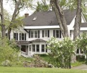
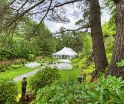
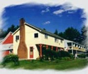
The Inn at Weathersfield
Golden Stage Inn Bed and Breakfast
THE POINTE AT CASTLE HILL RESORT
The Pond House Inn at Shattuck Hill Farm
CASTLE HILL RESORT AND SPA
Happy Trails At Okemo
Videos from this area
These are videos related to the place based on their proximity to this place.
5B Stone Cairn Lane Cavendish VT
http://myhzm.com/67671 Great lot with southern exposure Stone walls, underground utilities, a private road just off paved Tarbell Hill Road! Close to Okemo, Ludlow and the Upper Valley New...
powerlines
As I document some of the cool things herre in Vermont which will be missed, here is a favorite spot for off roading my KLR 600. I ride these powerline trails which run from Cavendish VT to Andover.
Vermont Home.wmv
View of my Vermont Farm House. This house was built in 1859. They would keep the aminals under the house and let them in the meadow in the back. There is a river in the back about 2000 feet back.
Singleton's General Store
Singleton's General Store Located at 356 Main St. in Proctorsville VT. 05156. (802)-226-7766 Singleton's specializes in all kinds of cut meats and Marinades.. Plus so much more. So please...
Grahall Omni-Media: The Grahall Estate
This is a short summary of the new Grahall book, "The Grahall Estate" by Alexandra Honkala. To find more information on this book, or for purchasing options, please visit our main page www.Grahall....
Ludlow, VT Andover and Pleasant Streets
Water from Jewel Brook eroding Andover St at around 3:00 PM during Hurricane Irene.
Ludlow, VT - Walker Bridge & Main Street
Water from the Black River crests over Walker Bridge and floods Main Street at about 5:00 PM during Hurricane Irene.
Ludlow, VT - Black River from Depot Street Bridge
Black River surges at around 3:15 PM during Hurricane Irene.
Videos provided by Youtube are under the copyright of their owners.


